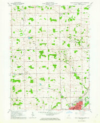
1962 Map of North Manchester North
USGS Topo · Published 1963About this map
Manchester College and the surrounding institutional grounds of North Manchester anchor the southern edge of this early 1960s landscape, where the Eel River and the Pennsylvania railroad intersect. The map documents a predominantly agrarian transition zone between Kosciusko and Wabash counties, defined by a dense grid of numbered section roads such as 800 South Road and 1100 South Road.
Find a feature on this map
47 named features on this map. Tap any name to fly to it.
Don’t see what you’re looking for? This feature index may not catch every label — zoom into the map to look around manually.
Map Details
Editions of this 1962 North Manchester North Map
2 editions found
Other maps of this area

1950 · Pierceton
USGS Topo · 1:24,000

1953 · Fort Wayne
USGS Topo · 1:250,000

1953 · Muncie
USGS Topo · 1:250,000

1956 · Muncie
USGS Topo · 1:250,000

1956 · Fort Wayne
USGS Topo · 1:250,000

1957 · Warsaw
USGS Topo · 1:24,000

1961 · Silver Lake
USGS Topo · 1:24,000

1961 · Roann
USGS Topo · 1:24,000
1961 · Servia
USGS Topo · 1:24,000
1961 · North Manchester South
USGS Topo · 1:24,000