Old Maps of Kankakee, Indiana for Academic Research
Study the evolution of Kankakee with 10 high-resolution historic maps. Whether you're teaching, researching, or modeling changes in land use, these maps provide essential visual documentation of urban, environmental, and geographic change.
- Analyze long-term change: Track patterns in development, transportation, and natural features.
- Ideal for environmental or urban studies: Support academic projects with primary historical map data.
- Use in the classroom or lab: Educators and researchers rely on these maps to bring historical context to life.
These maps are a powerful tool for teaching, research, and visualizing how Kankakee has changed over the decades.
Kankakee, IN maps
(10)- 1953 Map of Chicago, 1964 Print
 1953 Chicago1964 Print · USGSThe southern Lake Michigan shoreline was rapidly modernizing in the mid-fifties, balancing heavy industry with its famous academic centers. Researchers can trace the footprints of Notre Dame University or locate vanished sites like the Kingsbury Ordnance Plant and Meigs Field.5 unique versions available
 - 1957 Map of Chicago
 1957 Chicago1957 Print · USGSThe industrial heartland and southern Great Lakes shoreline are captured here during the peak of mid-century growth. Researchers can trace the massive Gary Steel Works, the grounds of the University of Notre Dame, and the early paths of the Tri-State Tollway.
 - 1958 Map of Stillwell, 1961 Print
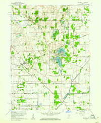 1958 Stillwell1961 Print · USGSLaPorte County in the late fifties shows a landscape of strategic industrial sites and critical rail junctions during the height of the Cold War. Genealogists and historians can trace the footprint of the Kingsbury Ordnance Plant and the rail corridors of the Wabash and New York Chicago and St Louis.
 - 1974 Map of Stillwell, 1975 Print
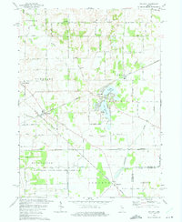 1974 Stillwell1975 Print · USGSLaPorte County in the mid-1970s is a landscape defined by the intersection of the Norfolk and Western railroad and the Little Kankakee River. Genealogists and historians can trace the lakeside development of Fish Lake or locate rural landmarks like Oak Grove Ch and the Cranberry Bog.2 unique versions available
 - 1983 Map of South Bend, 1984 Print
 1983 South Bend1984 Print · USGSThe Indiana-Michigan borderlands come alive in this early 1980s overview of the Michiana region's industrial and academic hubs. Researchers can trace the rail networks of Conrail and the Grand Trunk Western alongside landmarks like the University of Notre Dame and Indiana Dunes State Park.2 unique versions available
 - 2010 Map of Stillwell, 2010 Print
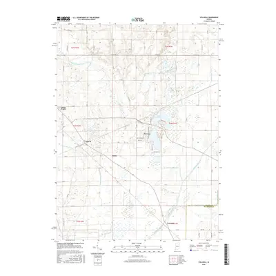
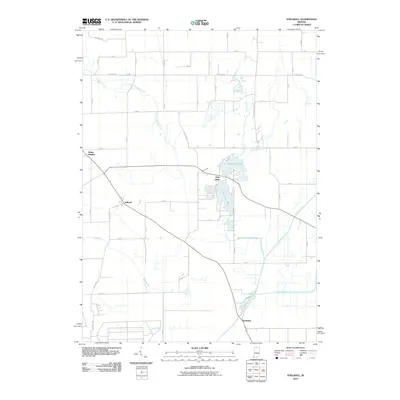 2010 Stillwell2010 Print · USGSCovers Kankakee, including Fish Lake, Salem Heights, and other nearby areas
 - 2013 Map of Stillwell, 2013 Print
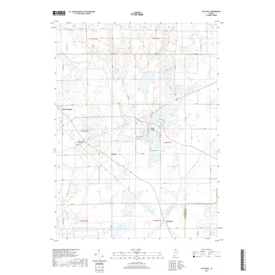
 2013 Stillwell2013 Print · USGSCovers Kankakee, including Fish Lake, Salem Heights, and other nearby areas
 - 2016 Map of Stillwell, 2016 Print
 2016 Stillwell2016 Print · USGSCovers Kankakee, including Fish Lake, Salem Heights, and other nearby areas
 - 2019 Map of Stillwell, 2019 Print
 2019 Stillwell2019 Print · USGSCovers Kankakee, including Fish Lake, Salem Heights, and other nearby areas
 - 2022 Map of Stillwell, 2022 Print
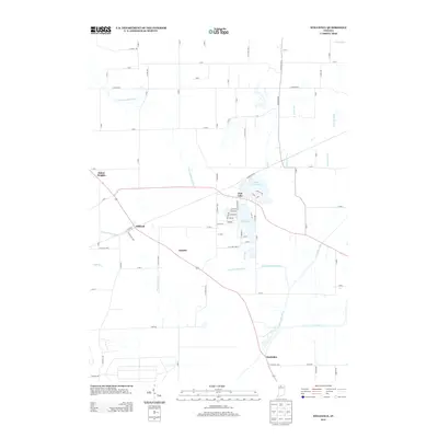
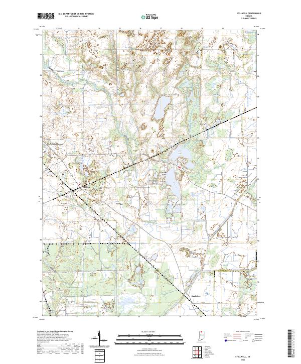 2022 Stillwell2022 Print · USGSLaPorte County, Indiana, is captured here in the early 2020s, showcasing a landscape of drained lowlands and rural townships. Genealogists and local researchers can trace family lands near the settlements of Stillwell and Hamlet or along the banks of Mill Creek.
End of results
Showing maps 1-10 of 10
Top cities near Kankakee
- South Bend historical maps
- La Porte historical maps
- Plymouth historical maps
- Olive historical maps
- Knox historical maps
- Walkerton historical maps
See more
Frequently asked questions
- What are the different types of historical maps available for Kankakee?
- What is the oldest map of Kankakee?
- Where can I purchase historical maps of Kankakee for my home or office?
- Where can I download high-res historical maps of Kankakee?
- Are there historical topographic maps available for Kankakee?
- Is there historical aerial imagery available for Kankakee?
- Where are historical maps of Kankakee sourced from?