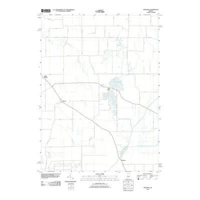
2010 Map of Stillwell
USGS Topo · Published 2010About this map
Stillwell stands as a focal point in this 2010 survey of LaPorte County, where the convergence of rail lines and regional roads anchors the local landscape. The map captures a complex hydrological network defined by the Kankakee River and its various tributaries, including the winding Little Kankakee River and Mill Creek. To the east, the recreational and residential geography around Fish Lake is meticulously detailed, showing the distinct basins of Upper Fish Lake and Lower Fish Lake. This area reflects a classic Midwestern pattern of small-town settlements like Salem Heights and Kankakee interspersed with a rigid grid of county roads. The drainage systems, such as the Barringer Ditch, illustrate the historical efforts to manage the low-lying wetlands that characterize this portion of northern Indiana.
Find a feature on this map
51 named features on this map. Tap any name to fly to it.
Don’t see what you’re looking for? This feature index may not catch every label — zoom into the map to look around manually.
Map Details
Editions of this 2010 Stillwell Map
This is the sole edition of this map. No revisions or reprints were ever made.
Other maps of this area

1953 · Chicago
USGS Topo · 1:250,000

1957 · Chicago
USGS Topo · 1:250,000

1958 · Lydick
USGS Topo · 1:24,000

1958 · Kingsford Heights
USGS Topo · 1:24,000

1958 · Hamlet
USGS Topo · 1:24,000

1958 · Walkerton
USGS Topo · 1:24,000

1958 · Stillwell
USGS Topo · 1:24,000

1958 · North Liberty
USGS Topo · 1:24,000

1958 · La Porte East
USGS Topo · 1:24,000

1958 · Springville
USGS Topo · 1:24,000