2020s Maps of Madison County, Indiana
Explore 15 historic maps of Madison County from the 2020s. These maps offer a rare glimpse into what life looked like during the 2020s — showing old roads, neighborhoods, homes, and landmarks that have changed or disappeared over time.
Whether you're researching your family's past, planning a metal detecting trip, or studying how Madison County's landscape evolved across the 2020s, these high-resolution maps are a powerful tool for exploring the history of this region.
- Focus on a specific era: All maps on this page are from the 2020s, giving you a focused view of this time period.
- See what’s changed: Compare century-old streets, trails, and buildings to today's modern landscape using overlays and satellite layers.
- Research with precision: Use these maps for genealogy, historical research, land use analysis, or educational projects.
- View, download, or print: Maps are fully viewable online in high resolution, and can be downloaded or printed for your own records.
Start exploring Madison County's history through authentic maps from the 2020s. This is your window into the past.
Madison County, IN maps
(15)- 2022 Map of Elwood, 2022 Print
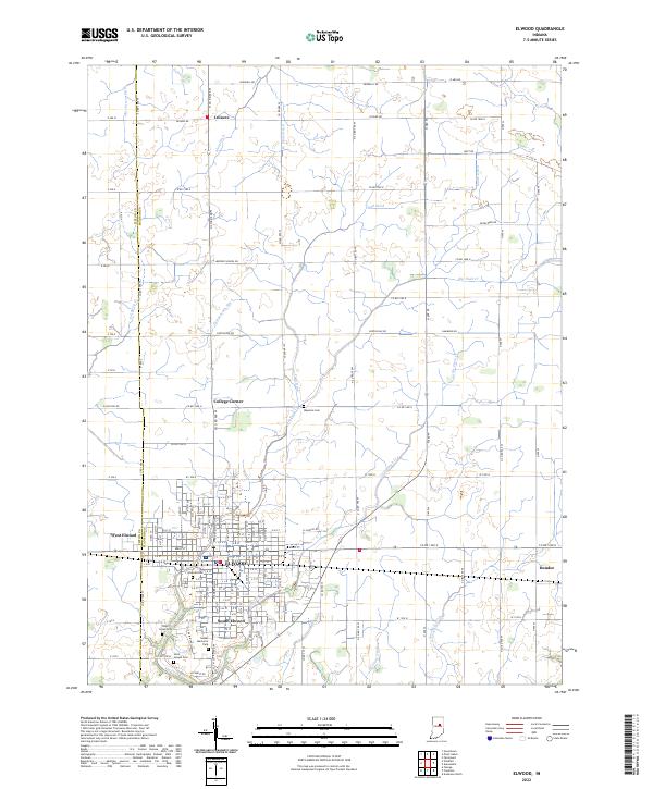 2022 Elwood2022 Print · USGSElwood and its neighboring settlements are documented in this recent survey of the Madison and Tipton County border. Genealogists and researchers can trace local landmarks like Waymire Cem, Duck Creek Cem, and the rural community of Leisure.
 - 2022 Map of Point Isabel, 2022 Print
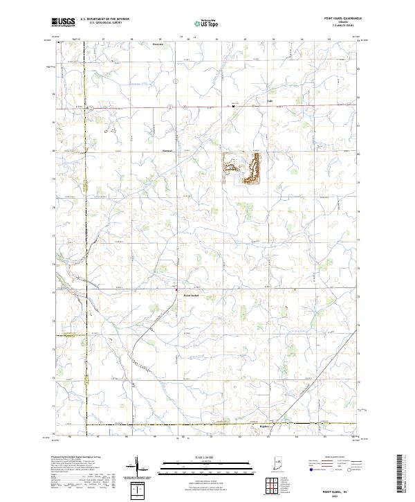 2022 Point Isabel2022 Print · USGSSettlements and farmsteads dot the Grant County landscape in the early 2020s, revealing a deeply rooted agricultural community. Researchers can trace family history through sites like Abel Cem or follow the paths of Wildcat Cr and the S Straw Town Pike.
 - 2022 Map of Shirley, 2022 Print
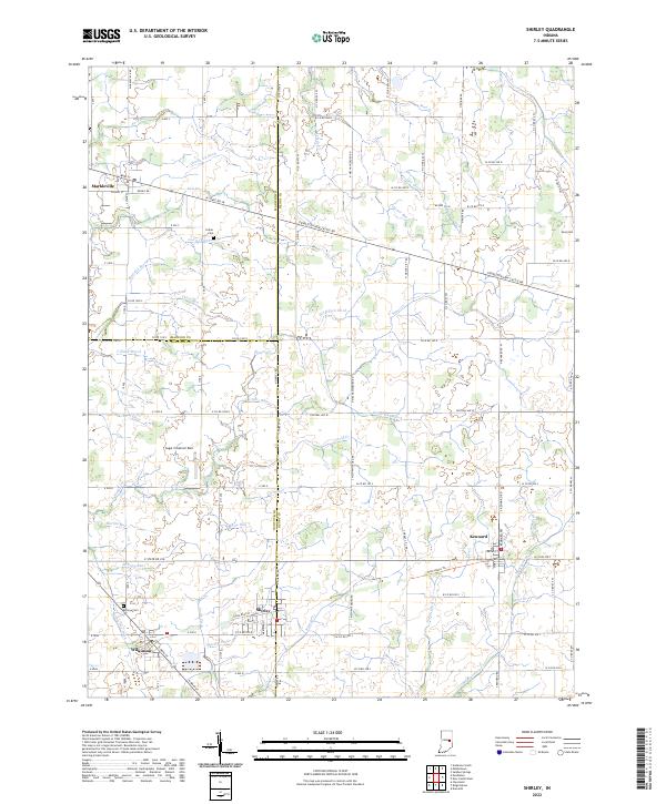 2022 Shirley2022 Print · USGSEastern Indiana farmlands and small-town junctions come alive in this contemporary record of the region. Local researchers can trace family plots at Hess Cem or explore the drainage networks of Village Brook and Sixmile Cr.
 - 2022 Map of Pendleton, 2022 Print
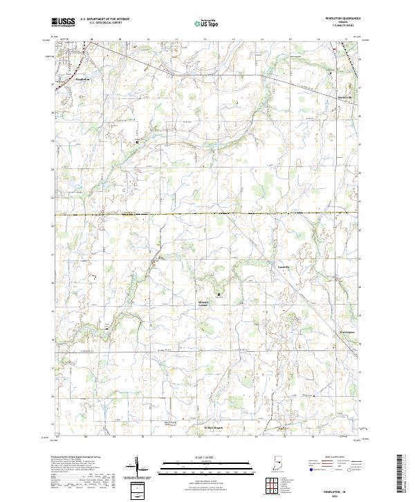 2022 Pendleton2022 Print · USGSThe borderlands of Madison and Hancock counties appear here in the early twenty-first century, showing a landscape of productive farmland and small crossroads communities. Genealogists can locate several rural burial grounds such as Walker Cemetery and Cook Cemetery, or trace the paths of Sugar Creek and Manifold Ditch.
 - 2022 Map of Anderson North, 2022 Print
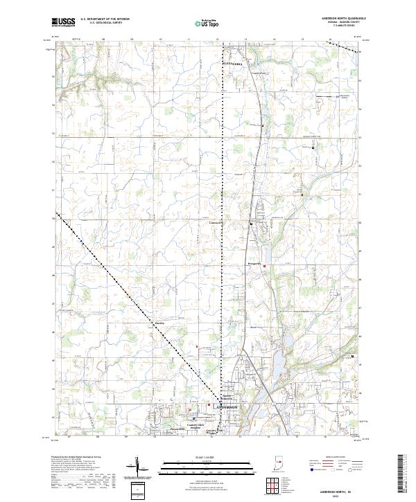 2022 Anderson North2022 Print · USGSMadison County in the early twenty-first century reveals a landscape of enduring rural crossroads and evolving suburban edges. Genealogists can trace family lines through local burial sites like Holson Cem and Smith Cem or explore the hamlets of Linwood and Florida.
 - 2022 Map of Fairmount, 2022 Print
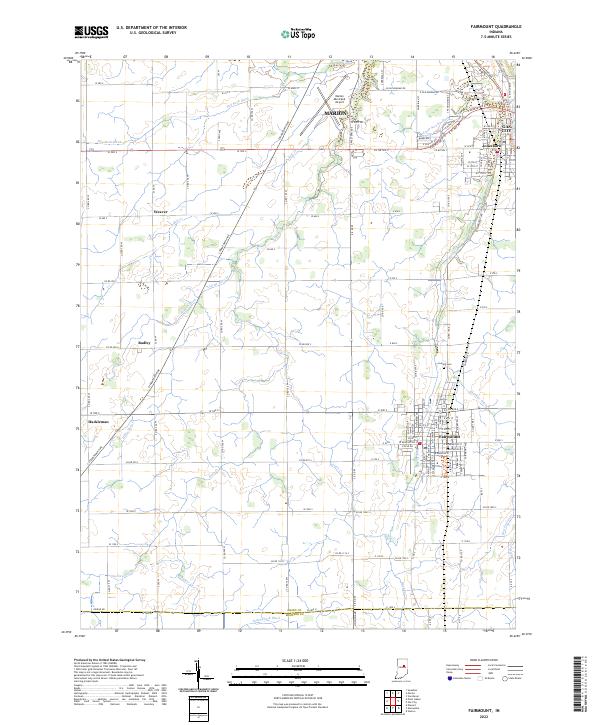 2022 Fairmount2022 Print · USGSFairmount and the surrounding Grant County countryside are shown here at the start of the 2020s, revealing a landscape defined by agricultural grids and small town centers. Researchers can trace family sites near Fairmount, Jonesboro, and Hackleman or locate burials at Park Cem.
 - 2022 Map of Alexandria, 2022 Print
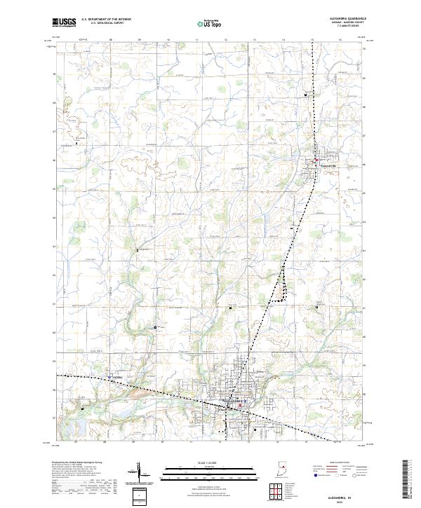 2022 Alexandria2022 Print · USGSMadison County, Indiana, is captured here in the early 2020s, showing a landscape where small-town grids meet a dense network of agricultural waterways. Researchers can trace local heritage through sites like Parkview Cem, Gimco City, and Summitville.
 - 2022 Map of Lapel, 2022 Print
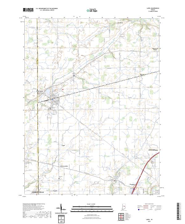 2022 Lapel2022 Print · USGSCentral Indiana at the start of the 2020s shows a landscape of long-established farmsteads and growing small towns. Genealogists and local historians can trace the exact locations of Old Woodward Cem, Brookside Cem, and the quiet crossroads of Hardscrabble.
 - 2022 Map of Frankton, 2022 Print
 2022 Frankton2022 Print · USGSMadison and Hamilton Counties appear here in the early 2020s, showing a landscape defined by the White River and the rural agricultural grids between Frankton and Perkinsville. Researchers can locate numerous local burial grounds such as Shell Cem and the Knights of Pythias Cem or trace the winding course of Pipe Creek.
 - 2022 Map of Middletown, 2022 Print
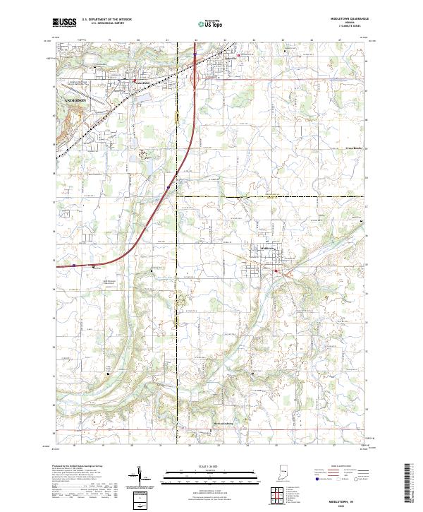 2022 Middletown2022 Print · USGSHenry and Madison counties show a landscape of established small towns and family farmsteads in this recent survey. Genealogists can locate numerous local burial sites like Keesling Cem and Painter Cem, or trace the winding course of Fall Creek.
 - 2022 Map of Gaston, 2022 Print
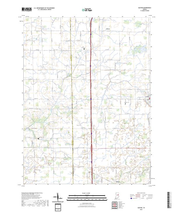 2022 Gaston2022 Print · USGSGaston and the fertile plains of East Central Indiana are captured here at the start of the 2020s. Genealogists and local historians can trace family ties at Zion Church Cem or Walker Cem and follow the routes between Bethel and Janney.
 - 2022 Map of Ingalls, 2022 Print
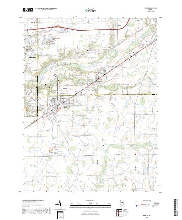 2022 Ingalls2022 Print · USGSThe Madison and Hancock county line comes alive in this contemporary survey, showing the residential growth of Ingalls and Fortville. Researchers can locate numerous family burial sites like Hiday Cem and Crosley Cem or trace the path of the McFadden Ditch.
 - 2022 Map of Gilman, 2022 Print
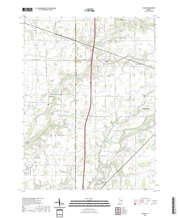 2022 Gilman2022 Print · USGSThe Madison and Delaware county line comes alive in the early 2020s, showing the settled corridors along the White River. Family historians can locate rural landmarks like Moonville Cem and traces of old rail and road networks at Reed Station.
 - 2022 Map of Gas City, 2022 Print
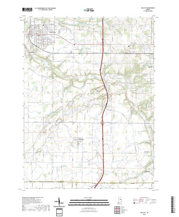 2022 Gas City2022 Print · USGSGrant County and its neighbors show a landscape of river-bend towns and prairie drainage at the start of the 2020s. Researchers can trace historic cemeteries like Jefferson Cem and the routes of old thoroughfares such as Wheeling Pike near Fowlerton.
 - 2022 Map of Anderson South, 2022 Print
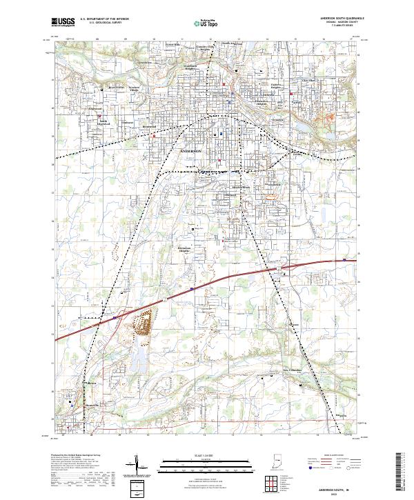 2022 Anderson South2022 Print · USGSMadison County at the start of the 2020s reveals the expanding footprint of Anderson and Pendleton. Genealogists can locate family sites at West Maplewood Cem and Mount Zion Lutheran Cem, or trace industrial ties near Irondale.
End of results
Showing maps 1-15 of 15
Top cities of Madison County
- Anderson historical maps
- Elwood historical maps
- Alexandria historical maps
- Pendleton historical maps
- Chesterfield historical maps
- Edgewood historical maps
See more
Frequently asked questions
- What are the different types of historical maps available for Madison County?
- What is the oldest map of Madison County?
- Where can I purchase historical maps of Madison County for my home or office?
- Where can I download high-res historical maps of Madison County?
- Are there historical topographic maps available for Madison County?
- Is there historical aerial imagery available for Madison County?
- Where are historical maps of Madison County sourced from?