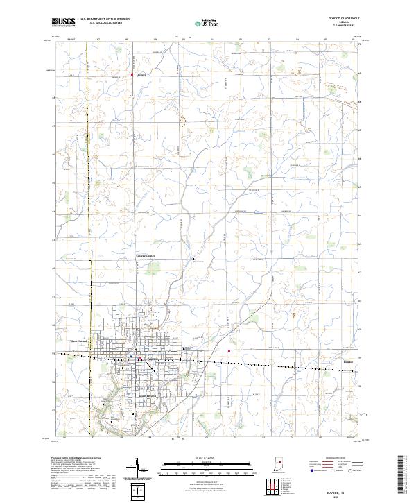
2022 Map of Elwood
USGS Topo · Published 2022About this map
Elwood and its surrounding communities are positioned along the border of Madison and Tipton Counties, defining the transition between the dense residential grid of the city and the expansive agricultural landscape of central Indiana. The city's growth is anchored by its established street network and outskirts such as West Elwood and South Elwood, which are flanked by several significant burial grounds including Waymire Cem, Elwood Cem, and Saint Joseph Cem.
Find a feature on this map
84 named features on this map. Tap any name to fly to it.
Don’t see what you’re looking for? This feature index may not catch every label — zoom into the map to look around manually.
Map Details
Editions of this 2022 Elwood Map
This is the sole edition of this map. No revisions or reprints were ever made.
Other maps of this area

1953 · Muncie
USGS Topo · 1:250,000

1956 · Muncie
USGS Topo · 1:250,000

1960 · Elwood
USGS Topo · 1:24,000

1960 · Point Isabel
USGS Topo · 1:24,000

1960 · Alexandria
USGS Topo · 1:24,000

1960 · Fairmount
USGS Topo · 1:24,000

1960 · Windfall
USGS Topo · 1:24,000

1960 · Greentown
USGS Topo · 1:24,000

1960 · Anderson North
USGS Topo · 1:24,000
1961 · Omega
USGS Topo · 1:24,000