
1960 Map of Elwood
USGS Topo · Published 1961About this map
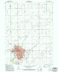
Elwood and its surroundings across the Tipton and Madison County line are captured in high detail just as the local infrastructure was modernizing. The urban center is a dense network of residential streets and civic landmarks, including Mercy Hospital, the Armory, and multiple parochial and public institutions such as St Josephs Church and Edgewood School. The surrounding township of Boone maintains its agricultural character, defined by an intricate system of drainage canals like Duck Creek, Savage Ditch, and Todd DITCH.
Find a feature on this map
57 named features on this map. Tap any name to fly to it.
Don’t see what you’re looking for? This feature index may not catch every label — zoom into the map to look around manually.
Map Details
Editions of this 1960 Elwood Map
2 editions found
Other maps of this area

1953 · Muncie
USGS Topo · 1:250,000

1956 · Muncie
USGS Topo · 1:250,000

1960 · Point Isabel
USGS Topo · 1:24,000

1960 · Alexandria
USGS Topo · 1:24,000

1960 · Fairmount
USGS Topo · 1:24,000

1960 · Windfall
USGS Topo · 1:24,000

1960 · Greentown
USGS Topo · 1:24,000

1960 · Anderson North
USGS Topo · 1:24,000
1961 · Omega
USGS Topo · 1:24,000
1962 · Frankton
USGS Topo · 1:24,000