Old Maps of Madison County, Indiana for Genealogy
Trace your family roots with 100 historic maps of Madison County. These high-res maps reveal old neighborhoods, homesites, landmarks, and streets — helping you uncover where your ancestors lived and how the area evolved over time.
- Explore historic neighborhoods: Identify where your relatives may have lived in the 1800s or 1900s.
- Compare maps over time: Trace the changes in streets, buildings, and landmarks for multi-generational research.
- Perfect for genealogy & ancestry research: Used by family historians and researchers to map out lineage and migration.
These maps are an incredible resource for exploring your personal connection to Madison County's past.
Madison County, IN maps
(100)- 1952 Map of Ingalls, 1953 Print
 1952 Ingalls1953 Print · USGSCentral Indiana's agricultural and industrial corridor is captured here in the early fifties, following the New York Central line. Genealogists can trace family footprints across dozens of sites like Gravel Lawn Cem, Beech Grove Ch, and the outlying settlement of Eden.
 - 1952 Map of Anderson, 1954 Print
 1952 Anderson1954 Print · USGSAnderson and the southern reaches of Madison County are captured in the early fifties during a period of significant postwar growth. Researchers can trace historic family plots at Harmeson Cem, locate the old Sun Valley Speedway, and explore the rail networks of the NY C RR and Pennsylvania RR.
 - 1953 Map of Pendleton, 1954 Print
 1953 Pendleton1954 Print · USGSThe rural borderlands of Madison and Hancock Counties are meticulously documented here in the early fifties. Researchers can trace family history through numerous rural landmarks like Bunker Cem, Sugar Grove Ch, and the small community at Warrington.2 unique versions available
 - 1953 Map of Lapel, 1954 Print
 1953 Lapel1954 Print · USGSMadison County in the early fifties shows a landscape of growing towns and established family homesteads. Genealogists and historians can locate markers like Old Woodward Cem, the Limestone Quarry in Lapel, and the rural Old German Ch.2 unique versions available
 - 1953 Map of Cincinnati, 1965 Print
 1953 Cincinnati1965 Print · USGSThe Ohio River valley and the industrial heartland of Indiana and Ohio are captured here during the mid-century peak of rail and river commerce. Genealogists and historians can trace connections between Cincinnati and outlying military sites like Camp Atterbury and Bakalar AFB.3 unique versions available
 - 1953 Map of Muncie, 1966 Print
 1953 Muncie1966 Print · USGSIndiana and Ohio borderlands thrive in the early fifties, showing a landscape defined by manufacturing cities and an intensive railroad network. Genealogists can trace family roots across the Indiana-Ohio line through Muncie, Celina, and Portland via the Pennsylvania railroad.5 unique versions available
 - 1956 Map of Muncie
 1956 Muncie1956 Print · USGSEastern Indiana and western Ohio are shown at a peak of rail-driven industry in the mid-fifties. Genealogists and rail historians can trace the paths of the Pennsylvania RR through Muncie or locate landmarks like Lake Saint Marys (Grand Lake Reservoir) and Frances Slocum State Forest.
 - 1957 Map of Cincinnati
 1957 Cincinnati1957 Print · USGSThe Ohio River valley and its surrounding highlands thrived during the mid-fifties industrial peak, centered on the bustling Cincinnati and Dayton metropolitan hubs. Researchers can trace the extensive rail networks and military sites like Wright-Patterson AFB and Camp Atterbury.
 - 1960 Map of Gilman
 1960 Gilman1960 Print · USGSThe Indiana countryside near Daleville and Gilman is shown here in the early 1960s, a landscape defined by its river bends and intersecting rail lines. Researchers can trace family sites at Vermillion Meetinghouse, identify old burials at Jones Cem, or locate former rail stops at Reed Station and Moonville.5 unique versions available
 - 1960 Map of Elwood, 1961 Print
 1960 Elwood1961 Print · USGSElwood and the Madison County borderlands are shown here in the early sixties as a thriving rail and agricultural hub. Local researchers can trace family plots at St Josephs Cemetery or locate vanished landmarks like the Drive-In Theater and Townships School.2 unique versions available
 - 1960 Map of Point Isabel, 1961 Print
 1960 Point Isabel1961 Print · USGSAgricultural life in central Indiana comes into focus during the early sixties, showing a landscape of small crossroads and family-named ditches. Genealogists can locate Antioch Ch, Knox Chapel, and the settlement of Point Isabel.4 unique versions available
 - 1960 Map of Middletown, 1961 Print
 1960 Middletown1961 Print · USGSThe rural landscapes of Madison, Delaware, and Henry counties are captured here at the dawn of the sixties. Genealogists can trace family names at Bronnenberg Cem or Painter Cem, and locate rural landmarks like the Allen-Bethel Ch and Valley Grove Sch.4 unique versions available
 - 1960 Map of Alexandria, 1961 Print
 1960 Alexandria1961 Print · USGSMadison County, Indiana, is captured here at the dawn of the sixties, showcasing the thriving railroad and farming hub of Alexandria. Researchers can trace the legacy of family farms and rural life through landmarks like Forrestville Cem, Cunningham Sch, and the town of Orestes.3 unique versions available
 - 1960 Map of Fairmount, 1961 Print
 1960 Fairmount1961 Print · USGSFairmount and Jonesboro stand at the center of this 1960s Grant County landscape, split by two major railroads and an old treaty line. Genealogists can locate family sites near Hill Chapel, Little Ridge Cem, and the small community of Weaver.3 unique versions available
 - 1960 Map of Gas City, 1961 Print
 1960 Gas City1961 Print · USGSGrant County is shown during a period of steady growth and industrial rail activity in the early sixties. Genealogists and historians can locate family plots at Riverside Cem or trace the early paths of the PENNSYLVANIA and CHESAPEAKE AND OHIO railroads.4 unique versions available
 - 1960 Map of Gaston, 1961 Print
 1960 Gaston1961 Print · USGSThe rural borderlands of Madison and Delaware counties are captured in the early sixties as agricultural life and rail commerce intersect. Researchers can locate family roots and local landmarks like Epworth Ch, Thompson Cem, and the Chesapeake and Ohio railroad.4 unique versions available
 - 1960 Map of Shirley, 1961 Print
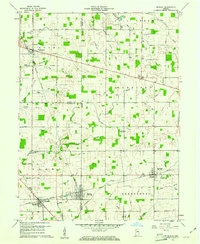 1960 Shirley1961 Print · USGSEast-central Indiana farmland is captured here in the early sixties, centered on the tri-county junction where Shirley meets the NEW YORK CENTRAL line. Local historians can trace family-named landmarks and rural hubs like McCray Cem, Harlan Ch, and the Township High Sch.2 unique versions available
 - 1960 Map of Anderson North, 1961 Print
 1960 Anderson North1961 Print · USGSMadison County in the early sixties shows the suburban growth of Anderson and Alexandria amidst a landscape of rural schools and family chapels. Genealogists can trace property near Wesley Chapel, Donahue Cem, and the village of Prosperity.5 unique versions available
 - 1961 Map of Anderson South, 1962 Print
 1961 Anderson South1962 Print · USGSMadison County at the dawn of the 1960s shows the suburban expansion of Anderson alongside long-established rural villages. Trace family roots and local industry through features like Grovelawn Cem, Mounds State Park, and the tracks of the Pennsylvania RR.4 unique versions available
 - 1962 Map of Frankton, 1963 Print
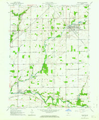 1962 Frankton1963 Print · USGSThe Madison County countryside comes into focus in the early sixties, centered on the rail-fed town of Frankton. Researchers can trace rural lineages through numerous local burial grounds like Howard Cem and Neese Cem or locate Ironwood Ch.2 unique versions available
 - 1962 Map of Ingalls, 1963 Print
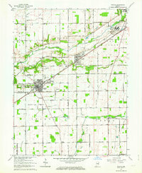 1962 Ingalls1963 Print · USGSAs the mid-century suburban shift began to reach central Indiana, this area saw traditional farming intersect with growing communities and institutional landmarks. Genealogists can trace family names through sites like Hiday Cem, Beech Grove Ch, and the State Reformatory.3 unique versions available
 - 1966 Map of Pendleton, 1968 Print
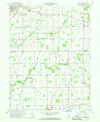 1966 Pendleton1968 Print · USGSMadison and Hancock Counties are captured here in the mid-1960s, showing a landscape of small crossroads settlements and family farms. Trace local history through landmarks like Milners Corner, the Zion Chapel, and old family plots like Cook Cem.
 - 1967 Map of Lapel, 1968 Print
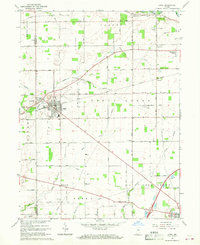 1967 Lapel1968 Print · USGSWestern Madison County in the late sixties reveals a landscape of growing towns and established rail lines. Genealogists and local historians can trace the foundations of Lapel and Pendleton, or locate rural landmarks like Old Woodward Cemetery and the Old German Church.2 unique versions available
 - 1986 Map of Muncie
 1986 Muncie1986 Print · USGSEast Central Indiana was a hub of manufacturing and higher education in the mid-eighties. Genealogists and historians can trace the streets of Muncie, locate rural Cem sites, and explore landmarks like Mounds State Park and Taylor Univ.3 unique versions available
 - 1986 Map of New Castle
 1986 New Castle1986 Print · USGSEast Central Indiana remains a patchwork of thriving county seats and rail-side hamlets in the mid-eighties. Genealogists and historians can locate family landmarks such as East Hill Cemetery, Little Blue River Church, and the transit lines of the CONRAIL railroad.2 unique versions available
Showing maps 1-25 of 100
Top cities of Madison County
- Anderson historical maps
- Elwood historical maps
- Alexandria historical maps
- Pendleton historical maps
- Chesterfield historical maps
- Edgewood historical maps
See more
Frequently asked questions
- What are the different types of historical maps available for Madison County?
- What is the oldest map of Madison County?
- Where can I purchase historical maps of Madison County for my home or office?
- Where can I download high-res historical maps of Madison County?
- Are there historical topographic maps available for Madison County?
- Is there historical aerial imagery available for Madison County?
- Where are historical maps of Madison County sourced from?