Old Maps of Handy, Indiana for Metal Detecting
Plan your next treasure hunt with 14 historic maps of Handy. Find old homesites, ghost towns, trails, and gathering spots that may be lost to time — perfect for identifying promising metal detecting locations.
- Locate forgotten sites: Uncover places like long-lost settlements, abandoned rail lines, or gathering spots.
- Plan better hunts: Use map overlays combined with LiDAR or satellite views to narrow in on historically rich areas.
- Made for detectorists: Thousands of hobbyists use these maps to discover relics, coins, and hidden history.
Use these historic maps to boost your research and find new opportunities beneath the surface of Handy.
Handy, IN maps
(14)- 1942 Map of Franklin
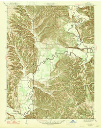
 1942 Franklin1942 Print · USGSCentral Indiana during the early years of the war shows a landscape of established rail towns and growing military installations. Genealogists can trace family names across small settlements like Nineveh, Bean Blossom, and Helmsburg, or locate the Indiana University Observatory.
 - 1947 Map of Allens Creek
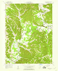
 1947 Allens Creek1947 Print · USGSSoutheastern Monroe County is shown here in the late 1940s, before the landscape was transformed by water management projects. Researchers can trace rural life through numerous country schools and churches, including Allens Creek Sch, Blackwell Ch, and the settlement at Fairfax.3 unique versions available
 - 1953 Map of Indianapolis, 1965 Print
 1953 Indianapolis1965 Print · USGSCentral Indiana and the Illinois borderlands are captured in the mid-sixties, showing the growth of Indianapolis and its industrial rail corridors. Genealogists and historians can trace the development of outlying towns like Zionsville or Beech Grove and find landmarks such as Atterbury AAF and Turkey Run State Park.4 unique versions available
 - 1956 Map of Indianapolis
 1956 Indianapolis1956 Print · USGSCentral Indiana in the mid-fifties is captured during a period of industrial growth and military presence. Genealogists and historians can trace the rail networks of the New York Central or locate regional landmarks like Fort Benjamin Harrison and Camp Atterbury.
 - 1957 Map of Indianapolis
 1957 Indianapolis1957 Print · USGSCentral Indiana in the mid-fifties is captured here as a crossroads of major rail lines and nascent federal highways. Genealogists and historians can trace family-named ridges like Poplar Ridge or locate strategic sites like Camp Atterbury and Speedway.2 unique versions available
 - 1957 Map of Allens Creek, 1959 Print
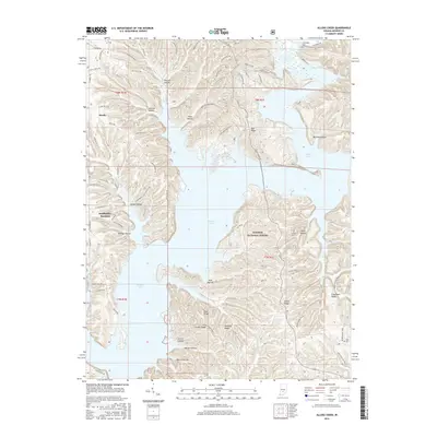
 1957 Allens Creek1959 Print · USGSMonroe County was a landscape of deep timber and winding creek bottoms in the years following the war. Genealogists can trace family names through dozens of landmarks like Friendship Cem, Allens Creek Ch, and Burgoon Sch.3 unique versions available
 - 1962 Map of Indianapolis
 1962 Indianapolis1962 Print · USGSCentral Indiana and the Illinois borderlands are captured here in the early sixties, showing the region's dense rail networks and growing urban centers. Genealogists and historians can locate family-named landmarks and institutions like Crown Hill Cem, Indiana University, and the Indianapolis Motor Speedway.
 - 1966 Map of Allens Creek, 1968 Print
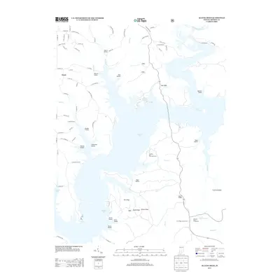
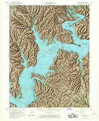 1966 Allens Creek1968 Print · USGSMonroe County terrain underwent a massive transformation in the mid-sixties as the newly formed Monroe Reservoir reshaped the valley. You can trace the submerged paths of Salt Creek and find enduring local landmarks like Shiloh Temple, Siscoe, and the Dutch Ridge Lookout Tower.6 unique versions available
 - 1986 Map of Bloomington
 1986 Bloomington1986 Print · USGSMid-century development and vast conservation areas define south-central Indiana during the eighties. Genealogists and historians can trace family roots through numerous landmarks like Beanblossom Cem, New Unionville Church, and the historic corridors of the Indiana RR.3 unique versions available
 - 2011 Map of Allens Creek, 2011 Print
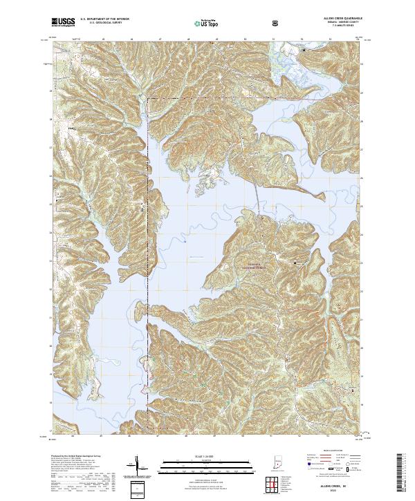
 2011 Allens Creek2011 Print · USGSCovers Handy, including Fairfax, Monroe County, and other nearby areas
 - 2013 Map of Allens Creek, 2013 Print
 2013 Allens Creek2013 Print · USGSCovers Handy, including Fairfax, Monroe County, and other nearby areas
 - 2016 Map of Allens Creek, 2016 Print
 2016 Allens Creek2016 Print · USGSCovers Handy, including Fairfax, Monroe County, and other nearby areas
 - 2019 Map of Allens Creek, 2019 Print
 2019 Allens Creek2019 Print · USGSCovers Handy, including Fairfax, Monroe County, and other nearby areas
 - 2022 Map of Allens Creek, 2022 Print
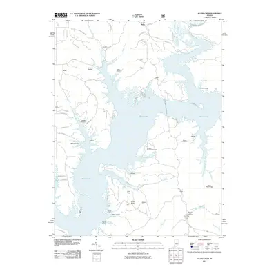
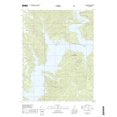
 2022 Allens Creek2022 Print · USGSMonroe County, Indiana, is defined by the massive Monroe Lake and the wooded terrain of the Hoosier National Forest in this recent survey. Researchers can locate family landmarks like Friendship Cem, Todd Cem, and the historic Burgoon Church.
End of results
Showing maps 1-14 of 14
Top cities near Handy
- Bloomington historical maps
- Bedford historical maps
- Ellettsville historical maps
- Clear Creek historical maps
- Guthrie historical maps
- Oolitic historical maps
See more
Frequently asked questions
- What are the different types of historical maps available for Handy?
- What is the oldest map of Handy?
- Where can I purchase historical maps of Handy for my home or office?
- Where can I download high-res historical maps of Handy?
- Are there historical topographic maps available for Handy?
- Is there historical aerial imagery available for Handy?
- Where are historical maps of Handy sourced from?