2020s Maps of Owen County, Indiana
Explore 11 historic maps of Owen County from the 2020s. These maps offer a rare glimpse into what life looked like during the 2020s — showing old roads, neighborhoods, homes, and landmarks that have changed or disappeared over time.
Whether you're researching your family's past, planning a metal detecting trip, or studying how Owen County's landscape evolved across the 2020s, these high-resolution maps are a powerful tool for exploring the history of this region.
- Focus on a specific era: All maps on this page are from the 2020s, giving you a focused view of this time period.
- See what’s changed: Compare century-old streets, trails, and buildings to today's modern landscape using overlays and satellite layers.
- Research with precision: Use these maps for genealogy, historical research, land use analysis, or educational projects.
- View, download, or print: Maps are fully viewable online in high resolution, and can be downloaded or printed for your own records.
Start exploring Owen County's history through authentic maps from the 2020s. This is your window into the past.
Owen County, IN maps
(11)- 2022 Map of Clay City, 2022 Print
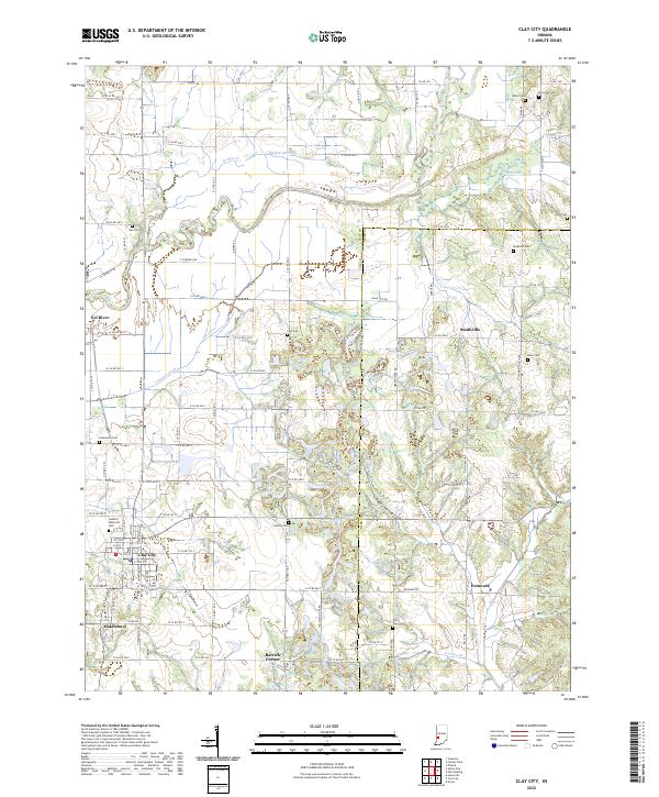 2022 Clay City2022 Print · USGSClay City and its neighboring hamlets are captured here in the early twenty-first century, showing a rural Indiana landscape deeply tied to its waterways. Genealogists can locate family landmarks like Stephens Cem, Liechty Cem, and the small community at Barrick Corner.
 - 2022 Map of Coal City, 2022 Print
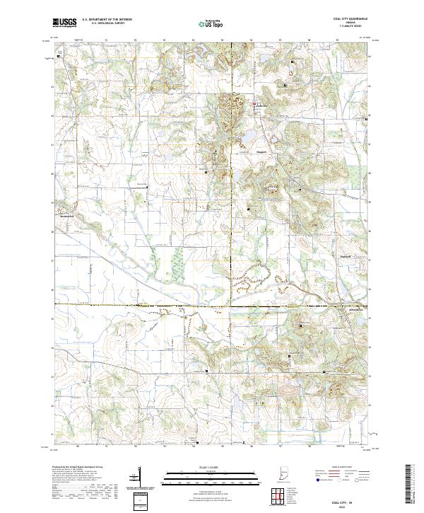 2022 Coal City2022 Print · USGSThe tri-county borderlands of Clay, Owen, and Greene counties are documented here in the early 2020s. Genealogists and local historians can trace the legacy of early settlements through sites like Scaffold Prairie Cem, Coal City, and the Wabash and Erie Canal.
 - 2022 Map of Patricksburg, 2022 Print
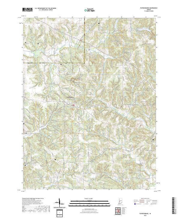 2022 Patricksburg2022 Print · USGSThe rural border of Owen and Clay counties is captured in this modern survey of central Indiana. Genealogists can locate numerous small burial grounds across the hills, including Steubenville Cemetery, Olive Hill Cemetery, and Snoddy Cemetery.
 - 2022 Map of Freedom, 2022 Print
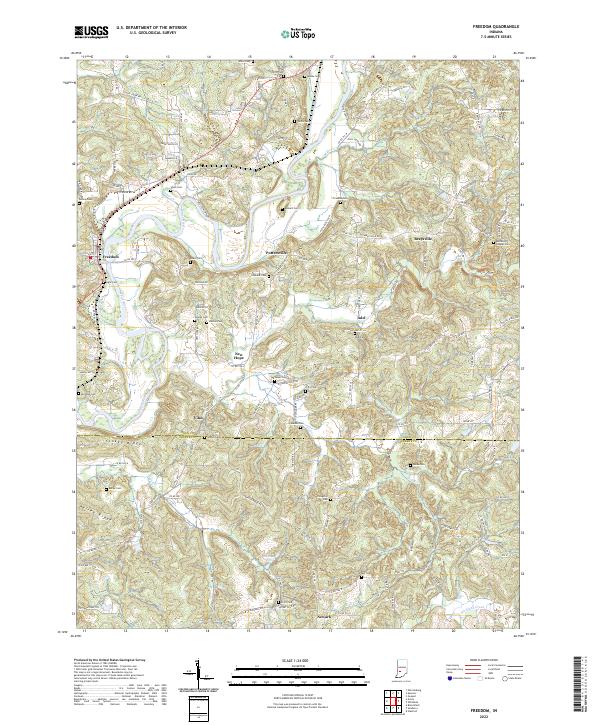 2022 Freedom2022 Print · USGSThe rural landscapes of Owen and Greene counties are captured here in the early 2020s as White River flows past Freedom. Genealogists can trace family burial sites like Oliphant Cem and Burkett Cem near the old settlement of Pottersville.
 - 2022 Map of Whitehall, 2022 Print
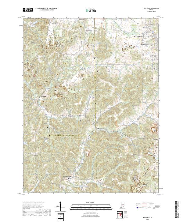 2022 Whitehall2022 Print · USGSSouthern Indiana's rolling landscape is shown in detail during the early 2020s, highlighting the enduring rural character of the Monroe and Owen county lines. Family history researchers can trace locations like Methodist Cem, Hendricksville, and the isolated Livingston Cem.
 - 2022 Map of Spencer, 2022 Print
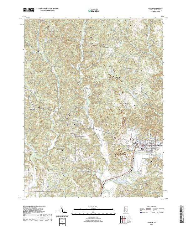 2022 Spencer2022 Print · USGSThe Owen County seat and the winding White River valley come into focus in this contemporary survey of the Indiana countryside. Genealogists and local historians can trace dozens of rural burial sites and landmarks like the Owen County Court House, Saint Walley Cem, and Southport.
 - 2022 Map of Quincy, 2022 Print
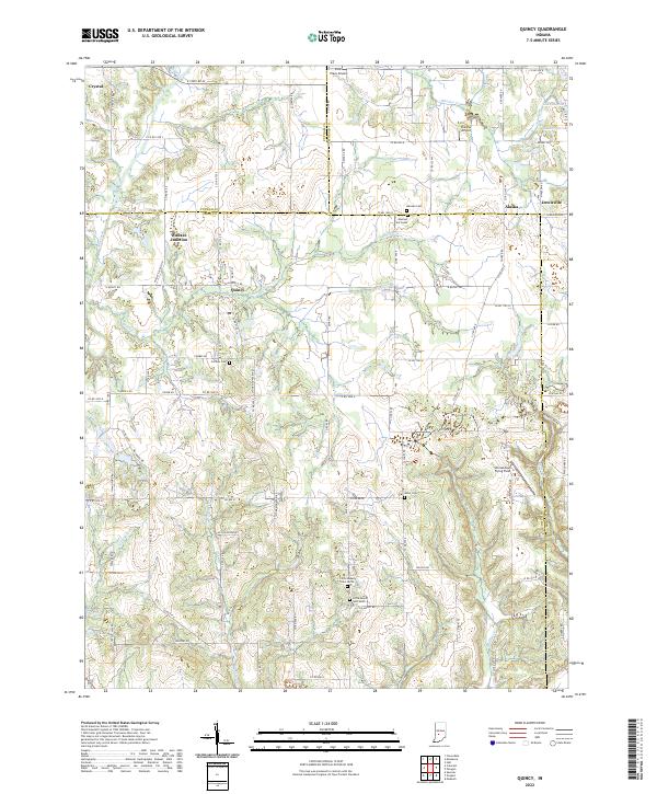 2022 Quincy2022 Print · USGSOwen County's rural landscape is captured here in the early twenty-first century, centered on the historic rail meeting point at Wallace Junction. Researchers can find numerous local landmarks like Mannan Cem, Quincy, and Shenandoah Flying Field.
 - 2022 Map of Cataract, 2022 Print
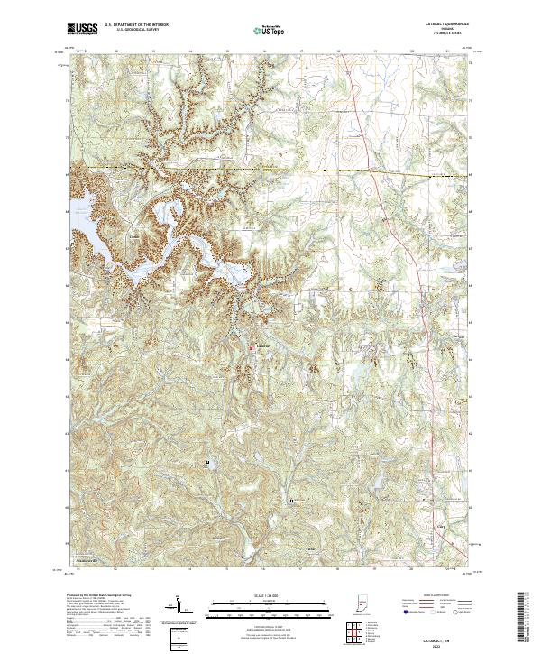 2022 Cataract2022 Print · USGSOwen County at the start of the 2020s remains a landscape defined by the winding Mill Creek and the waters of Cagles Mill Lake. Researchers can trace old family burial grounds like Maze Cem and explore the historic footprints of small towns such as Cataract and Cuba.
 - 2022 Map of Gosport, 2022 Print
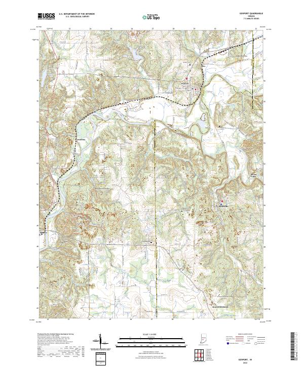 2022 Gosport2022 Print · USGSThe Owen and Monroe County line comes alive in the early 2020s, centered on the river-and-rail corridor of Gosport and Romona. Genealogists and hikers can trace the Indiana Rail Road or locate the Wolf Natural Bridges and Van Buskirk Cem.
 - 2022 Map of Arney, 2022 Print
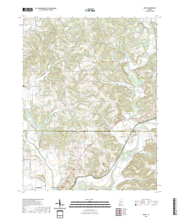 2022 Arney2022 Print · USGSThe confluence of the Eel and White Rivers defines this Owen and Greene County border region as it appears in the early 2020s. Local researchers can locate rural burial sites like Oak Grove Cem and trace the legacy of Point Commerce near Worthington.
 - 2022 Map of Poland, 2022 Print
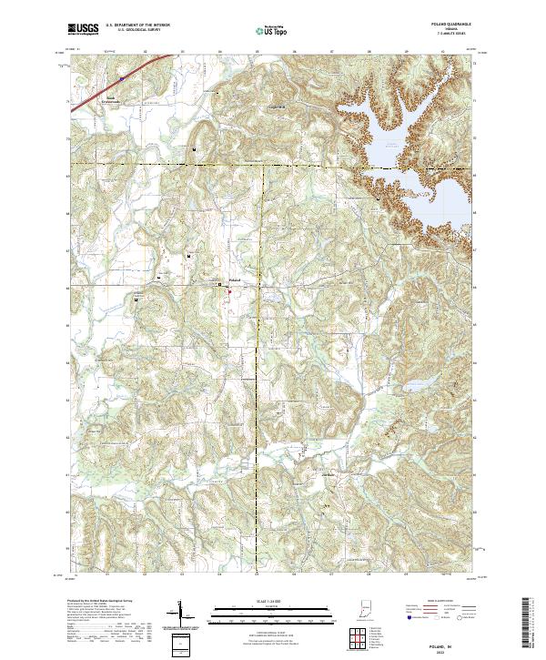 2022 Poland2022 Print · USGSThe rural crossroads of Owen and Clay counties are captured here in the early twenty-first century. Genealogists and local historians can trace family roots through numerous sites like Poland Chapel Cem, Raab Crossroads, and the old Wilkerson - Nees Cem.
End of results
Showing maps 1-11 of 11
Top cities of Owen County
Frequently asked questions
- What are the different types of historical maps available for Owen County?
- What is the oldest map of Owen County?
- Where can I purchase historical maps of Owen County for my home or office?
- Where can I download high-res historical maps of Owen County?
- Are there historical topographic maps available for Owen County?
- Is there historical aerial imagery available for Owen County?
- Where are historical maps of Owen County sourced from?