Old Maps of Owen County, Indiana for Academic Research
Study the evolution of Owen County with 87 high-resolution historic maps. Whether you're teaching, researching, or modeling changes in land use, these maps provide essential visual documentation of urban, environmental, and geographic change.
- Analyze long-term change: Track patterns in development, transportation, and natural features.
- Ideal for environmental or urban studies: Support academic projects with primary historical map data.
- Use in the classroom or lab: Educators and researchers rely on these maps to bring historical context to life.
These maps are a powerful tool for teaching, research, and visualizing how Owen County has changed over the decades.
Owen County, IN maps
(87)- 1908 Map of Clay City
 1908 Clay City1908 Print · USGSIndiana's coal and timber country comes alive in the years before the Great War, showing a landscape defined by deep river valleys and early rail lines. Genealogists can trace hundreds of family sites near Clay City and Center Point, or locate historic gathering places like Wesley Chapel and Roadman School.
 - 1908 Map of Bloomington
 1908 Bloomington1908 Print · USGSMonroe and Greene Counties appear at the height of their early rail-and-quarry era during the first decade of the 1900s. Genealogists can locate family landmarks among dozens of rural schoolhouses like Parks School and old parish sites like Mt Ebal Church.2 unique versions available
 - 1908 Map of Bloomfield, 1954 Print
 1908 Bloomfield1954 Print · USGSGreene County is defined by the sweeping bends of the White River and a dense network of early railroads in the late 1960s. Researchers can locate many family-named landmarks and old church sites like Stalcup Cem, Hashtown, and Tulip Ch.
 - 1910 Map of Clay City
 1910 Clay City1910 Print · USGSClay County at the height of its rail-and-river era shows a landscape shaped by coal transport and agriculture. You can trace the Wabash and Erie Canal, locate the Feederdam Bridge, and find dozens of family-named schoolhouses like Dutch Knob School.2 unique versions available
 - 1910 Map of Bloomington
 1910 Bloomington1910 Print · USGSMonroe County at the peak of its quarrying era reveals a landscape shaped by education, industry, and rail. Genealogists can trace family roots through Indiana University, Sanders PO, and the Greene County Chapel.6 unique versions available
 - 1938 Map of Coal City
 1938 Coal City1938 Print · USGSSouthern Indiana at the end of the 1930s shows a landscape of small coal-mining towns and rural crossroads between the forks of the Eel River. Researchers can trace the path of the Wabash and Erie Canal and locate family roots at Coal City, Sink Cem, or Scaffold Prairie Ch.
 - 1947 Map of Gosport, 1958 Print
 1947 Gosport1958 Print · USGSMid-century Owen and Monroe counties are seen here through their winding river valleys and small railroad towns. Researchers can trace the heritage of rural congregations and family lands near Stinesville, Shiloh Ch, and the Chambersville Cem.
 - 1948 Map of Coal City
 1948 Coal City1948 Print · USGSThe rural borderlands of Owen, Clay, and Greene Counties are shown here during the late 1940s, showcasing a landscape shaped by coal mining and transport. Researchers can trace the path of the Wabash and Erie Canal (Abandoned) and locate vanished landmarks like Stockton, Sink Cem, and the College Hill Sch.2 unique versions available
 - 1949 Map of Quincy
 1949 Quincy1949 Print · USGSOwen County’s rural townships are captured in the late 1940s, centered on the railroad hub at Quincy. Genealogists can trace family landmarks like Little Mount Cem, Montgomery Chapel, and the vanished School No. 2 near the Morgan County line.2 unique versions available
 - 1950 Map of Gosport
 1950 Gosport1950 Print · USGSMid-century Owen and Monroe Counties center on the winding river valley as the regional rail network and park system flourished. Researchers can trace rural lineages through sites like Old Dutch Ch, Stinesville, and the Chambersville Cem.
 - 1950 Map of Arney
 1950 Arney1950 Print · USGSMid-century Owen County life centered on the river junctions and rural townships. Trace the paths of the New York Central railroad and find historic river landmarks like Farmers Ferry and small settlements like Point Commerce.2 unique versions available
 - 1953 Map of Coal City
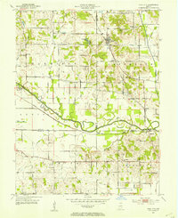 1953 Coal City1953 Print · USGSMid-century Owen and Clay counties are shown here during a peak era of surface mining and rail transport. Researchers can trace the Wabash and Erie Canal or locate rural landmarks like New Hope Ch and Tapawingo Lake.
 - 1953 Map of Indianapolis, 1965 Print
 1953 Indianapolis1965 Print · USGSCentral Indiana and the Illinois borderlands are captured in the mid-sixties, showing the growth of Indianapolis and its industrial rail corridors. Genealogists and historians can trace the development of outlying towns like Zionsville or Beech Grove and find landmarks such as Atterbury AAF and Turkey Run State Park.4 unique versions available
 - 1956 Map of Indianapolis
 1956 Indianapolis1956 Print · USGSCentral Indiana in the mid-fifties is captured during a period of industrial growth and military presence. Genealogists and historians can trace the rail networks of the New York Central or locate regional landmarks like Fort Benjamin Harrison and Camp Atterbury.
 - 1956 Map of Cataract, 1957 Print
 1956 Cataract1957 Print · USGSOwen County's landscape is defined by its state forests and the waters of the lake in the mid-fifties. Researchers can trace the Monon rail line or locate rural landmarks like Cataract Falls, Ernie Pyle Island, and Mill Grove Ch.6 unique versions available
 - 1956 Map of Patricksburg, 1957 Print
 1956 Patricksburg1957 Print · USGSOwen County in the mid-fifties was a landscape defined by the intersection of rail transport and rural industry. Genealogists can trace the location of family burial grounds like Steubenville Cem and landmarks like Patricksburg or the Monon Line.2 unique versions available
 - 1956 Map of Freedom, 1958 Print
 1956 Freedom1958 Print · USGSAcross the Owen and Greene County line in the mid-1950s, the river and rail network defined life for rural townships. Researchers can trace family roots through dozens of sites like Hedding Ch, McIndoo Cem, and the riverfront settlement of Freedom.5 unique versions available
 - 1956 Map of Spencer, 1958 Print
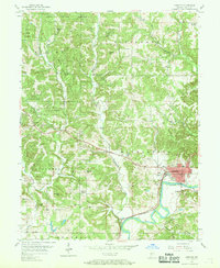 1956 Spencer1958 Print · USGSOwen County's landscape in the mid-fifties is centered on the river-bend town of Spencer and the wooded tracts of Owen State Forest. Genealogists and historians can trace family burial sites like Palestine Cem or locate the old Pennsylvania rail route and Southport settlement.5 unique versions available
 - 1957 Map of Indianapolis
 1957 Indianapolis1957 Print · USGSCentral Indiana in the mid-fifties is captured here as a crossroads of major rail lines and nascent federal highways. Genealogists and historians can trace family-named ridges like Poplar Ridge or locate strategic sites like Camp Atterbury and Speedway.2 unique versions available
 - 1957 Map of Clay City, 1958 Print
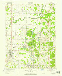 1957 Clay City1958 Print · USGSIndiana's Eel River valley comes into sharp focus during the late fifties, showing the interplay between rural agriculture and industrial rail lines. Genealogists can trace family roots through numerous sites like St Peters Ch, Middlebury, and the Red Brush Cem.2 unique versions available
 - 1957 Map of Whitehall, 1958 Print
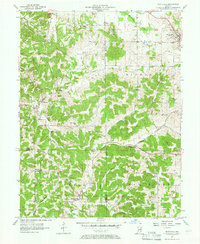 1957 Whitehall1958 Print · USGSSouthern Indiana's rural landscape is captured here in the mid-1950s at the junction of Monroe, Owen, and Greene counties. Researchers can trace ancestral roots through numerous local landmarks like Garrison Chapel, Whitehall, and the Hopewell Cem.4 unique versions available
 - 1957 Map of Poland, 1958 Print
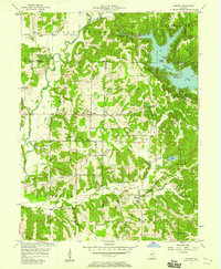 1957 Poland1958 Print · USGSCataract Lake and the Cagle Mill Dam emerge as major landmarks in the Indiana countryside of the mid-1950s. Genealogists can trace family names at Raab Crossroads or locate rural sites like Greeley Ch, Nier Cem, and Township Sch.4 unique versions available
 - 1958 Map of Quincy, 1959 Print
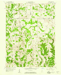 1958 Quincy1959 Print · USGSOwen County is captured in the late fifties at a time when the rail-and-river landscape still defined local life. Genealogists can trace family names at Hudson Hill Cem and Mannan Cem or locate the village of Quincy near the historic Treaty Boundary.2 unique versions available
 - 1962 Map of Indianapolis
 1962 Indianapolis1962 Print · USGSCentral Indiana and the Illinois borderlands are captured here in the early sixties, showing the region's dense rail networks and growing urban centers. Genealogists and historians can locate family-named landmarks and institutions like Crown Hill Cem, Indiana University, and the Indianapolis Motor Speedway.
 - 1963 Map of Coal City, 1964 Print
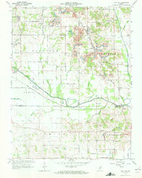 1963 Coal City1964 Print · USGSIndiana's western coal country is revealed in the early 1960s as a landscape of extraction and deep local roots. You can trace the New York Central rail line through Coal City or find family history at Winters Cem and the New Hope Ch.4 unique versions available
Showing maps 1-25 of 87
Top cities of Owen County
Frequently asked questions
- What are the different types of historical maps available for Owen County?
- What is the oldest map of Owen County?
- Where can I purchase historical maps of Owen County for my home or office?
- Where can I download high-res historical maps of Owen County?
- Are there historical topographic maps available for Owen County?
- Is there historical aerial imagery available for Owen County?
- Where are historical maps of Owen County sourced from?