1950s Maps of Valparaiso, Indiana
Explore 5 historic maps of Valparaiso from the 1950s. These maps offer a rare glimpse into what life looked like during the 1950s — showing old roads, neighborhoods, homes, and landmarks that have changed or disappeared over time.
Whether you're researching your family's past, planning a metal detecting trip, or studying how Valparaiso's landscape evolved across the 1950s, these high-resolution maps are a powerful tool for exploring the history of this region.
- Focus on a specific era: All maps on this page are from the 1950s, giving you a focused view of this time period.
- See what’s changed: Compare century-old streets, trails, and buildings to today's modern landscape using overlays and satellite layers.
- Research with precision: Use these maps for genealogy, historical research, land use analysis, or educational projects.
- View, download, or print: Maps are fully viewable online in high resolution, and can be downloaded or printed for your own records.
Start exploring Valparaiso's history through authentic maps from the 1950s. This is your window into the past.
Valparaiso, IN maps
(5)- 1953 Map of Wanatah, 1955 Print
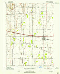 1953 Wanatah1955 Print · USGSIn the early 1950s, this area of Indiana was a bustling rail corridor where several major lines converged at Wanatah. Trace the path of the Lincoln Highway and find rural landmarks like Luther Cem and Haskells.
 - 1953 Map of Valparaiso, 1955 Print
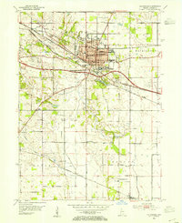 1953 Valparaiso1955 Print · USGSValparaiso and the surrounding Porter County townships are captured here in the mid-fifties, during a period of steady institutional and rural growth. Genealogists and local historians can trace family plots at Adam Cem, locate the old Morgan Sch, or follow the historic Lincoln Highway through town.
 - 1953 Map of Chesterton, 1955 Print
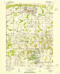 1953 Chesterton1955 Print · USGSPorter County's industrial and recreational landscape is captured here in the mid-fifties, centered on the busy rail junctions of Chesterton and Porter. Researchers can trace historic family burial sites at Gossett Cemetery and follow the old milling operations at Tratabas Mill.
 - 1953 Map of Chicago, 1964 Print
 1953 Chicago1964 Print · USGSThe southern Lake Michigan shoreline was rapidly modernizing in the mid-fifties, balancing heavy industry with its famous academic centers. Researchers can trace the footprints of Notre Dame University or locate vanished sites like the Kingsbury Ordnance Plant and Meigs Field.5 unique versions available
 - 1957 Map of Chicago
 1957 Chicago1957 Print · USGSThe industrial heartland and southern Great Lakes shoreline are captured here during the peak of mid-century growth. Researchers can trace the massive Gary Steel Works, the grounds of the University of Notre Dame, and the early paths of the Tri-State Tollway.
End of results
Showing maps 1-5 of 5
Top cities near Valparaiso
- Gary historical maps
- Portage historical maps
- Michigan City historical maps
- Merrillville historical maps
- Hobart historical maps
- Lake Station historical maps
See more
Top neighborhoods of Valparaiso
Frequently asked questions
- What are the different types of historical maps available for Valparaiso?
- What is the oldest map of Valparaiso?
- Where can I purchase historical maps of Valparaiso for my home or office?
- Where can I download high-res historical maps of Valparaiso?
- Are there historical topographic maps available for Valparaiso?
- Is there historical aerial imagery available for Valparaiso?
- Where are historical maps of Valparaiso sourced from?