Old Maps of Randolph County, Indiana for Hiking & Exploration
Hike through history with 86 historic maps of Randolph County. Explore old trails, ghost towns, and forgotten backroads — perfect for outdoor adventurers and local explorers.
- Rediscover forgotten places: Map out old mining camps, roads, and footpaths that no longer exist on modern maps.
- Layer with modern tools: Combine with LiDAR or satellite views to plan hikes through historical terrain.
- Made for exploration: Popular among hikers, overlanders, and local history lovers.
Use these maps to find adventure and explore the hidden past of Randolph County.
Randolph County, IN maps
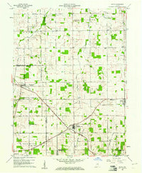
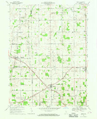
(86)- 1915 Map of Fort Recovery
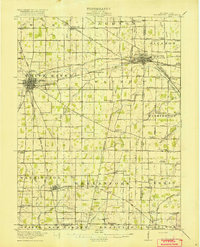
 1915 Fort Recovery1915 Print · USGSThe Indiana-Ohio borderlands come into focus during the mid-1910s, showing the agricultural and rail-dependent landscape around Fort Recovery. Genealogists and historians can trace the exact locations of numerous rural institutions like Oak Grove School, Mt Zion School, and the Lake Erie and Western railroad corridor.2 unique versions available
 - 1916 Map of Winchester
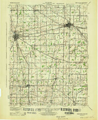
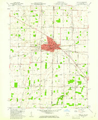
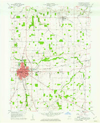
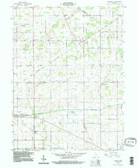
 1916 Winchester1916 Print · USGSIndiana's eastern borderlands during the height of the interurban era show a landscape of thriving rail towns and rural school districts. Genealogists can locate specific landmarks like the County Infirmary, McKinley School, and the cross-border community of Union City.3 unique versions available
 - 1918 Map of Winchester
 1918 Winchester1918 Print · USGSRandolph County sits at a crossroads of major rail lines and headwater streams during the late nineteen-teens. Genealogists can locate dozens of country schoolhouses like McKinley School and Sauerkraut School, or trace family ties in Union City and Lynn.2 unique versions available
 - 1918 Map of Fort Recovery, 1922 Print
 1918 Fort Recovery1922 Print · USGSFort Recovery and the surrounding Mercer County farmsteads are documented here in the early twentieth century, just years after the turn of the century. Genealogists can trace family connections through a high density of rural schoolhouses like Mt Zion School and settlements such as Macedon and Buck Corners.
 - 1943 Map of Winchester, 1944 Print
 1943 Winchester1944 Print · USGSThe Indiana-Ohio borderlands in the 1940s reveal a landscape of bustling rail junctions and tight-knit rural school districts. Genealogists can trace family footprints at Beech Grove Sch, the County Infirmary, or the curious Sauerkraut Sch.
 - 1952 Map of Maxville, 1953 Print
 1952 Maxville1953 Print · USGSRandolph County life in the early fifties is centered on the White River valley and its busy rail corridors. Genealogists and local historians can trace family roots at Woodlawn Cem, find the Moorman Orphanage, or locate the site of Funks Speedway.2 unique versions available
 - 1952 Map of Farmland, 1953 Print
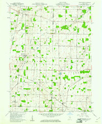
 1952 Farmland1953 Print · USGSMid-century Randolph County agriculture and rail transit are captured here just as the steam era fully gave way to diesel. Genealogists can trace family footprints through rural landmarks like Stoney Creek Sch, Union Cem, and the riverside settlement of Windsor.
 - 1953 Map of Muncie, 1966 Print
 1953 Muncie1966 Print · USGSIndiana and Ohio borderlands thrive in the early fifties, showing a landscape defined by manufacturing cities and an intensive railroad network. Genealogists can trace family roots across the Indiana-Ohio line through Muncie, Celina, and Portland via the Pennsylvania railroad.5 unique versions available
 - 1956 Map of Muncie
 1956 Muncie1956 Print · USGSEastern Indiana and western Ohio are shown at a peak of rail-driven industry in the mid-fifties. Genealogists and rail historians can trace the paths of the Pennsylvania RR through Muncie or locate landmarks like Lake Saint Marys (Grand Lake Reservoir) and Frances Slocum State Forest.
 - 1960 Map of Union City, 1961 Print
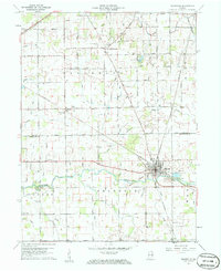
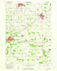
 1960 Union City1961 Print · USGSThe Indiana-Ohio border communities are captured here in the early sixties, centered on the bustling rail junction of Union City. Researchers can trace old family sites at Spring Hill Cem, Poplar Grove Ch, and the rural crossroads of New Lisbon.4 unique versions available
 - 1960 Map of Carlos, 1961 Print
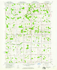
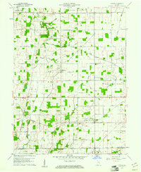 1960 Carlos1961 Print · USGSRandolph County's rural townships are captured here in the early sixties, showing the agricultural heartland of eastern Indiana. Researchers can trace historical property lines along the Indian Treaty Boundary and locate small communities like Huntsville, Unionport, and Carlos.3 unique versions available
 - 1960 Map of Spartanburg, 1961 Print
 1960 Spartanburg1961 Print · USGSThe Indiana-Ohio borderlands at the start of the 1960s reveal a landscape of well-ordered farms and quiet railroad hamlets. Researchers can locate family landmarks like Beech Cemetery and Bartonia Cemetery or trace the New York Central through Crete.2 unique versions available
 - 1960 Map of Lynn, 1961 Print
 1960 Lynn1961 Print · USGSEastern Indiana at the start of the sixties reveals a landscape of thriving rail hubs and quiet country crossroads. Genealogists and historians can locate family landmarks like Quaker Lynn Cem, the New York Central Line, and the town of Bloomingport.4 unique versions available
 - 1960 Map of Winchester, 1961 Print
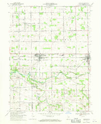
 1960 Winchester1961 Print · USGSWinchester served as a vital rail and river hub at the start of the sixties, where the White River met several major rail lines. Researchers can trace family roots through numerous local landmarks, including the Fountain Park Cemetery, Ward-Jackson Sch, and the small settlement of Jericho.3 unique versions available
 - 1960 Map of Cosmos, 1961 Print
 1960 Cosmos1961 Print · USGSThe Indiana-Ohio borderlands at the start of the sixties were a grid of productive farmland and small rural parishes. Researchers can trace ancestral sites and local landmarks like Salem, Raper Chapel, and Mt Zion Cem Ch across the state line.4 unique versions available
 - 1960 Map of Ridgeville, 1961 Print
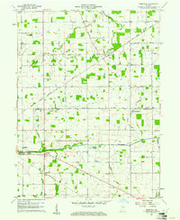
 1960 Ridgeville1961 Print · USGSEast-central Indiana is captured here at the start of the sixties, showing a landscape defined by the Mississinewa River and rail lines. Genealogists can locate family sites at Odd Fellows Cem and Powers Cem or trace the early Indian Treaty Boundary.3 unique versions available
 - 1960 Map of Deerfield, 1961 Print
 1960 Deerfield1961 Print · USGSRandolph and Jay counties appear here in the early sixties, a landscape defined by the Old Indian Treaty Boundary and the winding Mississinewa River. Genealogists can locate several historic burial sites like Lawn Dale Cem, Neimer Cem, and the community of New Pittsburg.
 - 1960 Map of Modoc, 1961 Print
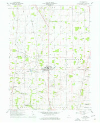
 1960 Modoc1961 Print · USGSRandolph and Henry Counties appear here in the early sixties, centered on the vital rail junctions of the eastern Indiana plains. Genealogists and local historians can trace the locations of Bronson, Blountsville, and rural sites like Grace Chapel.
 - 1960 Map of Redkey, 1962 Print
 1960 Redkey1962 Print · USGSEastern Indiana in the early sixties shows a landscape where industrial rail hubs meet the agricultural heartland. Genealogists and local historians can trace family roots through sites like Cherry Grove Sch, Shedville, and the Strong Cem near the Mississinewa River.2 unique versions available
 - 1969 Map of Farmland, 1970 Print
 1969 Farmland1970 Print · USGSRandolph and Delaware counties come into focus during the late sixties, showing the agricultural heartland between Parker and Farmland. Researchers can trace family history through sites like Swindley Cemetery, White River Church, and the Stoney Creek School.
 - 1969 Map of Maxville, 1970 Print
 1969 Maxville1970 Print · USGSThe rural landscape of Randolph County is captured in the late sixties, showcasing the agricultural heart of White River and Monroe townships. Genealogists can trace family history through sites like Hopewell Cem, Woodlawn Ch, and the North White River Sch.2 unique versions available
 - 1969 Map of Modoc, 1970 Print
 1969 Modoc1970 Print · USGSRandolph and Henry Counties are captured here in the late sixties, showing a landscape defined by intersecting railroads and rural crossroads. Genealogists and local historians can locate family landmarks like Poplar Run Cem, Union Ch, and the settlement of Blountsville.
 - 1986 Map of Piqua
 1986 Piqua1986 Print · USGSThe western Ohio and eastern Indiana borderlands appear here in the mid-1980s, showcasing a landscape of river-valley industry and fertile plains. Researchers can trace historic rail lines like Conrail and Norfolk and Western through towns like Greenville and Winchester.3 unique versions available
 - 1986 Map of Muncie
 1986 Muncie1986 Print · USGSEast Central Indiana was a hub of manufacturing and higher education in the mid-eighties. Genealogists and historians can trace the streets of Muncie, locate rural Cem sites, and explore landmarks like Mounds State Park and Taylor Univ.3 unique versions available
 - 1992 Map of Deerfield, 1995 Print
 1992 Deerfield1995 Print · USGSThe rural borderlands of Jay and Randolph Counties were documented in the 1990s as a landscape of river-fed farms and diagonal treaty lines. Genealogists can trace family roots through numerous sites like Lawn Dale Cemetery and Zion Church near the Mississinewa River.
Showing maps 1-25 of 86
Top cities of Randolph County
- Winchester historical maps
- Union City historical maps
- Farmland historical maps
- Parker City historical maps
- Lynn historical maps
- Ridgeville historical maps
See more
Frequently asked questions
- What are the different types of historical maps available for Randolph County?
- What is the oldest map of Randolph County?
- Where can I purchase historical maps of Randolph County for my home or office?
- Where can I download high-res historical maps of Randolph County?
- Are there historical topographic maps available for Randolph County?
- Is there historical aerial imagery available for Randolph County?
- Where are historical maps of Randolph County sourced from?