1960s Maps of Spencer County, Indiana
Explore 16 historic maps of Spencer County from the 1960s. These maps offer a rare glimpse into what life looked like during the 1960s — showing old roads, neighborhoods, homes, and landmarks that have changed or disappeared over time.
Whether you're researching your family's past, planning a metal detecting trip, or studying how Spencer County's landscape evolved across the 1960s, these high-resolution maps are a powerful tool for exploring the history of this region.
- Focus on a specific era: All maps on this page are from the 1960s, giving you a focused view of this time period.
- See what’s changed: Compare century-old streets, trails, and buildings to today's modern landscape using overlays and satellite layers.
- Research with precision: Use these maps for genealogy, historical research, land use analysis, or educational projects.
- View, download, or print: Maps are fully viewable online in high resolution, and can be downloaded or printed for your own records.
Start exploring Spencer County's history through authentic maps from the 1960s. This is your window into the past.
Spencer County, IN maps
(16)- 1960 Map of Santa Claus, 1962 Print
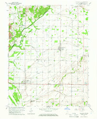
 1960 Santa Claus1962 Print · USGSSouthern Indiana in the early sixties was a landscape of memory and industry, balancing Lincoln family history with active coal and oil extraction. Local researchers can trace the old tracks of the Southern railroad or locate Buffaloville Cem and Little Pigeon Ch.3 unique versions available
 - 1960 Map of Saint Meinrad, 1962 Print
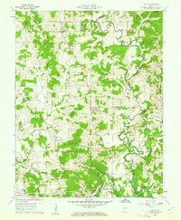
 1960 Saint Meinrad1962 Print · USGSSouthern Indiana at the dawn of the sixties shows a unique mix of monastic tradition and coal production. Genealogists and historians can trace family-named landmarks like Tenn Beard Cem and Taylor Cem or locate the Saint Meinrad Seminary and its surrounding shrines.4 unique versions available
 - 1960 Map of Fulda, 1962 Print
 1960 Fulda1962 Print · USGSSpencer and Perry Counties are shown at the dawn of the 1960s as a landscape of tight-knit rural parishes and hilltop forests. Genealogists can trace family names through numerous remote burial grounds like Rust Cem and Butler Cem or locate old community centers such as New Boston and Fulda.3 unique versions available
 - 1960 Map of De Gonia Springs, 1962 Print
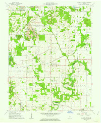 1960 De Gonia Springs1962 Print · USGSWarrick and Spencer counties are shown at the height of the mid-century mining era, as traditional farmsteads met expanding industrial footprints. Genealogists can trace family landmarks like Skelton Cems, Bethabara Ch, and the distinct settlements of De Gonia Springs and Degonia.2 unique versions available
 - 1960 Map of Chrisney, 1962 Print
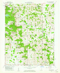
 1960 Chrisney1962 Print · USGSSpencer County at the start of the sixties reveals a transition from traditional rural townships to a landscape shaped by state parks and railroads. Researchers can trace family roots through St Martins Ch and Mt Mariah Cem, or locate landmarks like Gentryville and the Pigeon Creek Fish Hatchery.3 unique versions available
 - 1960 Map of Lewisport, 1962 Print
 1960 Lewisport1962 Print · USGSThe Ohio River corridor comes alive in this 1960s study of the river towns and rural backroads along the Kentucky-Indiana border. Genealogists and historians can trace family-named sites and industrial markers like Sand Hill Cem, Oil Wells, and the Louisville and Nashville rail line.
 - 1961 Map of Evansville
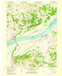
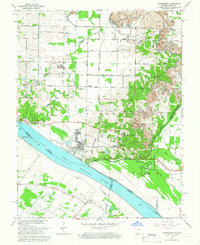
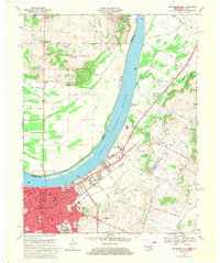
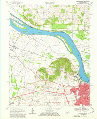
 1961 Evansville1961 Print · USGSThe Ohio River valley and its surrounding coalfields are captured here during the late fifties and early sixties. Trace the industrial rail networks of the Illinois Central RR and explore regional landmarks like Mammoth Cave National Park and Angel Mounds State Memorial.2 unique versions available
 - 1961 Map of Holland, 1962 Print
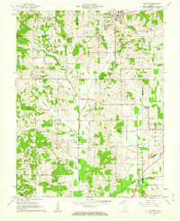 1961 Holland1962 Print · USGSThe crossroads of Dubois, Warrick, and Spencer counties come alive in the early sixties as rural life meets emerging industry. Researchers can trace the Old Indian Treaty Boundary and locate family burial sites like St James Cem or the Strip Mine near Selvin.3 unique versions available
 - 1961 Map of Tell City, 1963 Print
 1961 Tell City1963 Print · USGSThe Ohio River corridor comes alive in the early sixties as industrial Tell City and Hawesville face each other across the water. Genealogists can trace family heritage through local burial grounds like Thrasher Cem and St Columba Cem or locate the site of the old Newman Sch.5 unique versions available
 - 1961 Map of Dale, 1963 Print
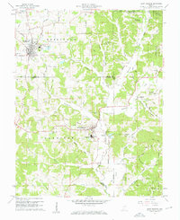
 1961 Dale1963 Print · USGSSpencer and Dubois counties are shown here in the early sixties, a period when local industry and historical boundaries still defined the landscape. Researchers can trace family sites at Pinkston Cem, follow the old Indian Treaty Boundary, or locate the Strip Mine operations near Mariah Hill.2 unique versions available
 - 1964 Map of Richland City, 1965 Print
 1964 Richland City1965 Print · USGSSpencer County's rural townships are captured in the mid-1960s as a landscape of managed drainage and quiet agricultural hubs. Researchers can trace ancestral sites at Hatfield Cem and Richardson Cem or locate the former Old Railroad Grade near Richland City.2 unique versions available
 - 1964 Map of Yankeetown, 1966 Print
 1964 Yankeetown1966 Print · USGSThe Indiana-Kentucky borderlands along the Ohio River appear here in the mid-1960s, showing a landscape of riverfront hamlets and industrial change. Genealogists and local historians can locate Yankeetown Cem, trace the Old Railroad Grade, and find rural landmarks like St Ruperts Ch.4 unique versions available
 - 1964 Map of Rockport, 1966 Print
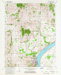 1964 Rockport1966 Print · USGSRockport and its surrounding riverfront townships are captured here in the mid-1960s as the river-and-rail economy shaped Spencer County. Genealogists and local historians can trace family plots at St Bernard Cem and Whitehouse Cem or locate the site of the County Infirmary.2 unique versions available
 - 1967 Map of Lewisport, 1969 Print
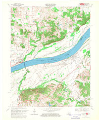 1967 Lewisport1969 Print · USGSThe Ohio River corridor comes to life in the late 1960s as it winds past Lewisport and Grandview. Genealogists and historians can trace family land near Old Gentry Cemetery, locate Chestnut Grove Church, or follow the Louisville and Nashville rail line.
 - 1967 Map of Owensboro East, 1970 Print
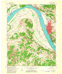
 1967 Owensboro East1970 Print · USGSDaviess County and the Indiana shoreline appear here during a period of significant urban growth in the late sixties. Researchers can trace the city’s expansion through landmarks like Brescia College, the Louisville and Nashville rail lines, and Elmwood Cemetery.3 unique versions available
 - 1968 Map of Owensboro West, 1969 Print
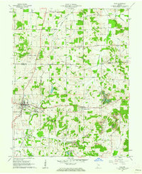
 1968 Owensboro West1969 Print · USGSDaviess County during the late sixties shows the western expansion of Owensboro toward the Bon Harbor Hills. Genealogists and historians can locate family landmarks like Lancaster Cem, the Louisville and Nashville rail line, and the riverside Lock and Dam No 46.3 unique versions available
End of results
Showing maps 1-16 of 16
Top cities of Spencer County
- Rockport historical maps
- Dale historical maps
- Grandview historical maps
- Chrisney historical maps
- Gentryville historical maps
Frequently asked questions
- What are the different types of historical maps available for Spencer County?
- What is the oldest map of Spencer County?
- Where can I purchase historical maps of Spencer County for my home or office?
- Where can I download high-res historical maps of Spencer County?
- Are there historical topographic maps available for Spencer County?
- Is there historical aerial imagery available for Spencer County?
- Where are historical maps of Spencer County sourced from?