2020s Maps of Spencer County, Indiana
Explore 15 historic maps of Spencer County from the 2020s. These maps offer a rare glimpse into what life looked like during the 2020s — showing old roads, neighborhoods, homes, and landmarks that have changed or disappeared over time.
Whether you're researching your family's past, planning a metal detecting trip, or studying how Spencer County's landscape evolved across the 2020s, these high-resolution maps are a powerful tool for exploring the history of this region.
- Focus on a specific era: All maps on this page are from the 2020s, giving you a focused view of this time period.
- See what’s changed: Compare century-old streets, trails, and buildings to today's modern landscape using overlays and satellite layers.
- Research with precision: Use these maps for genealogy, historical research, land use analysis, or educational projects.
- View, download, or print: Maps are fully viewable online in high resolution, and can be downloaded or printed for your own records.
Start exploring Spencer County's history through authentic maps from the 2020s. This is your window into the past.
Spencer County, IN maps
(15)- 2022 Map of Tell City, 2022 Print
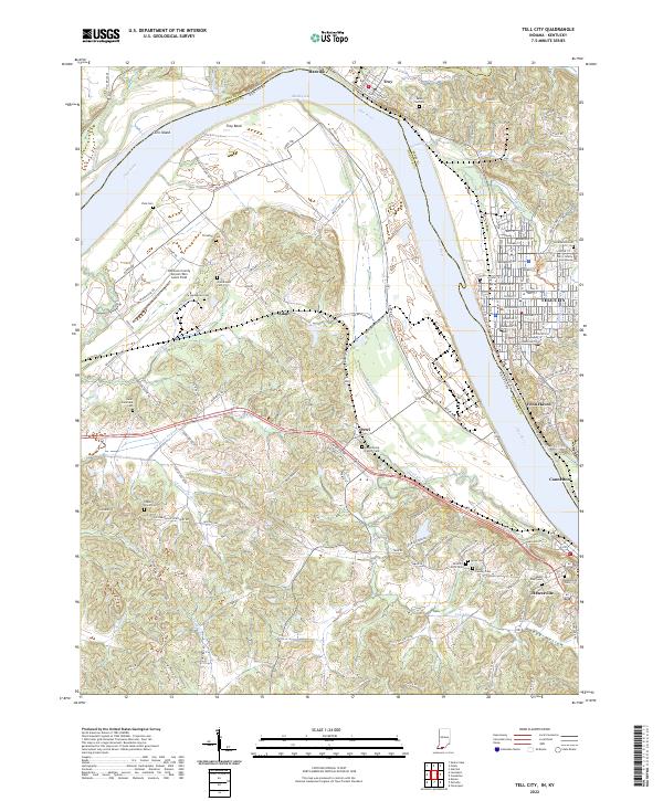 2022 Tell City2022 Print · USGSThe Ohio River borderlands between Indiana and Kentucky are showcased here at the turn of the decade. Genealogists can trace family sites like Mount Calvary Cem and Ayres Cem near Tell City and Hawesville.
 - 2022 Map of Richland City, 2022 Print
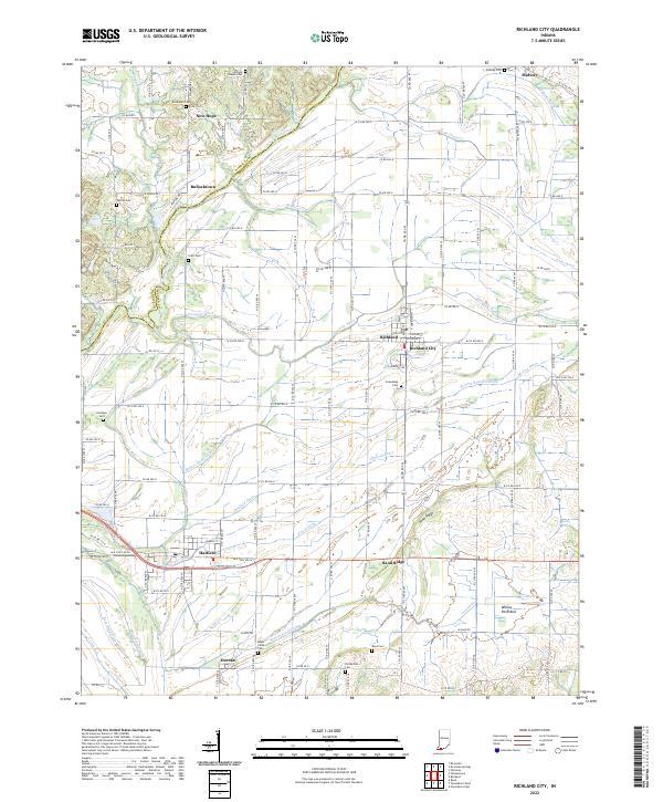 2022 Richland City2022 Print · USGSSpencer County settlements and farmsteads are mapped in detail here during the early twenty-first century. Researchers can trace family history through numerous rural burial sites like Broshears Cem and explore the drainage networks of Hooppole Ditch and Baker Creek.
 - 2022 Map of De Gonia Springs, 2022 Print
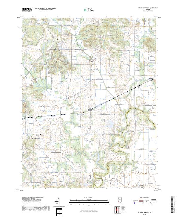 2022 De Gonia Springs2022 Print · USGSThe rural landscapes of Warrick and Spencer counties come into focus in this early twenty-first-century survey. Genealogists and local historians can trace family land near De Gonia Springs, Ash Iron Springs, and the waters of Little Pigeon Creek.
 - 2022 Map of Rockport, 2022 Print
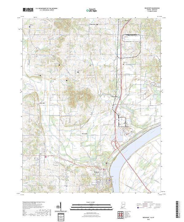 2022 Rockport2022 Print · USGSThe Ohio River waterfront at Rockport is captured here in the early 2020s, showcasing the county seat alongside its neighboring river-bottom farmlands. Researchers can trace local heritage through sites like the Spencer County Courthouse and numerous pioneer-era burial grounds including Hackleman Cem and Stateler Cem.
 - 2022 Map of Holland, 2022 Print
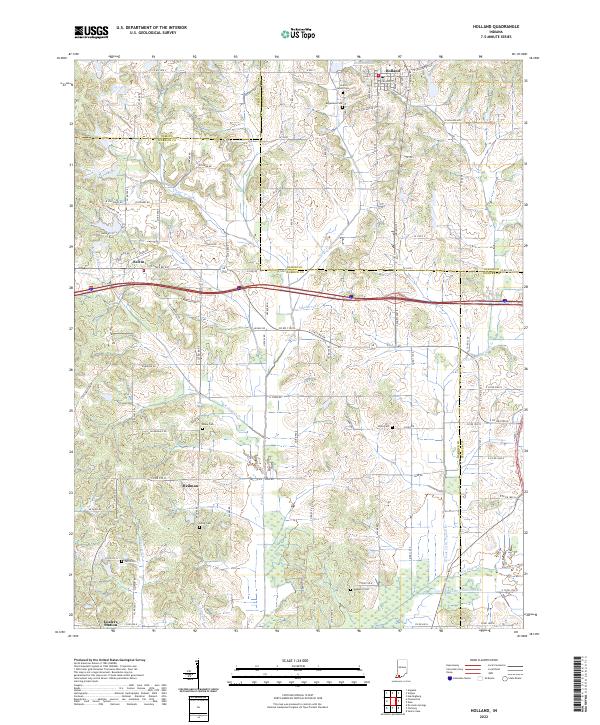 2022 Holland2022 Print · USGSThis Southern Indiana landscape at the turn of the 2020s shows a rural region shaped by agricultural drainage and local tradition. Genealogists can trace family sites at Augustana Cem and Selvin Cem or explore the crossroads of Heilman and Loafers Station.
 - 2022 Map of Saint Meinrad, 2022 Print
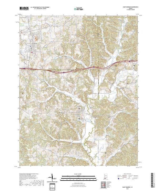 2022 Saint Meinrad2022 Print · USGSSouthern Indiana's monastic and rural heritage is preserved here in this recent survey of the Dubois, Spencer, and Perry county borders. Genealogists and historians can locate family landmarks like Saint Meinrad Archabbey Cem and trace the paths of Blackhawk Cr through St. Meinrad.
 - 2022 Map of Fulda, 2022 Print
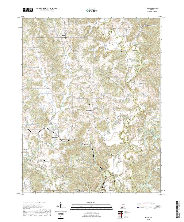 2022 Fulda2022 Print · USGSSpencer and Perry counties at the start of the 2020s remain defined by their river valleys and deep-rooted family settlements. Genealogists can trace local lineages through numerous burial sites like Butler Cem and Rust Cem or locate the quiet crossroads of Schley and Huffman.
 - 2022 Map of Yankeetown, 2022 Print
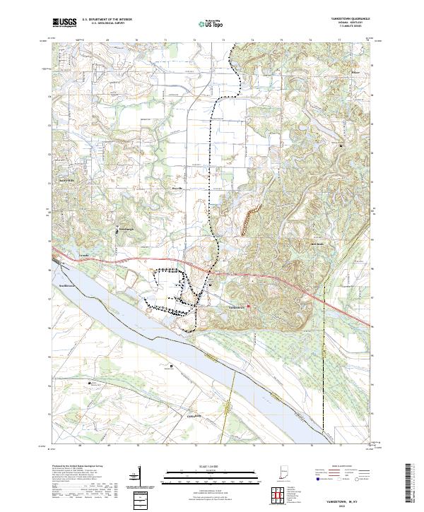 2022 Yankeetown2022 Print · USGSWarrick County river life and the evolving shoreline of the Ohio River are captured here in the early 2020s. Researchers can trace family history through several local burial sites like Bates Hill Cem and Vanada Cem or locate the landing at Scuffletown.
 - 2022 Map of Dale, 2022 Print
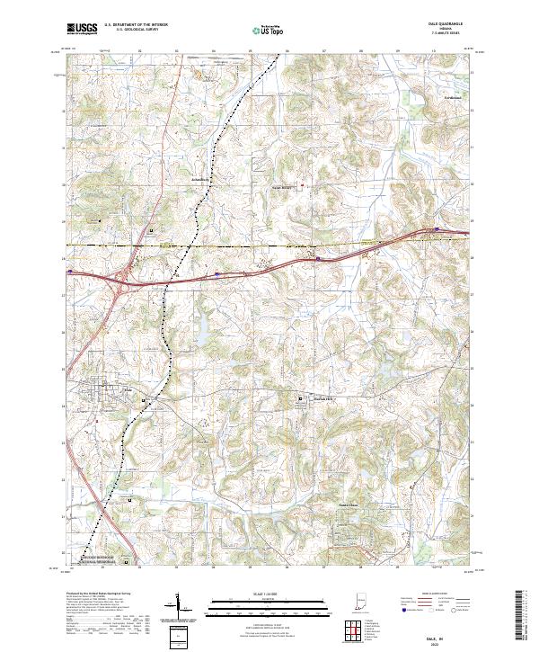 2022 Dale2022 Print · USGSSouthern Indiana's rolling landscape near the Spencer and Dubois county line comes into focus in this recent survey. Local historians can trace the borders of the Lincoln Boyhood National Memorial and locate numerous family burial grounds like Pinkston Cem and Mount Vernon Cem.
 - 2022 Map of Santa Claus, 2022 Print
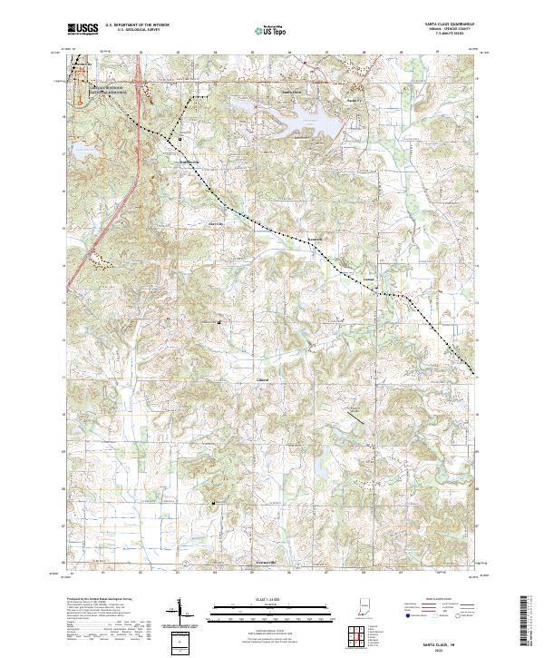 2022 Santa Claus2022 Print · USGSSouthern Indiana's unique cultural landscape is documented here in the early twenty-first century, from presidential history to holiday-themed developments. Researchers can locate ancestral sites at Buffaloville Cem or trace the rural roads connecting Lincoln City, Santa Fe, and Lamar.
 - 2022 Map of Owensboro East, 2022 Print
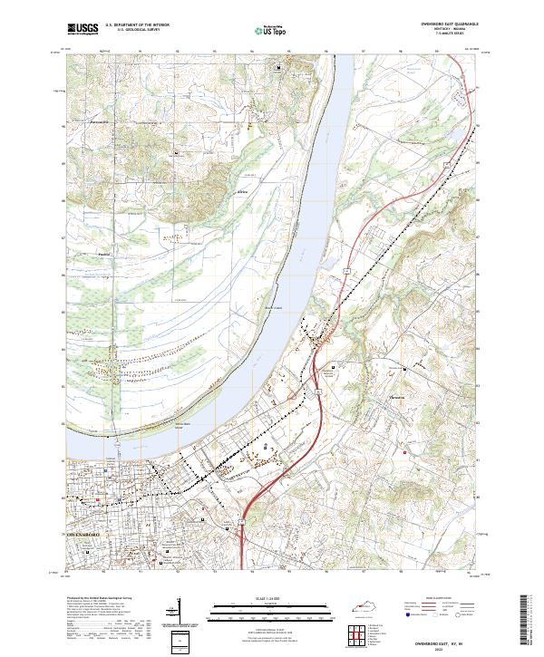 2022 Owensboro East2022 Print · USGSDaviess County and the Indiana borderlands appear here in the early twenty-first century as the river-port city of Owensboro expands. Researchers can locate several historic burial grounds like Settler Cem and trace the paths of rural settlements such as Patronville and Africa.
 - 2022 Map of Lewisport, 2022 Print
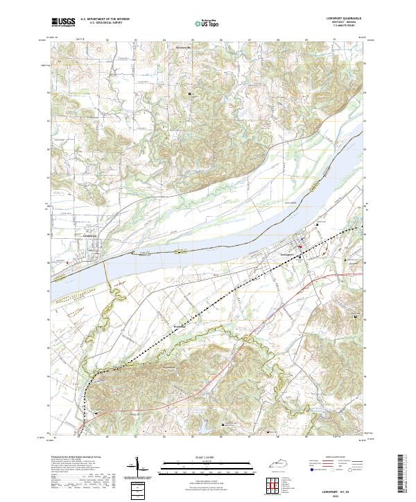 2022 Lewisport2022 Print · USGSThe Ohio River corridor between Indiana and Kentucky is captured here in the early twenty-first century, showing the established river towns of Lewisport and Grandview. Researchers can trace rural lineages through numerous local burial sites like Old Sargeant Cem and Holland Cem.
 - 2022 Map of Chrisney, 2022 Print
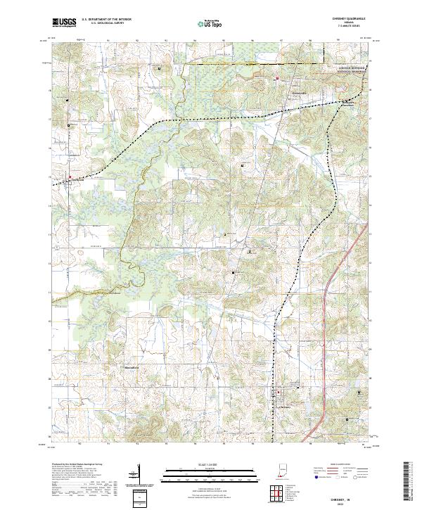 2022 Chrisney2022 Print · USGSIn the rural heart of Spencer County, this modern survey documents the landscape surrounding the Lincoln Boyhood National Memorial. Family historians can trace local roots at Saint Martins Catholic Cemetery, Stark Cemetery, and Fisher Knobs.
 - 2022 Map of Reed, 2022 Print
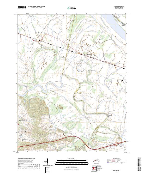 2022 Reed2022 Print · USGSThe Henderson and Daviess County border comes alive in the early 2020s, showing a landscape shaped by the Green River and the Ohio River. Family historians can trace rural roots through Saint Augustine Cem, Bethel Cem, and the river community of Birk City.
 - 2022 Map of Owensboro West, 2022 Print
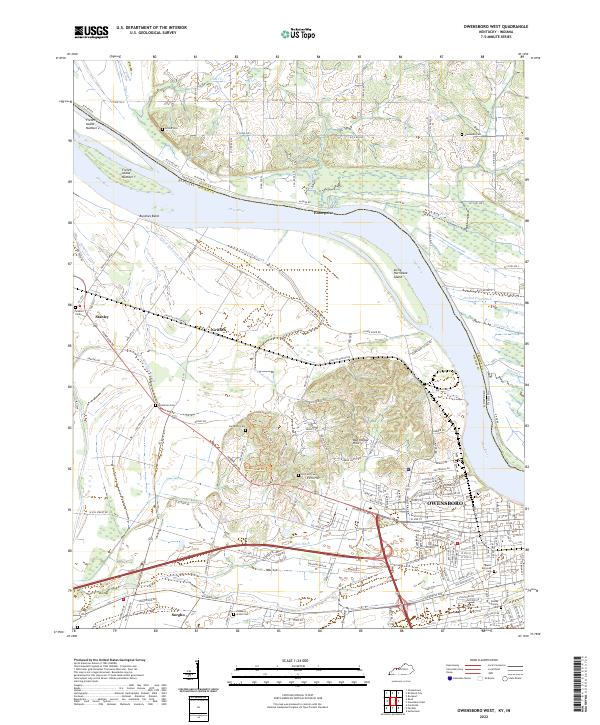 2022 Owensboro West2022 Print · USGSThe riverfront west of OWENSBORO and the fertile lowlands of the Kentucky-Indiana border are captured here in the early 2020s. Researchers can locate numerous local burial sites like Mater Dolorosa Cem and Bosley Family Cem or trace the winding Cowhide Slough.
End of results
Showing maps 1-15 of 15
Top cities of Spencer County
- Rockport historical maps
- Dale historical maps
- Grandview historical maps
- Chrisney historical maps
- Gentryville historical maps
Frequently asked questions
- What are the different types of historical maps available for Spencer County?
- What is the oldest map of Spencer County?
- Where can I purchase historical maps of Spencer County for my home or office?
- Where can I download high-res historical maps of Spencer County?
- Are there historical topographic maps available for Spencer County?
- Is there historical aerial imagery available for Spencer County?
- Where are historical maps of Spencer County sourced from?