Old Maps of Chrisney, Indiana
Explore 26 old maps of Chrisney, spanning from 1900 to today. These high-resolution historic maps reveal how streets, neighborhoods, landmarks, and natural features evolved over time — perfect for genealogy, metal detecting, research, and local history exploration.
What you can do with these maps:
- See how Chrisney changed over time: Compare historical maps to modern-day views to trace roads, homesites, rail lines & more.
- View detailed metadata: Each map includes creators, publishers, year, scale, and archive source.
- Overlay maps with satellite & LiDAR: Visualize the past alongside modern tools to explore terrain & human change.
- Trusted historical sources: Maps sourced from the USGS, Library of Congress, and other archives.
- Access maps your way: View online, download high-res files, or order prints for personal or research use.
Start exploring old maps of Chrisney to uncover forgotten places, hidden landmarks, and the deep history beneath your feet.
Chrisney, IN maps
(26)- 1900 Map of De Gonia Springs, 1963 Print
 1900 De Gonia Springs1963 Print · USGSSouthern Indiana at the turn of the century shows a landscape of rail-dependent towns and mineral spring resorts across Warrick and Spencer counties. Genealogists and historians can trace the early layouts of De Gonia Springs, Folsomville, and Tennyson along the SOUTHERN railroad lines.
 - 1901 Map of Owensboro
 1901 Owensboro1901 Print · USGSThe Ohio River bend at the turn of the century shows a bustling corridor of rail and river commerce between Kentucky and Indiana. Trace the early footprints of Owensboro and Rockport alongside vanished landmarks like Lake Mills and the Willow Pond Bed.5 unique versions available
 - 1902 Map of Ditney
 1902 Ditney1902 Print · USGSSouthern Indiana at the start of the century was a landscape of expanding railroads and rural hamlets. Family historians can trace ancestral roots through dozens of small settlements like Coats Springs, Dongola, and Boonville along the Southern RR.3 unique versions available
 - 1902 Map of Degonia Springs
 1902 Degonia Springs1902 Print · USGSSouthwestern Indiana is captured here at the turn of the century as the rail network linked the region's mineral springs and rural townships. Genealogists can trace the early layout of Degonia Springs, Folsomville, and Gentryville along the SOUTHERN railroad lines.2 unique versions available
 - 1952 Map of Rockport, 1953 Print
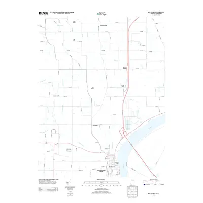
 1952 Rockport1953 Print · USGSSpencer County sits on the bank of the Ohio River during the early 1950s, showing a well-established river-and-rail hub. Genealogists can locate family landmarks such as the County Infirmary, Silverdale Sch, and the Lincoln Pioneer Village.2 unique versions available
 - 1954 Map of Evansville
 1954 Evansville1954 Print · USGSThe Ohio River borderlands between Indiana and Kentucky appear here during a period of robust industrial and military growth. Genealogists and researchers can trace the rail corridors of the Illinois Central and find landmarks like US Lock and Dam No 48 or Camp Breckinridge.
 - 1956 Map of Vincennes, 1967 Print
 1956 Vincennes1967 Print · USGSSouthern Indiana and the Illinois borderlands are captured here in the mid-fifties, showing the region's dense network of river towns and rail lines. Researchers can trace historic river crossings along the Wabash River or locate landmarks like Wyandotte Cave and Lincoln State Park.4 unique versions available
 - 1957 Map of Vincennes
 1957 Vincennes1957 Print · USGSSouthwest Indiana and the Illinois borderlands come alive in the late 1950s, a period of heavy rail traffic and expanding state forests. Genealogists and historians can trace the riverfronts and rail lines of Vincennes, New Harmony, and the vast Crane Naval Ammunition Depot.
 - 1957 Map of Evansville, 1969 Print
 1957 Evansville1969 Print · USGSIndiana and Kentucky meet along the Ohio River in this mid-century survey of a vital industrial and transport corridor. Genealogists and historians can trace the development of river towns like Owensboro and Newburgh or locate old rail lines like the Southern Ry.3 unique versions available
 - 1958 Map of Vincennes
 1958 Vincennes1958 Print · USGSSouthern Indiana and the Illinois borderlands are captured during a mid-century period of heavy rail traffic and military activity. Researchers can trace the sprawling bounds of the Crane Naval Ammunition Depot or locate historic settlements like New Harmony and French Lick.2 unique versions available
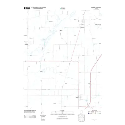
 - 1960 Map of Chrisney, 1962 Print
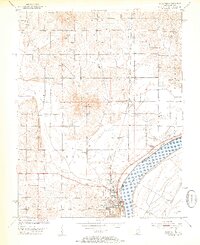
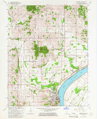
 1960 Chrisney1962 Print · USGSSpencer County at the start of the sixties reveals a transition from traditional rural townships to a landscape shaped by state parks and railroads. Researchers can trace family roots through St Martins Ch and Mt Mariah Cem, or locate landmarks like Gentryville and the Pigeon Creek Fish Hatchery.3 unique versions available
 - 1961 Map of Evansville
 1961 Evansville1961 Print · USGSThe Ohio River valley and its surrounding coalfields are captured here during the late fifties and early sixties. Trace the industrial rail networks of the Illinois Central RR and explore regional landmarks like Mammoth Cave National Park and Angel Mounds State Memorial.2 unique versions available
 - 1964 Map of Rockport, 1966 Print
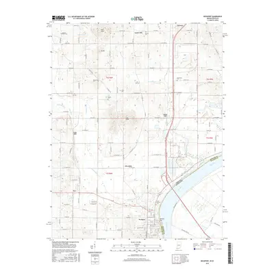
 1964 Rockport1966 Print · USGSRockport and its surrounding riverfront townships are captured here in the mid-1960s as the river-and-rail economy shaped Spencer County. Genealogists and local historians can trace family plots at St Bernard Cem and Whitehouse Cem or locate the site of the County Infirmary.2 unique versions available
 - 1986 Map of Evansville
 1986 Evansville1986 Print · USGSThe Ohio River valley thrives in the mid-1980s as a hub of river commerce, industry, and natural preservation spanning the Indiana-Kentucky border. Genealogists and historians can locate remote landmarks like Dead Mans Cem, Lippe Church, and the riverside community of Scuffletown.
 - 1986 Map of Princeton
 1986 Princeton1986 Print · USGSSouthwestern Indiana is defined by the confluence of the Wabash and White Rivers during the mid-eighties, a period of established rail lines and expanding interstates. Genealogists and historians can trace property locations across numerous townships or locate family sites in Mount Carmel, Poseyville, and Boonville.2 unique versions available
 - 1991 Map of Evansville
 1991 Evansville1991 Print · USGSThe tri-state region of Indiana and Kentucky was a hub of river commerce and rail transport in the early nineties. Researchers can trace the industrial corridor between Evansville and Owensboro, locating landmarks like Angel Mounds State Memorial and the Seaboard System railroad.
 - 2010 Map of Rockport, 2010 Print
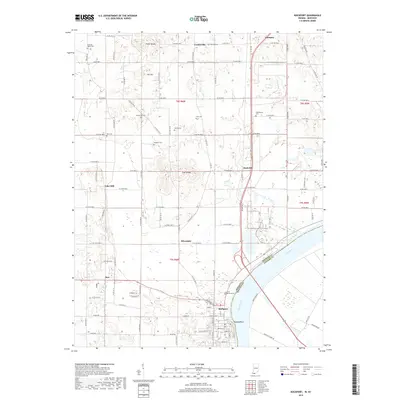
 2010 Rockport2010 Print · USGSCovers Chrisney, including Rockport, Ritchie, and other nearby areas
 - 2010 Map of Chrisney, 2010 Print
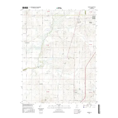
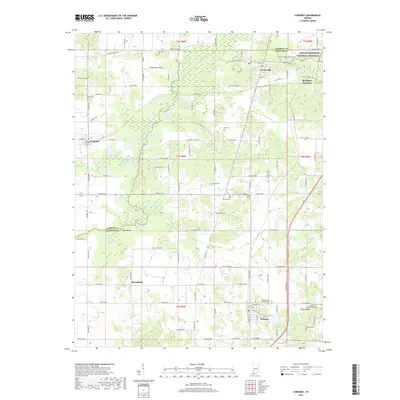
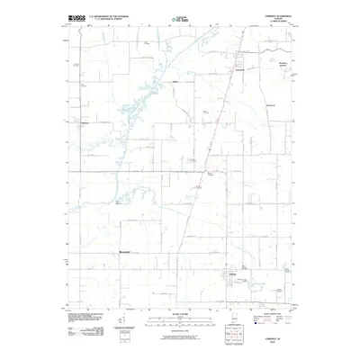 2010 Chrisney2010 Print · USGSCovers Chrisney, including Tennyson, Gentryville, and other nearby areas
 - 2013 Map of Chrisney, 2013 Print
 2013 Chrisney2013 Print · USGSCovers Chrisney, including Tennyson, Gentryville, and other nearby areas
 - 2013 Map of Rockport, 2013 Print
 2013 Rockport2013 Print · USGSCovers Chrisney, including Rockport, Ritchie, and other nearby areas
 - 2016 Map of Rockport, 2016 Print
 2016 Rockport2016 Print · USGSCovers Chrisney, including Rockport, Ritchie, and other nearby areas
 - 2016 Map of Chrisney, 2016 Print
 2016 Chrisney2016 Print · USGSCovers Chrisney, including Tennyson, Gentryville, and other nearby areas
 - 2019 Map of Rockport, 2019 Print
 2019 Rockport2019 Print · USGSCovers Chrisney, including Rockport, Ritchie, and other nearby areas
 - 2019 Map of Chrisney, 2019 Print
 2019 Chrisney2019 Print · USGSCovers Chrisney, including Tennyson, Gentryville, and other nearby areas
 - 2022 Map of Rockport, 2022 Print
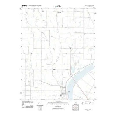
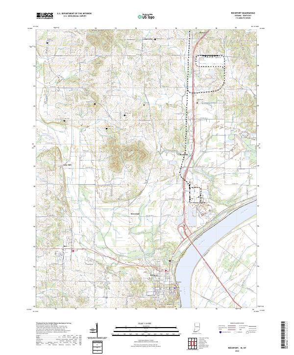 2022 Rockport2022 Print · USGSThe Ohio River waterfront at Rockport is captured here in the early 2020s, showcasing the county seat alongside its neighboring river-bottom farmlands. Researchers can trace local heritage through sites like the Spencer County Courthouse and numerous pioneer-era burial grounds including Hackleman Cem and Stateler Cem.
Showing maps 1-25 of 26
Top cities near Chrisney
- Owensboro historical maps
- Boonville historical maps
- Ferdinand historical maps
- Rockport historical maps
- Lewisport historical maps
- Dale historical maps
See more
Frequently asked questions
- What are the different types of historical maps available for Chrisney?
- What is the oldest map of Chrisney?
- Where can I purchase historical maps of Chrisney for my home or office?
- Where can I download high-res historical maps of Chrisney?
- Are there historical topographic maps available for Chrisney?
- Is there historical aerial imagery available for Chrisney?
- Where are historical maps of Chrisney sourced from?