1950s Maps of St. Paul, Indiana
Explore 4 historic maps of St. Paul from the 1950s. These maps offer a rare glimpse into what life looked like during the 1950s — showing old roads, neighborhoods, homes, and landmarks that have changed or disappeared over time.
Whether you're researching your family's past, planning a metal detecting trip, or studying how St. Paul's landscape evolved across the 1950s, these high-resolution maps are a powerful tool for exploring the history of this region.
- Focus on a specific era: All maps on this page are from the 1950s, giving you a focused view of this time period.
- See what’s changed: Compare century-old streets, trails, and buildings to today's modern landscape using overlays and satellite layers.
- Research with precision: Use these maps for genealogy, historical research, land use analysis, or educational projects.
- View, download, or print: Maps are fully viewable online in high resolution, and can be downloaded or printed for your own records.
Start exploring St. Paul's history through authentic maps from the 1950s. This is your window into the past.
St. Paul, IN maps
(4)- 1953 Map of Cincinnati, 1965 Print
 1953 Cincinnati1965 Print · USGSThe Ohio River valley and the industrial heartland of Indiana and Ohio are captured here during the mid-century peak of rail and river commerce. Genealogists and historians can trace connections between Cincinnati and outlying military sites like Camp Atterbury and Bakalar AFB.3 unique versions available
 - 1956 Map of Waldron, 1957 Print
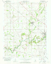 1956 Waldron1957 Print · USGSSoutheastern Shelby County comes alive in this mid-century survey of rural Indiana as it appeared before modern suburban sprawl. Researchers can locate family landmarks like Wesley Chapel, find the old Stone Quarry at Saint Paul, and trace the path of the New York Central railroad.5 unique versions available
 - 1957 Map of Cincinnati
 1957 Cincinnati1957 Print · USGSThe Ohio River valley and its surrounding highlands thrived during the mid-fifties industrial peak, centered on the bustling Cincinnati and Dayton metropolitan hubs. Researchers can trace the extensive rail networks and military sites like Wright-Patterson AFB and Camp Atterbury.
 - 1959 Map of Adams, 1960 Print
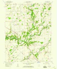 1959 Adams1960 Print · USGSSoutheastern Indiana's rural landscape is captured here in the late fifties, showing the river-carved borders of Rush and Decatur counties. Genealogists and researchers can locate several family-named landmarks and rural congregations, including Mt Hebron Cem, Star Ch, and the community of Downeyville.3 unique versions available
End of results
Showing maps 1-4 of 4
Top cities near St. Paul
- Columbus historical maps
- Shelbyville historical maps
- Greensburg historical maps
- Rushville historical maps
- Hope historical maps
- Marion historical maps
See more
Top neighborhoods of St. Paul
Frequently asked questions
- What are the different types of historical maps available for St. Paul?
- What is the oldest map of St. Paul?
- Where can I purchase historical maps of St. Paul for my home or office?
- Where can I download high-res historical maps of St. Paul?
- Are there historical topographic maps available for St. Paul?
- Is there historical aerial imagery available for St. Paul?
- Where are historical maps of St. Paul sourced from?