1960s Maps of Steuben County, Indiana
Explore 9 historic maps of Steuben County from the 1960s. These maps offer a rare glimpse into what life looked like during the 1960s — showing old roads, neighborhoods, homes, and landmarks that have changed or disappeared over time.
Whether you're researching your family's past, planning a metal detecting trip, or studying how Steuben County's landscape evolved across the 1960s, these high-resolution maps are a powerful tool for exploring the history of this region.
- Focus on a specific era: All maps on this page are from the 1960s, giving you a focused view of this time period.
- See what’s changed: Compare century-old streets, trails, and buildings to today's modern landscape using overlays and satellite layers.
- Research with precision: Use these maps for genealogy, historical research, land use analysis, or educational projects.
- View, download, or print: Maps are fully viewable online in high resolution, and can be downloaded or printed for your own records.
Start exploring Steuben County's history through authentic maps from the 1960s. This is your window into the past.
Steuben County, IN maps
(9)- 1960 Map of Bronson South, 1961 Print
 1960 Bronson South1961 Print · USGSThe Michigan-Indiana borderlands are captured here in the early sixties, showing the rural landscape between the railroad at Bronson and the Indiana Toll Road. Researchers can locate family landmarks like St Marys Cem, Greenfield Mills, and Hickory Corners Sch.2 unique versions available
 - 1960 Map of Camden, 1961 Print
 1960 Camden1961 Print · USGSHillsdale County and the tri-state border region are captured here in the early sixties as the rail-and-river economy of southern Michigan flourished. Researchers can trace family sites like Maple Lawn Cem or follow the New York Central through Montgomery.2 unique versions available
 - 1960 Map of Kinderhook, 1961 Print
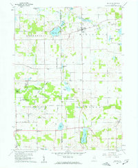
 1960 Kinderhook1961 Print · USGSThe Michigan-Indiana state line comes alive in the early sixties, showing the rural communities of Kinderhook and East Gilead amid a landscape of glacial lakes. Researchers can trace family roots at Knauss Cem or Ovid Cem and locate vanished landmarks like Snow Prairie Sch.
 - 1960 Map of California, 1962 Print
 1960 California1962 Print · USGSBranch County, Michigan, and Steuben County, Indiana, meet at the state line in this 1960 survey. Researchers can trace rural lineages through numerous cemeteries like Wilson Cem and Lester Cem or locate the old Amish Sch and Stokes Chapel.2 unique versions available
 - 1960 Map of Orland, 1962 Print
 1960 Orland1962 Print · USGSThe Indiana lake country at the turn of the sixties reveals a landscape shaped by conservation and rural community life. Genealogists and historians can trace family locations through Greenlawn Cem, East Springfield Ch, and the settlement of Orland.2 unique versions available
 - 1960 Map of Angola East, 1962 Print
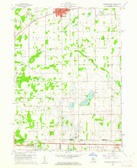
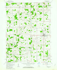
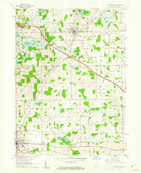 1960 Angola East1962 Print · USGSSteuben County during the early sixties shows a landscape transitioning between traditional farming and modern infrastructure. Genealogists and local historians can locate family landmarks like Jones Chapel, Lakeside Cem, and the Scott Center Sch.3 unique versions available
 - 1960 Map of Angola West, 1963 Print
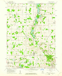
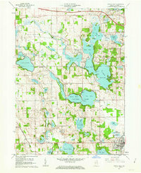 1960 Angola West1963 Print · USGSSteuben County is a network of mid-century resorts and rural settlements at the height of the post-war vacation era. Researchers can locate vanished names and civic landmarks from Nevada Mills to Tri-State College and the Potawatomi Inn.3 unique versions available
 - 1961 Map of Clear Lake, 1963 Print
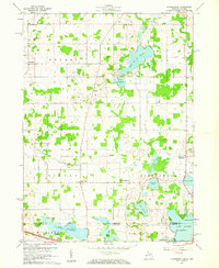
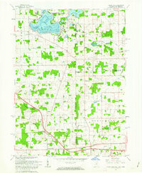 1961 Clear Lake1963 Print · USGSThe tri-state junction of Indiana, Ohio, and Michigan comes alive in the early sixties as a crossroads of high-speed travel and quiet lakeside life. Researchers can trace the connection between the Indiana Toll Road and the Ohio Turnpike or locate family roots at Teeters Cemetery and Powers Church.3 unique versions available
 - 1961 Map of Edon, 1963 Print
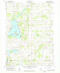
 1961 Edon1963 Print · USGSIn the early 1960s, this tri-state border region centered on Edon highlights a landscape of river-fed farms and remote rural settlements. Researchers can locate historic landmarks like the Covered Bridge and family heritage sites such as Eddy Cem and Zion Ch.4 unique versions available
End of results
Showing maps 1-9 of 9
Top cities of Steuben County
- Angola historical maps
- Jamestown historical maps
- Fremont historical maps
- York historical maps
- Hudson historical maps
- Clear Lake historical maps
See more
Frequently asked questions
- What are the different types of historical maps available for Steuben County?
- What is the oldest map of Steuben County?
- Where can I purchase historical maps of Steuben County for my home or office?
- Where can I download high-res historical maps of Steuben County?
- Are there historical topographic maps available for Steuben County?
- Is there historical aerial imagery available for Steuben County?
- Where are historical maps of Steuben County sourced from?