Old Maps of Sullivan County, Indiana for Metal Detecting
Plan your next treasure hunt with 155 historic maps of Sullivan County. Find old homesites, ghost towns, trails, and gathering spots that may be lost to time — perfect for identifying promising metal detecting locations.
- Locate forgotten sites: Uncover places like long-lost settlements, abandoned rail lines, or gathering spots.
- Plan better hunts: Use map overlays combined with LiDAR or satellite views to narrow in on historically rich areas.
- Made for detectorists: Thousands of hobbyists use these maps to discover relics, coins, and hidden history.
Use these historic maps to boost your research and find new opportunities beneath the surface of Sullivan County.
Sullivan County, IN maps
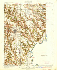
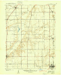
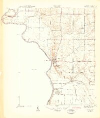
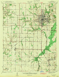
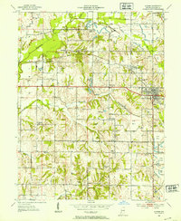
(155)- 1908 Map of Clay City
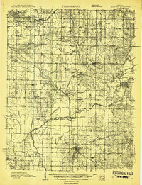 1908 Clay City1908 Print · USGSIndiana's coal and timber country comes alive in the years before the Great War, showing a landscape defined by deep river valleys and early rail lines. Genealogists can trace hundreds of family sites near Clay City and Center Point, or locate historic gathering places like Wesley Chapel and Roadman School.
 - 1910 Map of Clay City
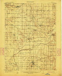 1910 Clay City1910 Print · USGSClay County at the height of its rail-and-river era shows a landscape shaped by coal transport and agriculture. You can trace the Wabash and Erie Canal, locate the Feederdam Bridge, and find dozens of family-named schoolhouses like Dutch Knob School.2 unique versions available
 - 1917 Map of Birds
 1917 Birds1917 Print · USGSCrawford and Lawrence counties thrive along the Wabash River at the height of the rail era. Genealogists can trace family roots through dozens of local schools like Hazel Dell School and river landings such as Shaws Landing.2 unique versions available
 - 1932 Map of Marshall, 1957 Print
 1932 Marshall1957 Print · USGSThe Illinois-Indiana borderlands of the early 1930s come alive through this survey of the Marshall rail corridor and Wabash River valley. Trace family roots and vanished landmarks like Bohn Ferry, Ziegler Cem, and the Airway Beacon.
 - 1937 Map of Marshall
 1937 Marshall1937 Print · USGSClark and Edgar Counties are captured here in the 1930s, showing a landscape of river-bend settlements and dense rural school districts. Genealogists can trace family names through Forsythe Cem, identify remote crossings like Bohn Ferry, or locate lost schoolhouses like Rabbit Ridge Sch.2 unique versions available
 - 1940 Map of Lewis
 1940 Lewis1940 Print · USGSVigo and Sullivan counties are shown here just before the Second World War as coal mining and rail transport shaped the local economy. Researchers can trace family history through sites like Smith Cem or locate industrial landmarks like the Blackhawk Mine and Brown Jug Corner.
 - 1940 Map of Linton
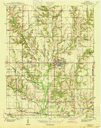
 1940 Linton1940 Print · USGSLinton and its surrounding coalfields are captured in the late thirties, showcasing a landscape shaped by heavy industry and rail. Genealogists and historians can locate vanished country landmarks like Morris Chapel, Victoria, and Sassafras Sch among the early Strip Mine sites.2 unique versions available
 - 1940 Map of Jasonville
 1940 Jasonville1940 Print · USGSJasonville and the surrounding coalfields are captured in the late 1930s, showing a landscape defined by industry and rural community. Genealogists can locate family landmarks like Sanderson Cem, Little Flock Ch, and Listen Sch.2 unique versions available
 - 1940 Map of Pimento
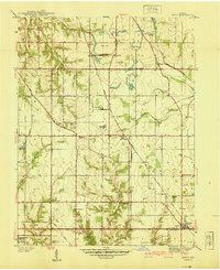
 1940 Pimento1940 Print · USGSVigo and Sullivan Counties are shown in the late 1930s, capturing the rural character of the Indiana prairie before modern development. Genealogists can trace family roots through numerous local landmarks, including Kester Cem, Farmers Chapel, and the settlement of Prairie Creek.2 unique versions available
 - 1942 Map of Fairbanks
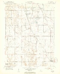
 1942 Fairbanks1942 Print · USGSSullivan County, Indiana, is captured here in the early 1940s as a landscape of river-bend farms and historic family plots. Genealogists and local historians can trace the Harrison Trail or locate ancestral sites like Pogue Cem, Johnson Cem, and the York Ferry river crossing.2 unique versions available
 - 1942 Map of Shelburn
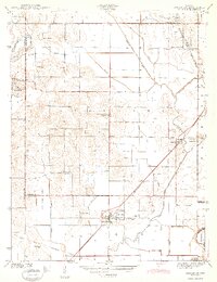
 1942 Shelburn1942 Print · USGSWestern Indiana coal and rail life are captured here in the early 1940s, as mining towns thrived along the corridor. Trace local family roots at Ebenezer Cem or explore the rail hubs of Shelburn and Curryville near the Linda Lou Mine.2 unique versions available
 - 1942 Map of Hutton
 1942 Hutton1942 Print · USGSThe Indiana-Illinois borderlands along the Wabash River are captured here in the early 1940s, showing a landscape of bayous and ferries. Researchers can trace historic river crossings at Darwin Ferry and locate family burial sites at Shattuck Cem and Lykens Cem.2 unique versions available
 - 1942 Map of Birds, 1958 Print
 1942 Birds1958 Print · USGSThe Wabash River valley comes to life in this mid-century survey of the Illinois-Indiana borderlands. Genealogists can locate family lands near Oil Grove or trace ancestors through rural landmarks like Buncombe School and Brightlight Ferry.
 - 1943 Map of Merom
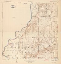
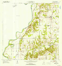
 1943 Merom1943 Print · USGSThe Wabash River bluffs of Sullivan County are documented here during the early years of the war. Researchers can trace family history through several local landmarks like Merom Institute, the Old French Cem, and the river community of Riverton.2 unique versions available
 - 1943 Map of Hymera
 1943 Hymera1943 Print · USGSSullivan County was a bustling coal corridor in the early 1940s, where heavy rail lines connected numerous active mining sites. Researchers can trace the lineage of small communities and family-named sites like Miner City, Nye Chapel, and the Jackson Hill Mine.2 unique versions available
 - 1943 Map of Carlisle
 1943 Carlisle1943 Print · USGSSouthern Sullivan County was a landscape of rail-linked towns and quiet country cemeteries in the years following the Great Depression. Genealogists and local historians can trace family roots through sites like Odd Fellows Cem or locate the old Shaker Prairie Ch along the Vincennes Tract.2 unique versions available
 - 1943 Map of Sandborn
 1943 Sandborn1943 Print · USGSIn the early 1940s, this portion of Knox and Greene Counties was a busy corridor for coal mining and rail transport. Researchers can trace family history through local landmarks like Marco Cem, Pleasant Grove Ch, and the many Strip Mine works near Sponsler.2 unique versions available
 - 1943 Map of Sullivan
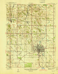
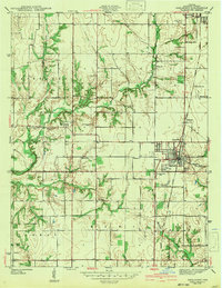
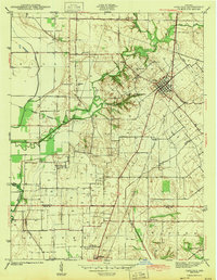
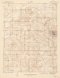
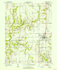
 1943 Sullivan1943 Print · USGSSullivan County during the early 1940s reveals a structured landscape of rail-dependent towns and rural family farmsteads. Researchers can trace the routes of the Illinois Central and locate dozens of local landmarks like Depot Town and Mt Zion Cem.2 unique versions available
 - 1943 Map of Dugger
 1943 Dugger1943 Print · USGSSullivan County’s coal-mining country is captured here during the 1940s, showing a landscape defined by rail lines and extraction. Researchers can trace family history through local landmarks like Dugger Cem, Center Sch, and small settlements like Caledonia and Jericho.2 unique versions available
 - 1944 Map of Bucktown
 1944 Bucktown1944 Print · USGSThe rural borders of Sullivan and Knox counties appear here during the early 1940s as traditional farming life met industrial coal extraction. Genealogists can locate family burial grounds like Land Cem and McDade Cem or rural centers such as Bucktown and Pleasantville.2 unique versions available
 - 1947 Map of Linton
 1947 Linton1947 Print · USGSGreene County is seen during a period of industrial transition in the late 1940s, when coal mining and rail transport defined the local economy. Researchers can locate family-named landmarks and rural hubs such as Wright High Sch, Antioch Ch, and the settlement of Island City.3 unique versions available
 - 1952 Map of Dugger, 1953 Print
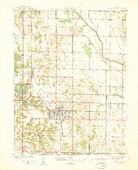
 1952 Dugger1953 Print · USGSSullivan County’s coal country is captured here in the early fifties as surface mining reshaped the Indiana landscape. Researchers can trace the industrial footprint of the Illinois Central railroad alongside local sites like Long Chapel and Woodward Cem.
 - 1952 Map of Lewis, 1953 Print
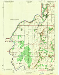
 1952 Lewis1953 Print · USGSVigo and Sullivan counties during the early fifties reveal a landscape transitioning from the canal era to an intensive mining economy. Genealogists and local historians can trace family roots through numerous landmarks like Fletcher Chapel, Stephens Cem, and the settlement of Lewis.2 unique versions available
 - 1952 Map of Fairbanks, 1953 Print
 1952 Fairbanks1953 Print · USGSSullivan County and the Wabash River bottomlands are captured here in the early fifties, showing a rural Indiana landscape of bluffs and bayous. Researchers can locate numerous family burial sites like Pound Cem and Riggs Cem or trace the historic Harrison Trail.2 unique versions available
 - 1952 Map of Shelburn, 1953 Print
 1952 Shelburn1953 Print · USGSSullivan County’s coal and rail landscape is captured here in the early fifties, centered on the corridor between Farmersburg and Shelburn. Genealogists and historians can trace numerous rural landmarks, including Little Flock Cem, Douglas Chapel Ch, and the workings of a local Strip Mine.2 unique versions available
Showing maps 1-25 of 155
Top cities of Sullivan County
- Sullivan historical maps
- Cass historical maps
- Shelburn historical maps
- Farmersburg historical maps
- Dugger historical maps
- Hymera historical maps
See more
Frequently asked questions
- What are the different types of historical maps available for Sullivan County?
- What is the oldest map of Sullivan County?
- Where can I purchase historical maps of Sullivan County for my home or office?
- Where can I download high-res historical maps of Sullivan County?
- Are there historical topographic maps available for Sullivan County?
- Is there historical aerial imagery available for Sullivan County?
- Where are historical maps of Sullivan County sourced from?