2020s Maps of Tippecanoe County, Indiana
Explore 16 historic maps of Tippecanoe County from the 2020s. These maps offer a rare glimpse into what life looked like during the 2020s — showing old roads, neighborhoods, homes, and landmarks that have changed or disappeared over time.
Whether you're researching your family's past, planning a metal detecting trip, or studying how Tippecanoe County's landscape evolved across the 2020s, these high-resolution maps are a powerful tool for exploring the history of this region.
- Focus on a specific era: All maps on this page are from the 2020s, giving you a focused view of this time period.
- See what’s changed: Compare century-old streets, trails, and buildings to today's modern landscape using overlays and satellite layers.
- Research with precision: Use these maps for genealogy, historical research, land use analysis, or educational projects.
- View, download, or print: Maps are fully viewable online in high resolution, and can be downloaded or printed for your own records.
Start exploring Tippecanoe County's history through authentic maps from the 2020s. This is your window into the past.
Tippecanoe County, IN maps
(16)- 2022 Map of Round Grove, 2022 Print
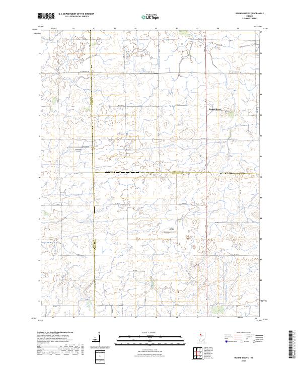 2022 Round Grove2022 Print · USGSThe tri-county borderlands of Tippecanoe, White, and Benton counties are mapped here during the early twenty-first century. Genealogists and local researchers can trace family-named waterworks and rural landmarks like Round Grove, Durftinger Airport, and Darby Ditch.
 - 2022 Map of Westpoint, 2022 Print
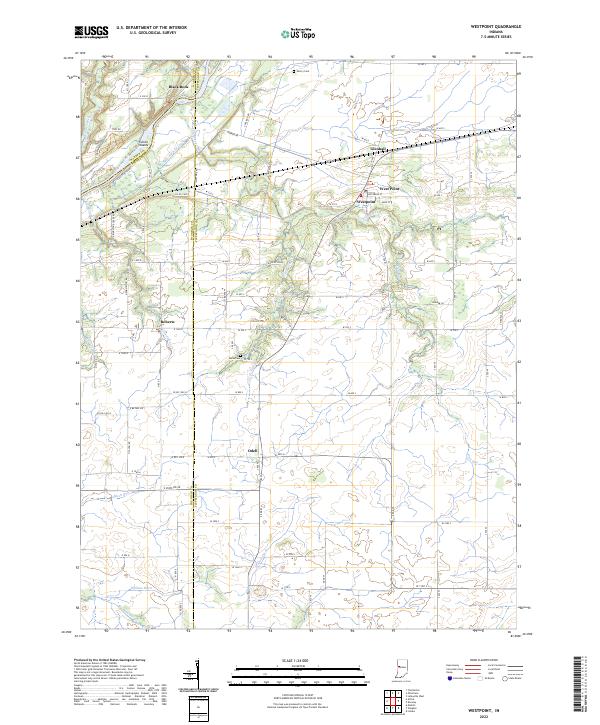 2022 Westpoint2022 Print · USGSTippecanoe County is seen here in the early twenty-first century, where the Wabash River and old canal routes meet modern rail lines. Genealogists can locate family landmarks at Sherry Cem or trace the small settlements of Odell and Glenhall.
 - 2022 Map of Wingate, 2022 Print
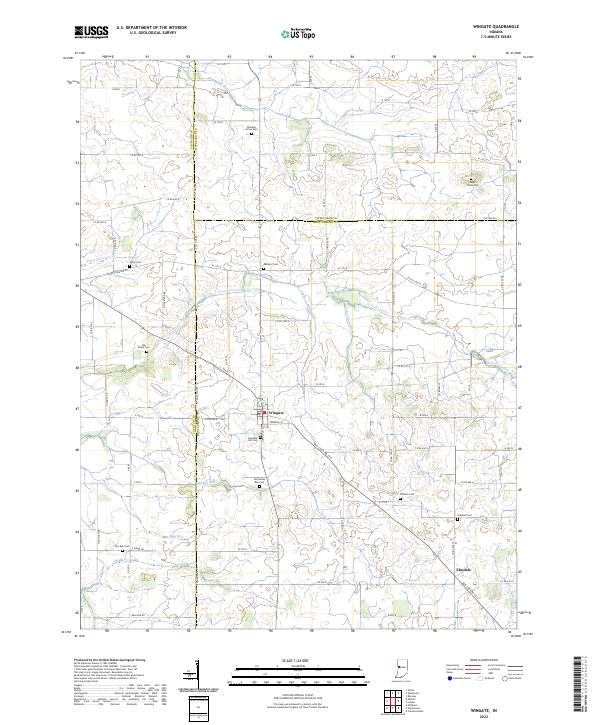 2022 Wingate2022 Print · USGSWingate and Elmdale anchor this Indiana rural landscape at the crossroads of Fountain, Montgomery, and Tippecanoe counties. Genealogists can trace family roots through numerous burial sites like Meharry Cem, Sugar Grove Cem, and Oakland Cem.
 - 2022 Map of Stockwell, 2022 Print
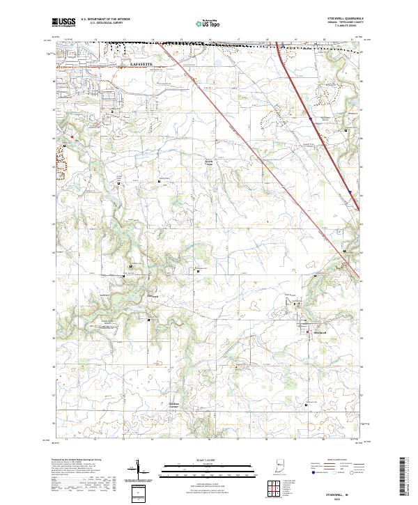 2022 Stockwell2022 Print · USGSSoutheastern Tippecanoe County is shown in this recent survey, featuring the agricultural outskirts of Lafayette and the village of Stockwell. Genealogists can locate numerous burial sites such as Conarroe Cem, Yorktown Cem, and Wildcat Cem.
 - 2022 Map of Linden, 2022 Print
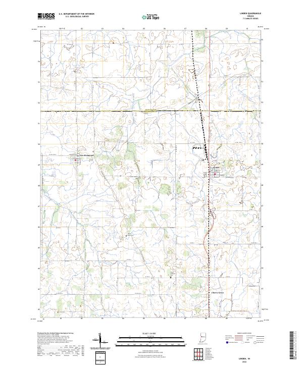 2022 Linden2022 Print · USGSThe Indiana prairie north of Crawfordsville is captured here in the early 2020s, showing the intersection of agricultural tradition and modern geography. Researchers can locate family burial grounds like Wilson-Killen Cem or trace the routes through New Richmond and Linden.
 - 2022 Map of Pyrmont, 2022 Print
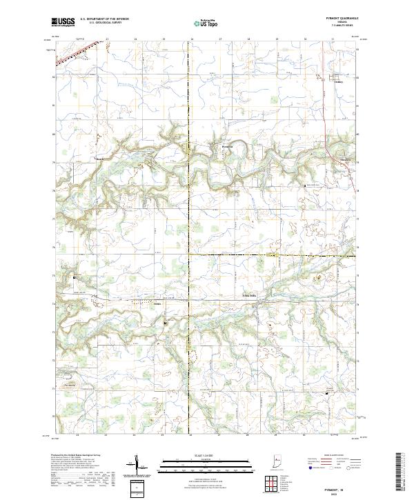 2022 Pyrmont2022 Print · USGSThe rural borderlands of Tippecanoe, Carroll, and Clinton counties come into focus in this contemporary survey. Researchers can trace the heritage of local settlements like Edna Mills and Pyrmont or locate family plots at Swank Cem and Zion Cem.
 - 2022 Map of Lafayette West, 2022 Print
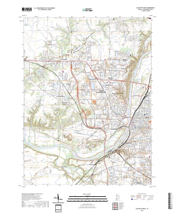 2022 Lafayette West2022 Print · USGSThe twin cities of the Wabash River are captured in the early 2020s, showcasing a landscape defined by collegiate life and regional governance. Local researchers can pinpoint institutions like Purdue University and the Tippecanoe County Courthouse, or trace family sites at Hebron Cem and Elston.
 - 2022 Map of Delphi, 2022 Print
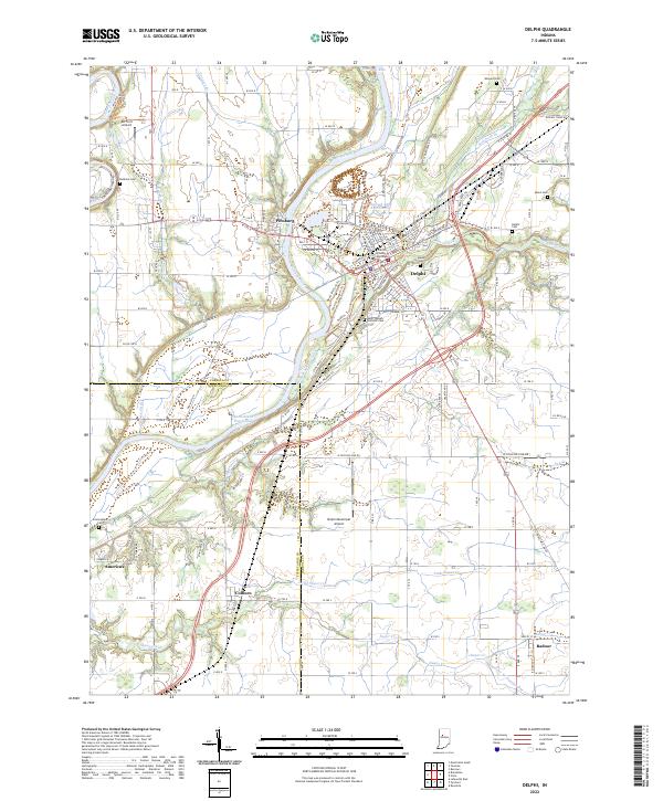 2022 Delphi2022 Print · USGSDelphi and the Wabash valley are shown in contemporary detail just as the region's historic water and rail corridors continue to shape the landscape. Researchers can trace ancestral sites at Carroll County Courthouse, follow the old Wabash and Erie Canal, and locate family plots at Baum Cem or Mears Cem.
 - 2022 Map of Kirkpatrick, 2022 Print
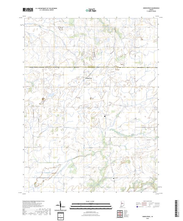 2022 Kirkpatrick2022 Print · USGSThe agricultural plains of Montgomery and Tippecanoe counties are shown here in the early 2020s, centered on the crossroads of Kirkpatrick. Genealogists and local historians can trace old property boundaries and find resting places like Peterson Cem and Rice Cem.
 - 2022 Map of Romney, 2022 Print
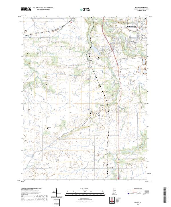 2022 Romney2022 Print · USGSSouth of the growing city of Lafayette in 2022, this region maintains its traditional agricultural character and network of rural villages. Genealogists and local historians can trace family locations through numerous sites like Shelby Cem, Durkee Cem, and the village of Romney.
 - 2022 Map of Brookston, 2022 Print
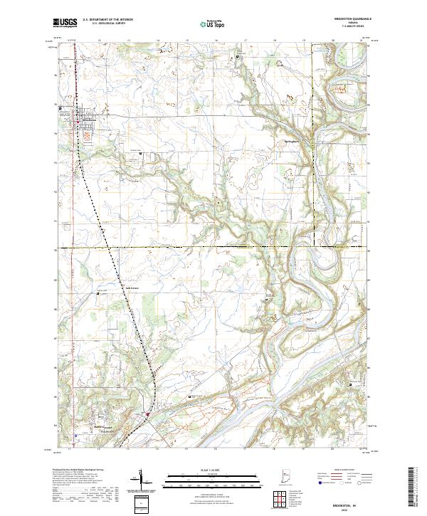 2022 Brookston2022 Print · USGSThe river valleys of White and Tippecanoe Counties come into focus in the early 2020s, showing the agricultural plains meeting the water. Researchers can locate numerous family cemeteries and local landmarks like Prophet Rock, Battle Ground, and the Independent Order of Odd Fellows Cem.
 - 2022 Map of Brookston SW, 2022 Print
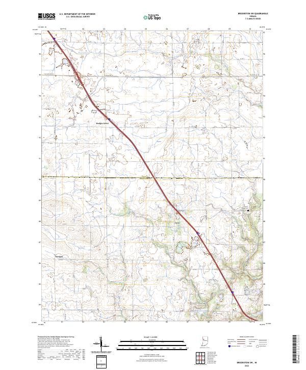 2022 Brookston SW2022 Print · USGSTippecanoe and White counties are mapped here during the early twenty-first century, showing the rural grid and water management of the Indiana heartland. Genealogists and historians can locate Liberty Chapel Cem and trace the paths of Badger Grove, Cairo, and Octagon.
 - 2022 Map of Lafayette East, 2022 Print
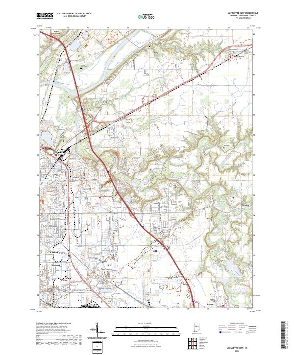 2022 Lafayette East2022 Print · USGSTippecanoe County is documented here in the early 2020s, showing the modern footprint of LAFAYETTE as it expands toward Monitor and Eastwitch. Researchers can trace the placement of local landmarks like Spring Vale Cem and the Ivy Tech Community College.
 - 2022 Map of Colfax, 2022 Print
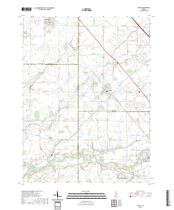 2022 Colfax2022 Print · USGSIndiana's rural heartland is meticulously documented in this survey of the four-county junction area involving Clinton, Montgomery, Boone, and Tippecanoe Counties. Researchers can locate family heritage sites like Shiloh Cem, trace the route of the Big Four Trl, and explore the layout of Colfax.
 - 2022 Map of Mulberry, 2022 Print
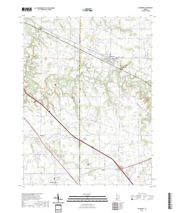 2022 Mulberry2022 Print · USGSClinton and Tippecanoe Counties come together in this modern portrait of Indiana’s agricultural heartland. Researchers can trace historic family burial grounds like Baker Cem and Abbot Cem or locate the small rural settlements of Wyandot and Fickle.
 - 2022 Map of Otterbein, 2022 Print
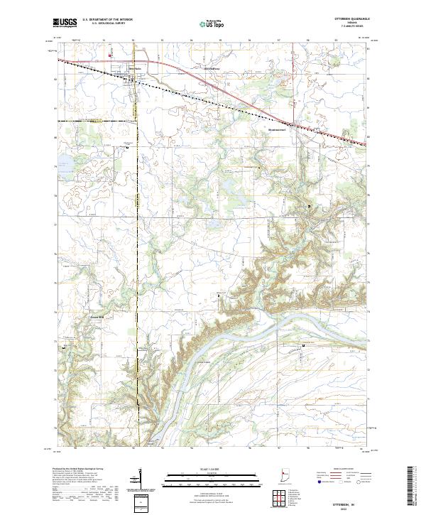 2022 Otterbein2022 Print · USGSThe rural borders of Tippecanoe, Benton, and Warren counties are captured here in the early twenty-first century. Researchers can locate family burial plots at Pond Grove Cem or Granville Cem and trace the drainage of Little Pine Cr to the Wabash River.
End of results
Showing maps 1-16 of 16
Top cities of Tippecanoe County
- Lafayette historical maps
- West Lafayette historical maps
- Shadeland historical maps
- Battle Ground historical maps
- Dayton historical maps
- Clarks Hill historical maps
See more
Frequently asked questions
- What are the different types of historical maps available for Tippecanoe County?
- What is the oldest map of Tippecanoe County?
- Where can I purchase historical maps of Tippecanoe County for my home or office?
- Where can I download high-res historical maps of Tippecanoe County?
- Are there historical topographic maps available for Tippecanoe County?
- Is there historical aerial imagery available for Tippecanoe County?
- Where are historical maps of Tippecanoe County sourced from?