Old Maps of Vanderburgh County, Indiana for Academic Research
Study the evolution of Vanderburgh County with 94 high-resolution historic maps. Whether you're teaching, researching, or modeling changes in land use, these maps provide essential visual documentation of urban, environmental, and geographic change.
- Analyze long-term change: Track patterns in development, transportation, and natural features.
- Ideal for environmental or urban studies: Support academic projects with primary historical map data.
- Use in the classroom or lab: Educators and researchers rely on these maps to bring historical context to life.
These maps are a powerful tool for teaching, research, and visualizing how Vanderburgh County has changed over the decades.
Vanderburgh County, IN maps
(94)- 1901 Map of Haubstadt, 1955 Print
 1901 Haubstadt1955 Print · USGSSouthwestern Indiana thrived as a rail-centric farming region at the turn of the century. Genealogists and historians can trace old property lines and rural crossroads like Parker's Settlement, St. Wendells, and the thriving rail hub at Haubstadt.
 - 1902 Map of Ditney
 1902 Ditney1902 Print · USGSSouthern Indiana at the start of the century was a landscape of expanding railroads and rural hamlets. Family historians can trace ancestral roots through dozens of small settlements like Coats Springs, Dongola, and Boonville along the Southern RR.3 unique versions available
 - 1902 Map of Boonville
 1902 Boonville1902 Print · USGSWarrick and Gibson Counties at the opening of the twentieth century reveal a landscape of evolving transport and established rural life. Trace the path of the Wabash and Erie Canal or locate family roots in Boonville, Millersburg, and Lynnville.4 unique versions available
 - 1903 Map of Haubstadt
 1903 Haubstadt1903 Print · USGSSouthern Indiana at the start of the century shows a landscape of busy rail junctions and tight-knit crossroads. Genealogists can trace family footprints across Parker's Settlement, St. Wendells, and McCutchanville as they appeared before modern road expansion.2 unique versions available
 - 1903 Map of Patoka
 1903 Patoka1903 Print · USGSThe lower Wabash Valley at the start of the twentieth century was a vital crossroads of river trade and rail expansion. Genealogists can trace family roots through settlements like New Harmony and Parker's Settlement or locate the County Farm and Grand Rapids.2 unique versions available
 - 1905 Map of Newburg
 1905 Newburg1905 Print · USGSThe Ohio River bottomlands of Indiana and Kentucky are captured here in the early twentieth century, showing a world defined by river transit and rail. Genealogists can locate river-town homesteads near Newburg or trace family river crossings at MASON FERRY and HAMILTON FERRY.3 unique versions available
 - 1914 Map of Henderson
 1914 Henderson1914 Print · USGSThe Ohio River borderlands between Indiana and Kentucky are captured here in the years before the Great War. Genealogists can trace family farms near St Vincents Church or locate long-gone rural schoolhouses like Corkie School and Three Mile School.
 - 1916 Map of Henderson
 1916 Henderson1916 Print · USGSThe Ohio River borderlands between Indiana and Kentucky thrived on a mix of river commerce and rail power during the early twentieth century. Genealogists and historians can trace numerous rural districts and schools such as Corkie School, St Vincent, and the riverfront at Mc Donalds Landing.3 unique versions available
 - 1952 Map of Evansville, 1953 Print
 1952 Evansville1953 Print · USGSThe Ohio River floodplain at the Indiana-Kentucky border comes alive in this early 1950s survey. Genealogists and local historians can trace family landholdings like Mc Clair and Bennett alongside landmarks such as Dade Park and White City.
 - 1952 Map of Henderson, 1953 Print
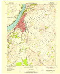 1952 Henderson1953 Print · USGSHenderson thrived as a vital river and rail crossroads in the early fifties, just as local oil exploration was dotting the landscape. Genealogists can trace family footprints across Fairmont Cemetery, visit Marshall Ch, or locate the old Audubon Sch.
 - 1952 Map of Newburgh, 1953 Print
 1952 Newburgh1953 Print · USGSThe Indiana-Kentucky borderlands along the Ohio River come to life in the early fifties, showing the transition from agricultural bottomlands to riverfront settlements. Researchers can trace family roots at Rose Hill Cem or locate the historic Angel Mounds State Memorial and Lock No 47.2 unique versions available
 - 1952 Map of Wilson, 1954 Print
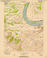 1952 Wilson1954 Print · USGSThe Ohio River loops through this borderland in the early fifties, defining a landscape of deep sloughs and timbered ridges. Genealogists can trace family names and sites at Geneva, St Johns Ch, and the Clay Cem while exploring the river's Lock and Dam No 48.
 - 1954 Map of Evansville
 1954 Evansville1954 Print · USGSThe Ohio River borderlands between Indiana and Kentucky appear here during a period of robust industrial and military growth. Genealogists and researchers can trace the rail corridors of the Illinois Central and find landmarks like US Lock and Dam No 48 or Camp Breckinridge.
 - 1956 Map of Vincennes, 1967 Print
 1956 Vincennes1967 Print · USGSSouthern Indiana and the Illinois borderlands are captured here in the mid-fifties, showing the region's dense network of river towns and rail lines. Researchers can trace historic river crossings along the Wabash River or locate landmarks like Wyandotte Cave and Lincoln State Park.4 unique versions available
 - 1957 Map of Vincennes
 1957 Vincennes1957 Print · USGSSouthwest Indiana and the Illinois borderlands come alive in the late 1950s, a period of heavy rail traffic and expanding state forests. Genealogists and historians can trace the riverfronts and rail lines of Vincennes, New Harmony, and the vast Crane Naval Ammunition Depot.
 - 1957 Map of West Franklin, 1959 Print
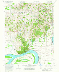 1957 West Franklin1959 Print · USGSSouthwestern Indiana and the Kentucky borderlands meet along the Ohio River in the late fifties. Genealogists can trace family names across Nashville Hollow and locate rural landmarks like St Peters Ch, West Franklin, and Diamond Island.2 unique versions available
 - 1957 Map of Evansville, 1959 Print
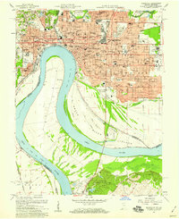 1957 Evansville1959 Print · USGSEvansville is seen in a period of significant postwar growth, where the industrial riverfront meets a rapidly expanding network of neighborhoods and schools. Researchers can trace family roots through numerous local landmarks like Evansville College, Bosse Field, and the St Marys Hospital.2 unique versions available
 - 1957 Map of Evansville, 1969 Print
 1957 Evansville1969 Print · USGSIndiana and Kentucky meet along the Ohio River in this mid-century survey of a vital industrial and transport corridor. Genealogists and historians can trace the development of river towns like Owensboro and Newburgh or locate old rail lines like the Southern Ry.3 unique versions available
 - 1958 Map of Vincennes
 1958 Vincennes1958 Print · USGSSouthern Indiana and the Illinois borderlands are captured during a mid-century period of heavy rail traffic and military activity. Researchers can trace the sprawling bounds of the Crane Naval Ammunition Depot or locate historic settlements like New Harmony and French Lick.2 unique versions available
 - 1959 Map of Wilson, 1960 Print
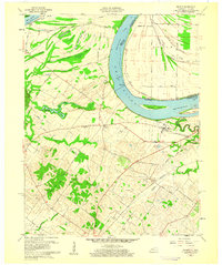 1959 Wilson1960 Print · USGSThe Ohio River meanders between Henderson County and Indiana in the late fifties, revealing a landscape of fertile bottomlands and complex river sloughs. Genealogists and local historians can locate Geneva, Lock and Dam No 48, and rural markers like St Johns Ch and Clay Cem.2 unique versions available
 - 1959 Map of Henderson, 1960 Print
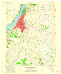 1959 Henderson1960 Print · USGSThe riverfront city of Henderson thrived in the late fifties as a hub of Kentucky industry and civic life. Genealogists can trace family names through local sites like Fairmont Cemetery, Walnut Hill Ch, and the rural community of Anthoston.
 - 1961 Map of Evansville
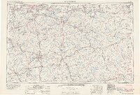 1961 Evansville1961 Print · USGSThe Ohio River valley and its surrounding coalfields are captured here during the late fifties and early sixties. Trace the industrial rail networks of the Illinois Central RR and explore regional landmarks like Mammoth Cave National Park and Angel Mounds State Memorial.2 unique versions available
 - 1961 Map of Cynthiana, 1962 Print
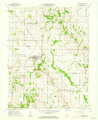 1961 Cynthiana1962 Print · USGSCynthiana and the surrounding Tri-State area are captured here in the early sixties at a peak of rail and rural development. Genealogists and researchers can trace local family landmarks such as Blythe Chapel, Antioch Ch, and the Knowles Cem burial ground.3 unique versions available
 - 1961 Map of Elberfeld, 1963 Print
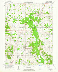 1961 Elberfeld1963 Print · USGSThe rural landscape around Elberfeld and Buckskin in the early sixties was a unique blend of active energy production and historical transit routes. Local historians can trace the path of the Erie and Wabash Canal and locate family sites like Nobles Cem or Zion Cem.4 unique versions available
 - 1961 Map of Daylight, 1963 Print
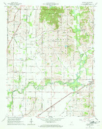 1961 Daylight1963 Print · USGSWarrick and Vanderburgh counties are shown in the early sixties as rural life centered on the rail corridors of the New York Central. Researchers can trace the legacy of the Wabash and Erie Canal or locate local landmarks like Daylight Sch and Blue Grass Cem.4 unique versions available
Showing maps 1-25 of 94
Top cities of Vanderburgh County
Frequently asked questions
- What are the different types of historical maps available for Vanderburgh County?
- What is the oldest map of Vanderburgh County?
- Where can I purchase historical maps of Vanderburgh County for my home or office?
- Where can I download high-res historical maps of Vanderburgh County?
- Are there historical topographic maps available for Vanderburgh County?
- Is there historical aerial imagery available for Vanderburgh County?
- Where are historical maps of Vanderburgh County sourced from?