1970s Maps of Wayne County, Indiana
Explore 3 historic maps of Wayne County from the 1970s. These maps offer a rare glimpse into what life looked like during the 1970s — showing old roads, neighborhoods, homes, and landmarks that have changed or disappeared over time.
Whether you're researching your family's past, planning a metal detecting trip, or studying how Wayne County's landscape evolved across the 1970s, these high-resolution maps are a powerful tool for exploring the history of this region.
- Focus on a specific era: All maps on this page are from the 1970s, giving you a focused view of this time period.
- See what’s changed: Compare century-old streets, trails, and buildings to today's modern landscape using overlays and satellite layers.
- Research with precision: Use these maps for genealogy, historical research, land use analysis, or educational projects.
- View, download, or print: Maps are fully viewable online in high resolution, and can be downloaded or printed for your own records.
Start exploring Wayne County's history through authentic maps from the 1970s. This is your window into the past.
Wayne County, IN maps
(3)- 1972 Map of Brownsville, 1973 Print
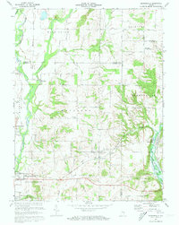 1972 Brownsville1973 Print · USGSFayette and Union Counties are captured here in the early seventies during the formation of the lake. Local historians can trace the foundations of communities like Springersville, find family plots at Philomath Cem, and locate the Covered Bridge at Brownsville.3 unique versions available
 - 1972 Map of Connersville, 1973 Print
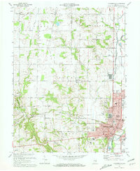 1972 Connersville1973 Print · USGSThe rail-and-river hub of Fayette County is captured here in the early seventies, showing a landscape shaped by the Whitewater River and the Penn Central tracks. Local historians can trace family roots through several rural burial grounds like Wiley Chapel Cem and 24 City Cemetery.2 unique versions available
 - 1974 Map of Liberty, 1975 Print
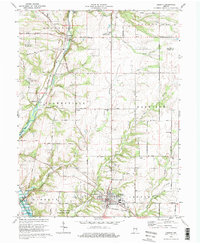 1974 Liberty1975 Print · USGSLiberty and the Whitewater River valley are shown here in the mid-seventies just as Brookville Lake was reshaping the local landscape. Genealogists and local historians can locate several rural burial grounds including Patterson Cem and Silver Creek Cem, or trace the old Baltimore and Ohio rail line.2 unique versions available
End of results
Showing maps 1-3 of 3
Top cities of Wayne County
- Richmond historical maps
- Centerville historical maps
- Cambridge City historical maps
- Hagerstown historical maps
- Webster historical maps
- Abington historical maps
See more
Frequently asked questions
- What are the different types of historical maps available for Wayne County?
- What is the oldest map of Wayne County?
- Where can I purchase historical maps of Wayne County for my home or office?
- Where can I download high-res historical maps of Wayne County?
- Are there historical topographic maps available for Wayne County?
- Is there historical aerial imagery available for Wayne County?
- Where are historical maps of Wayne County sourced from?