Old Maps of Wayne County, Indiana for Genealogy
Trace your family roots with 116 historic maps of Wayne County. These high-res maps reveal old neighborhoods, homesites, landmarks, and streets — helping you uncover where your ancestors lived and how the area evolved over time.
- Explore historic neighborhoods: Identify where your relatives may have lived in the 1800s or 1900s.
- Compare maps over time: Trace the changes in streets, buildings, and landmarks for multi-generational research.
- Perfect for genealogy & ancestry research: Used by family historians and researchers to map out lineage and migration.
These maps are an incredible resource for exploring your personal connection to Wayne County's past.
Wayne County, IN maps
(116)- 1915 Map of New Paris
 1915 New Paris1915 Print · USGSThe Indiana-Ohio borderlands at the onset of the Great War reveal a landscape of thriving rail hubs and pioneer roads. Genealogists and researchers can trace the early layouts of Hollansburg, Campbellstown, and Sunbeam, or follow the path of the historic National Road.
 - 1915 Map of College Corner
 1915 College Corner1915 Print · USGSThe Indiana-Ohio borderlands at the start of the twentieth century are defined here by rail hubs and rural townships. Trace family roots and vanished landmarks near College Corner, Concord Church, and the winding Fourmile Creek.
 - 1916 Map of Winchester
 1916 Winchester1916 Print · USGSIndiana's eastern borderlands during the height of the interurban era show a landscape of thriving rail towns and rural school districts. Genealogists can locate specific landmarks like the County Infirmary, McKinley School, and the cross-border community of Union City.3 unique versions available
 - 1918 Map of Winchester
 1918 Winchester1918 Print · USGSRandolph County sits at a crossroads of major rail lines and headwater streams during the late nineteen-teens. Genealogists can locate dozens of country schoolhouses like McKinley School and Sauerkraut School, or trace family ties in Union City and Lynn.2 unique versions available
 - 1918 Map of College Corner
 1918 College Corner1918 Print · USGSThe Indiana-Ohio borderlands come into focus during the Great War era, showing the intersection of rail and road commerce. Genealogists and historians can trace the early layout of College Corner, the grounds of Tallawanda Springs, and rural landmarks like School No 3.4 unique versions available
 - 1918 Map of New Paris, 1922 Print
 1918 New Paris1922 Print · USGSThe Indiana-Ohio border during the First World War reveals a landscape defined by pioneering electric railways and historic transit corridors. Genealogists and historians can trace the growth of New Paris and Hollansburg, or locate small communities like Sunbeam and Cedar Springs.
 - 1943 Map of Winchester, 1944 Print
 1943 Winchester1944 Print · USGSThe Indiana-Ohio borderlands in the 1940s reveal a landscape of bustling rail junctions and tight-knit rural school districts. Genealogists can trace family footprints at Beech Grove Sch, the County Infirmary, or the curious Sauerkraut Sch.
 - 1953 Map of Cincinnati, 1965 Print
 1953 Cincinnati1965 Print · USGSThe Ohio River valley and the industrial heartland of Indiana and Ohio are captured here during the mid-century peak of rail and river commerce. Genealogists and historians can trace connections between Cincinnati and outlying military sites like Camp Atterbury and Bakalar AFB.3 unique versions available
 - 1953 Map of Muncie, 1966 Print
 1953 Muncie1966 Print · USGSIndiana and Ohio borderlands thrive in the early fifties, showing a landscape defined by manufacturing cities and an intensive railroad network. Genealogists can trace family roots across the Indiana-Ohio line through Muncie, Celina, and Portland via the Pennsylvania railroad.5 unique versions available
 - 1956 Map of Muncie
 1956 Muncie1956 Print · USGSEastern Indiana and western Ohio are shown at a peak of rail-driven industry in the mid-fifties. Genealogists and rail historians can trace the paths of the Pennsylvania RR through Muncie or locate landmarks like Lake Saint Marys (Grand Lake Reservoir) and Frances Slocum State Forest.
 - 1956 Map of Brownsville, 1957 Print
 1956 Brownsville1957 Print · USGSFayette County is captured in the mid-fifties at a moment when rural crossroads like Philomath and Lyonsville still served as vital community centers. Researchers can locate vanished landmarks and family burial sites such as Philomath Cem and Simpson Cem.
 - 1956 Map of Connersville, 1957 Print
 1956 Connersville1957 Print · USGSIn the mid-1950s, the Connersville area flourished as a crossroads for the Baltimore and Ohio and Pennsylvania railroads. Genealogists and historians can trace family locations near Wiley Chapel Cem, Harrisburg, and several rural Township Sch sites.
 - 1957 Map of Cincinnati
 1957 Cincinnati1957 Print · USGSThe Ohio River valley and its surrounding highlands thrived during the mid-fifties industrial peak, centered on the bustling Cincinnati and Dayton metropolitan hubs. Researchers can trace the extensive rail networks and military sites like Wright-Patterson AFB and Camp Atterbury.
 - 1960 Map of Liberty, 1961 Print
 1960 Liberty1961 Print · USGSThe eastern Indiana countryside around the town of Liberty is shown here in the early sixties, just as the local landscape was being shaped by the new Whitewater State Park. Researchers can locate numerous family landmarks and burial sites, including Potter Cem, Woods Chapel, and the Baltimore and Ohio rail line.
 - 1960 Map of Fairhaven, 1961 Print
 1960 Fairhaven1961 Print · USGSThe Indiana-Ohio state line was a landscape of quiet agricultural hamlets and steam-era rail lines in the early sixties. Genealogists can trace the rural communities of Fairhaven and Goodwins Corner, along with the Sugar Grove Ch and several local cemeteries.2 unique versions available
 - 1960 Map of Carlos, 1961 Print
 1960 Carlos1961 Print · USGSRandolph County's rural townships are captured here in the early sixties, showing the agricultural heartland of eastern Indiana. Researchers can trace historical property lines along the Indian Treaty Boundary and locate small communities like Huntsville, Unionport, and Carlos.3 unique versions available
 - 1960 Map of Hagerstown, 1961 Print
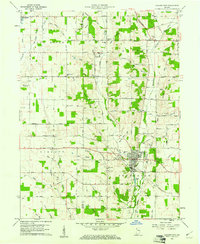 1960 Hagerstown1961 Print · USGSHagerstown and the surrounding Wayne County farmland are captured here in the early sixties, showing a landscape defined by the Whitewater River and the Pennsylvania Railroad. Genealogists can locate specific sites like the Wilbur Wright Memorial, Township School, and West Lawn Cemetery.2 unique versions available
 - 1960 Map of Spartanburg, 1961 Print
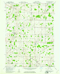 1960 Spartanburg1961 Print · USGSThe Indiana-Ohio borderlands at the start of the 1960s reveal a landscape of well-ordered farms and quiet railroad hamlets. Researchers can locate family landmarks like Beech Cemetery and Bartonia Cemetery or trace the New York Central through Crete.2 unique versions available
 - 1960 Map of Fountain City, 1961 Print
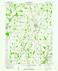 1960 Fountain City1961 Print · USGSWayne County farming communities thrive in the early 1960s amidst a landscape carved by the Whitewater River and Nolands Fork. Genealogists can trace family roots at Old Concord Cem or Hopewell Ch, while discovering landmarks like the Covered Bridge on Quill Creek.
 - 1960 Map of Lynn, 1961 Print
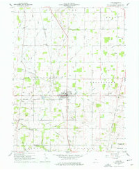 1960 Lynn1961 Print · USGSEastern Indiana at the start of the sixties reveals a landscape of thriving rail hubs and quiet country crossroads. Genealogists and historians can locate family landmarks like Quaker Lynn Cem, the New York Central Line, and the town of Bloomingport.4 unique versions available
 - 1960 Map of Richmond, 1961 Print
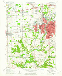 1960 Richmond1961 Print · USGSRichmond and Centerville are captured at a point of mid-century growth when rail lines still defined the local economy. Researchers can trace the grounds of Earlham College, find family plots at Earlham Cemetery, and locate vanished neighborhood landmarks like Sevastopol Sch.2 unique versions available
 - 1960 Map of Jacksonburg, 1961 Print
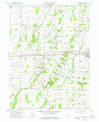 1960 Jacksonburg1961 Print · USGSWayne County is captured in the early sixties as a thriving landscape of rural churches and agricultural hubs along the historic National Road. Researchers can locate family roots at Doddridge Chapel, Hoover Mill, and cemeteries like Crown Hill Cem or West Cem.3 unique versions available
 - 1960 Map of Whitewater, 1961 Print
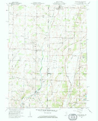 1960 Whitewater1961 Print · USGSThe Indiana-Ohio borderlands at the start of the sixties reveal a landscape of thriving crossroads and river-valley farms. Genealogists can trace family footprints through the Middleboro settlement, Friendship Ch, and several rural burial grounds like Bethel Cem.3 unique versions available
 - 1960 Map of New Paris, 1961 Print
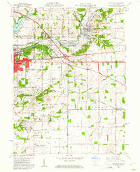 1960 New Paris1961 Print · USGSThe Indiana-Ohio border comes alive in the early sixties as the city of Richmond expands toward New Paris. Genealogists and historians can trace family locations through Smyrna Ch, Spring Lawn Cemetery, and the many farms along the historic National Road.4 unique versions available
 - 1960 Map of Modoc, 1961 Print
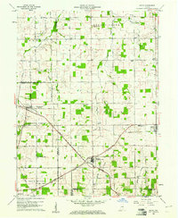 1960 Modoc1961 Print · USGSRandolph and Henry Counties appear here in the early sixties, centered on the vital rail junctions of the eastern Indiana plains. Genealogists and local historians can trace the locations of Bronson, Blountsville, and rural sites like Grace Chapel.
Showing maps 1-25 of 116
Top cities of Wayne County
- Richmond historical maps
- Centerville historical maps
- Cambridge City historical maps
- Hagerstown historical maps
- Webster historical maps
- Abington historical maps
See more
Frequently asked questions
- What are the different types of historical maps available for Wayne County?
- What is the oldest map of Wayne County?
- Where can I purchase historical maps of Wayne County for my home or office?
- Where can I download high-res historical maps of Wayne County?
- Are there historical topographic maps available for Wayne County?
- Is there historical aerial imagery available for Wayne County?
- Where are historical maps of Wayne County sourced from?