1960s Maps of Allamakee County, Iowa
Explore 10 historic maps of Allamakee County from the 1960s. These maps offer a rare glimpse into what life looked like during the 1960s — showing old roads, neighborhoods, homes, and landmarks that have changed or disappeared over time.
Whether you're researching your family's past, planning a metal detecting trip, or studying how Allamakee County's landscape evolved across the 1960s, these high-resolution maps are a powerful tool for exploring the history of this region.
- Focus on a specific era: All maps on this page are from the 1960s, giving you a focused view of this time period.
- See what’s changed: Compare century-old streets, trails, and buildings to today's modern landscape using overlays and satellite layers.
- Research with precision: Use these maps for genealogy, historical research, land use analysis, or educational projects.
- View, download, or print: Maps are fully viewable online in high resolution, and can be downloaded or printed for your own records.
Start exploring Allamakee County's history through authentic maps from the 1960s. This is your window into the past.
Allamakee County, IA maps
(10)- 1961 Map of La Crosse
 1961 La Crosse1961 Print · USGSThe Driftless Area at the start of the 1960s reveals a complex network of river towns and rail lines along the Mississippi River. Genealogists and historians can trace old settlements like New Amsterdam and Wyattville or locate major landmarks like Camp McCoy Military Reservation and Effigy Mounds National Monument.
 - 1965 Map of La Crosse
 1965 La Crosse1965 Print · USGSThe Driftless Area and the Upper Mississippi valley are captured here during a period of steady mid-century growth. Researchers can trace the rail lines of the Chicago and North Western or locate riverfront sites like Effigy Mounds National Monument and the Camp McCoy Military Reservation.
 - 1965 Map of Wilmington, 1966 Print
 1965 Wilmington1966 Print · USGSThe Houston County borderlands are captured here in the mid-sixties, showing the transition from wooded ridges to deep creek valleys. Researchers can locate family landmarks like Stone Cem, the Wilmington Ch, and the rural settlement of Bee.2 unique versions available
 - 1965 Map of Stoddard, 1968 Print
 1965 Stoddard1968 Print · USGSWisconsin's driftless coulee country and the Mississippi River islands are captured here in the mid-sixties. Genealogists and local historians can trace rural family life through landmarks like St Peters Ch, North Ridge Sch, and the isolated German Cem.
 - 1966 Map of Ferryville, 1968 Print
 1966 Ferryville1968 Print · USGSThe Mississippi River valley in the mid-sixties is shown in detail, capturing the intricate sloughs and ridges along the Wisconsin and Iowa border. Researchers can trace the riverfront rail lines and find small upland landmarks like Red Mound, Retreat, and Walnut Mound Cem.2 unique versions available
 - 1967 Map of Prairie Du Chien, 1969 Print
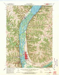 1967 Prairie Du Chien1969 Print · USGSThe river-and-rail hub of the Upper Mississippi comes alive in this late-sixties study of the Wisconsin-Iowa border. Genealogists can locate family names at Campbell Cem and Hazen Corners Cem or trace old rail lines through Harpers Ferry and Marquette.
 - 1968 Map of Church, 1970 Print
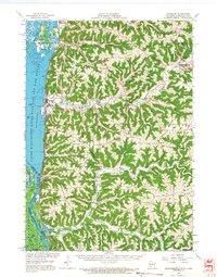
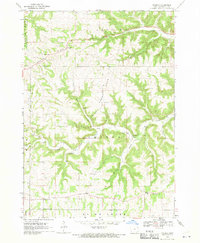 1968 Church1970 Print · USGSAllamakee County’s high ridges and creek valleys are documented here in the late sixties, showing a landscape defined by farming and faith. Genealogists can trace family roots through several specific sites including Old West Paint Creek Ch, Lansing Ridge Cem, and the village of Church.2 unique versions available
 - 1968 Map of Waukon, 1970 Print
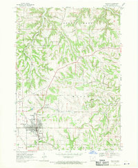 1968 Waukon1970 Print · USGSThe Allamakee County seat at Waukon is captured here in the late sixties, showing a town and its surrounding agricultural valleys. Researchers can trace family sites at Oakland Cemetery, the community around St Marys Ch in Lycurgus, and the Fairground.
 - 1968 Map of New Albin, 1970 Print
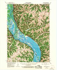
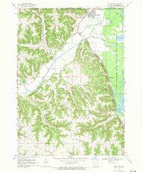 1968 New Albin1970 Print · USGSNew Albin sits at the convergence of river and rail during the late sixties, where the Iowa and Minnesota border meets the Mississippi wetlands. You can trace the Chicago Milwaukee St Paul and Pacific rail line past Indian Mounds and the remote Kains Siding.2 unique versions available
 - 1968 Map of Waukon NW, 1970 Print
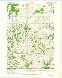
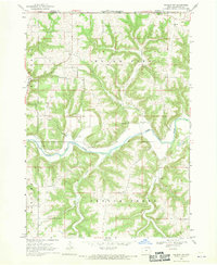 1968 Waukon NW1970 Print · USGSAllamakee County’s river valleys and township lines are captured here in the late sixties as the rural landscape remained deeply tied to its waterways. Local history hunters can find St Johns Ch Cem, the old Townhall, and industrial traces like the Quarry.
End of results
Showing maps 1-10 of 10
Top cities of Allamakee County
- Waukon historical maps
- Lansing historical maps
- New Albin historical maps
- Harpers Ferry historical maps
- Waterville historical maps
Frequently asked questions
- What are the different types of historical maps available for Allamakee County?
- What is the oldest map of Allamakee County?
- Where can I purchase historical maps of Allamakee County for my home or office?
- Where can I download high-res historical maps of Allamakee County?
- Are there historical topographic maps available for Allamakee County?
- Is there historical aerial imagery available for Allamakee County?
- Where are historical maps of Allamakee County sourced from?