Old Maps of Allamakee County, Iowa for Hiking & Exploration
Hike through history with 130 historic maps of Allamakee County. Explore old trails, ghost towns, and forgotten backroads — perfect for outdoor adventurers and local explorers.
- Rediscover forgotten places: Map out old mining camps, roads, and footpaths that no longer exist on modern maps.
- Layer with modern tools: Combine with LiDAR or satellite views to plan hikes through historical terrain.
- Made for exploration: Popular among hikers, overlanders, and local history lovers.
Use these maps to find adventure and explore the hidden past of Allamakee County.
Allamakee County, IA maps
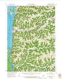
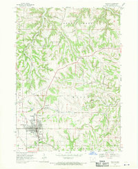
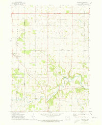
(130)- 1903 Map of Waukon
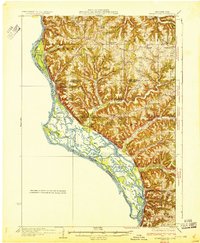
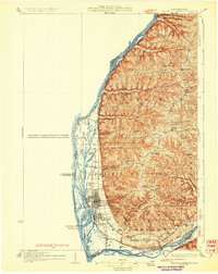
 1903 Waukon1903 Print · USGSThe Upper Mississippi River valley comes alive in the early 1900s, showing a landscape of steep bluffs, river landings, and early rail lines. You can trace the path of the Chicago Milwaukee and St. Paul RR to the county seat at Waukon or find old riverfront points like Harpers Ferry and Lansing.5 unique versions available
 - 1906 Map of Decorah
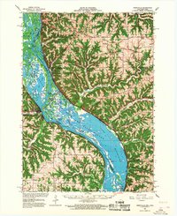
 1906 Decorah1906 Print · USGSNortheast Iowa at the turn of the century was a land of intricate river valleys and vital railroad junctions. Genealogists can trace the early rail-and-river economy through landmarks like Decorah, the historic site of Fort Atkinson, and the junction at Calmar.3 unique versions available
 - 1926 Map of Stoddard
 1926 Stoddard1926 Print · USGSUpper Mississippi river life and ridge-top farming meet in the mid-1920s along the Wisconsin-Minnesota border. Researchers can trace the complex river channels near Stoddard or find family roots at rural landmarks like Evening Star School and Romance.2 unique versions available
 - 1929 Map of Ferryville, 1957 Print
 1929 Ferryville1957 Print · USGSThe riverfront and ridge-top communities of Crawford and Vernon counties are captured here in the late 1920s before major lock and dam construction. Genealogists can locate family landmarks such as Freeman Church, Redmound School, and the riverside tracks of the Chicago Burlington and Quincy Railroad.2 unique versions available
 - 1929 Map of Prairie Du Chien, 1963 Print
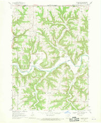
 1929 Prairie Du Chien1963 Print · USGSThe Mississippi River valley of Crawford County at the end of the twenties shows a landscape of complex sloughs and rugged ridges. Genealogists can locate family schoolhouses like Frenchtown Sch and Hazen Corners Sch or trace the early rail lines through Prairie du Chien.
 - 1932 Map of Ferryville
 1932 Ferryville1932 Print · USGSThe Mississippi River bottoms and the ridge-and-hollow country of western Wisconsin are captured here in the early 1930s. Genealogists can trace family farm locations near dozens of rural landmarks like Redmound School, Freeman Church, and Battle Slough.
 - 1932 Map of Prairie Du Chien
 1932 Prairie Du Chien1932 Print · USGSCrawford County at the confluence of the two great rivers in the early thirties shows a landscape of ridge-top schools and bustling riverfront rail towns. Genealogists can trace family footprints at Wrights Ferry, Hazen Corners, or rural outposts like Lamer Ridge Sch.4 unique versions available
 - 1956 Map of Brownsville, 1958 Print
 1956 Brownsville1958 Print · USGSSoutheastern Minnesota and the Mississippi River bottoms are captured here in the mid-fifties, showing the region's transition from rural school districts. Researchers can trace dozens of family-named landmarks and closed schools like Peacock Ridge Sch (Abandoned) or visit St Peters Ch.2 unique versions available
 - 1958 Map of La Crosse, 1979 Print
 1958 La Crosse1979 Print · USGSThe Driftless Area of Wisconsin and Iowa is captured here during the late seventies, showing the intricate river valleys and ridge-top settlements. Genealogists and historians can trace the rail corridors of the Soo Line or locate landmarks like Grandad Bluff and Effigy Mounds National Monument.2 unique versions available
 - 1961 Map of La Crosse
 1961 La Crosse1961 Print · USGSThe Driftless Area at the start of the 1960s reveals a complex network of river towns and rail lines along the Mississippi River. Genealogists and historians can trace old settlements like New Amsterdam and Wyattville or locate major landmarks like Camp McCoy Military Reservation and Effigy Mounds National Monument.
 - 1965 Map of La Crosse
 1965 La Crosse1965 Print · USGSThe Driftless Area and the Upper Mississippi valley are captured here during a period of steady mid-century growth. Researchers can trace the rail lines of the Chicago and North Western or locate riverfront sites like Effigy Mounds National Monument and the Camp McCoy Military Reservation.
 - 1965 Map of Wilmington, 1966 Print
 1965 Wilmington1966 Print · USGSThe Houston County borderlands are captured here in the mid-sixties, showing the transition from wooded ridges to deep creek valleys. Researchers can locate family landmarks like Stone Cem, the Wilmington Ch, and the rural settlement of Bee.2 unique versions available
 - 1965 Map of Stoddard, 1968 Print
 1965 Stoddard1968 Print · USGSWisconsin's driftless coulee country and the Mississippi River islands are captured here in the mid-sixties. Genealogists and local historians can trace rural family life through landmarks like St Peters Ch, North Ridge Sch, and the isolated German Cem.
 - 1966 Map of Ferryville, 1968 Print
 1966 Ferryville1968 Print · USGSThe Mississippi River valley in the mid-sixties is shown in detail, capturing the intricate sloughs and ridges along the Wisconsin and Iowa border. Researchers can trace the riverfront rail lines and find small upland landmarks like Red Mound, Retreat, and Walnut Mound Cem.2 unique versions available
 - 1967 Map of Prairie Du Chien, 1969 Print
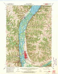 1967 Prairie Du Chien1969 Print · USGSThe river-and-rail hub of the Upper Mississippi comes alive in this late-sixties study of the Wisconsin-Iowa border. Genealogists can locate family names at Campbell Cem and Hazen Corners Cem or trace old rail lines through Harpers Ferry and Marquette.
 - 1968 Map of Church, 1970 Print
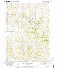
 1968 Church1970 Print · USGSAllamakee County’s high ridges and creek valleys are documented here in the late sixties, showing a landscape defined by farming and faith. Genealogists can trace family roots through several specific sites including Old West Paint Creek Ch, Lansing Ridge Cem, and the village of Church.2 unique versions available
 - 1968 Map of Waukon, 1970 Print
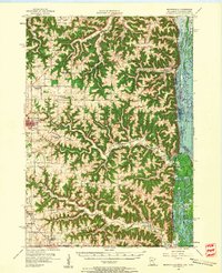
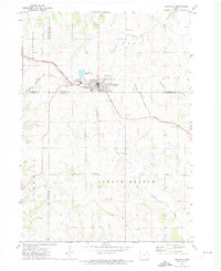
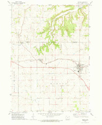
 1968 Waukon1970 Print · USGSThe Allamakee County seat at Waukon is captured here in the late sixties, showing a town and its surrounding agricultural valleys. Researchers can trace family sites at Oakland Cemetery, the community around St Marys Ch in Lycurgus, and the Fairground.
 - 1968 Map of New Albin, 1970 Print
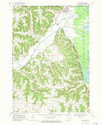 1968 New Albin1970 Print · USGSNew Albin sits at the convergence of river and rail during the late sixties, where the Iowa and Minnesota border meets the Mississippi wetlands. You can trace the Chicago Milwaukee St Paul and Pacific rail line past Indian Mounds and the remote Kains Siding.2 unique versions available
 - 1968 Map of Waukon NW, 1970 Print
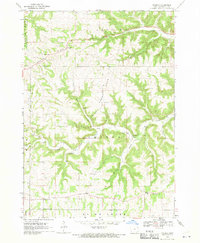
 1968 Waukon NW1970 Print · USGSAllamakee County’s river valleys and township lines are captured here in the late sixties as the rural landscape remained deeply tied to its waterways. Local history hunters can find St Johns Ch Cem, the old Townhall, and industrial traces like the Quarry.
 - 1971 Map of Postville, 1973 Print
 1971 Postville1973 Print · USGSPostville and the four-county border region of northeast Iowa are captured here during the early seventies as a thriving rail and agricultural center. Local historians can trace the Chicago Milwaukee St Paul and Pacific rail line and locate landmarks like Township Cem, the Fairground, and various Quarries.
 - 1971 Map of Waterville, 1973 Print
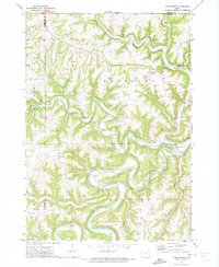
 1971 Waterville1973 Print · USGSNortheastern Iowa in the early 1970s is captured here, showing the intricate valleys and bluffs of Allamakee County. Researchers can trace the path of the Old Grade and locate rural landmarks like East Paint Creek Ch, St Pius Ch, and Volney.2 unique versions available
 - 1971 Map of Rossville, 1973 Print
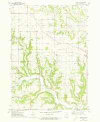 1971 Rossville1973 Print · USGSAllamakee County farmland meets the winding Yellow River in the early 1970s. Genealogists and researchers can trace local family landmarks through Evergreen Cem, the Forest Mills Ch, and the small settlement of Rossville.
 - 1971 Map of Dorchester, 1973 Print
 1971 Dorchester1973 Print · USGSAllamakee County, Iowa, is captured in the early 1970s as a landscape of deep river valleys and upland ridges. Genealogists and local historians can trace the foundations of the community at Dorchester, Quandahl, and the Waterloo Ridge Ch.
 - 1971 Map of Monona, 1973 Print
 1971 Monona1973 Print · USGSClayton and Allamakee Counties are shown in the early seventies as the region's agricultural and rail patterns remained firmly established. Researchers can find numerous family-history sites like Pioneer Cem and Hardin Cem, or trace the path of the Chicago Milwaukee St. Paul and Pacific railroad.
 - 1971 Map of Frankville, 1973 Print
 1971 Frankville1973 Print · USGSAllamakee and Winneshiek counties are captured in the early 1970s, showcasing the rural landscapes surrounding the Yellow River. Researchers can trace old family sites near Salem Ch, Bethlehem Cem, and numerous hillside Quarries.
Showing maps 1-25 of 130
Top cities of Allamakee County
- Waukon historical maps
- Lansing historical maps
- New Albin historical maps
- Harpers Ferry historical maps
- Waterville historical maps
Frequently asked questions
- What are the different types of historical maps available for Allamakee County?
- What is the oldest map of Allamakee County?
- Where can I purchase historical maps of Allamakee County for my home or office?
- Where can I download high-res historical maps of Allamakee County?
- Are there historical topographic maps available for Allamakee County?
- Is there historical aerial imagery available for Allamakee County?
- Where are historical maps of Allamakee County sourced from?