Old Maps of Buchanan County, Iowa for Metal Detecting
Plan your next treasure hunt with 132 historic maps of Buchanan County. Find old homesites, ghost towns, trails, and gathering spots that may be lost to time — perfect for identifying promising metal detecting locations.
- Locate forgotten sites: Uncover places like long-lost settlements, abandoned rail lines, or gathering spots.
- Plan better hunts: Use map overlays combined with LiDAR or satellite views to narrow in on historically rich areas.
- Made for detectorists: Thousands of hobbyists use these maps to discover relics, coins, and hidden history.
Use these historic maps to boost your research and find new opportunities beneath the surface of Buchanan County.
Buchanan County, IA maps
(132)- 1901 Map of Oelwein
 1901 Oelwein1901 Print · USGSNortheast Iowa at the turn of the century was a bustling network of rail-side towns and river valleys. Genealogists can trace family locations across dozens of early settlements like Strawberry Point, Hawkeye, and the railroad junction at Oelwein.4 unique versions available
 - 1903 Map of Winthrop
 1903 Winthrop1903 Print · USGSEast Central Iowa was a landscape of thriving rail towns and river crossings at the turn of the century. Genealogists and historians can trace the early footprints of Independence and Marion, or locate smaller centers like Quasqueton and Toddville.2 unique versions available
 - 1954 Map of Waterloo, 1968 Print
 1954 Waterloo1968 Print · USGSCentral Iowa at the height of its mid-century agricultural and rail boom features the growing hubs of Waterloo and Cedar Falls. Genealogists and researchers can trace the rail corridors of the Chicago Great Western and find local landmarks like Iowa State College and Brushy Ridge.4 unique versions available
 - 1955 Map of Waterloo
 1955 Waterloo1955 Print · USGSCentral Iowa in the mid-fifties presents a dense landscape of rail-connected farming towns and growing river cities. Researchers can trace ancestral roots and old transport routes through Waterloo, Marshalltown, and Ames, while locating rural Cemeteries and local Quarries.2 unique versions available
 - 1959 Map of Dubuque, 1982 Print
 1959 Dubuque1982 Print · USGSThe Tri-State region comes alive in the mid-twentieth century as a hub of river commerce and rail transit. Genealogists and historians can trace the paths of the Illinois Central Gulf through Dubuque or locate the Savanna Ordnance Depot and Lock and Dam No 11.
 - 1961 Map of Dubuque
 1961 Dubuque1961 Print · USGSThe Tri-State region's river-and-rail landscape is captured here during the early sixties, showing the convergence of Iowa, Illinois, and Wisconsin. Trace mid-century rail lines like the Chicago Great Western Ry and explore sites like the Savanna Ordnance Depot and Backbone State Park.
 - 1962 Map of Dubuque
 1962 Dubuque1962 Print · USGSThe Tri-State region's river-and-rail economy is captured here in the early sixties, centered on the Mississippi River bluffs. Genealogists and historians can locate Numerous lead and zinc mines, the New Melleray Abbey Monastery, and rural hubs like Saint Olaf.2 unique versions available
 - 1965 Map of Strawberry Point, 1966 Print
 1965 Strawberry Point1966 Print · USGSStrawberry Point and the surrounding Iowa countryside are captured here in the mid-sixties at the junction of four counties. Trace the rail-and-river landscape from the Milwaukee Road tracks to Backbone State Forest and the Fish Hatchery.
 - 1965 Map of Arlington, 1966 Print
 1965 Arlington1966 Print · USGSArlington and the rolling farm country of Fayette and Buchanan counties appear here in the mid-1960s as a landscape of river-fed townships and rail. Trace the old rail lines of the Milwaukee Road and find family sites at Union Ch Cem or Maryville.
 - 1965 Map of Lamont, 1967 Print
 1965 Lamont1967 Print · USGSThe rural landscapes of Buchanan County are captured here in the mid-1960s, showing the agricultural heartland centered on the towns of Lamont and Aurora. Genealogists and historians can locate family sites near Byron Cem, the Madison Gem schoolhouse, and the Chicago Great Western rail line.2 unique versions available
 - 1965 Map of Dundee, 1967 Print
 1965 Dundee1967 Print · USGSDundee and the surrounding Delaware County townships are shown in the mid-1960s as a thriving hub of rail transport and river-front recreation. Researchers can locate family sites like St Albert Cem, the village of Forestville, and the extensive grounds of Backbone State Park.
 - 1971 Map of Brandon, 1973 Print
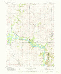 1971 Brandon1973 Print · USGSThe Cedar River valley near the tri-county junction of Black Hawk, Buchanan, and Benton is captured here in the early 1970s. Trace the rural landscape through landmarks like Spring Creek Cem, the Fish Farm, and the Mt Auburn Bridge.2 unique versions available
 - 1971 Map of Fairbank, 1973 Print
 1971 Fairbank1973 Print · USGSNortheast Iowa farmland at the start of the 1970s is centered here on the crossing of the Little Wapsipinicon River and the Chicago and North Western railroad. Genealogists can trace family roots at Immaculate Conception Cem and St Peter Cem or explore the old layout of Fairbank.
 - 1971 Map of Littleton, 1973 Print
 1971 Littleton1973 Print · USGSThe river valleys of Buchanan and Black Hawk counties are captured here in the early seventies, centered on the village of Littleton. Genealogists and researchers can trace a wealth of local landmarks including Amish Cem, Barclay Cem, and the old Brown Sch.
 - 1971 Map of Jesup, 1973 Print
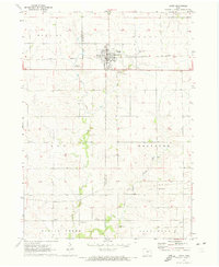 1971 Jesup1973 Print · USGSMidwestern prairie life is captured here in the early seventies, detailing the county line communities between Black Hawk and Buchanan. Genealogists can locate family sites near St Athanasius Cem, the old Townhall, or rural settlements like Jubilee and Shady Grove.
 - 1973 Map of Independence, 1977 Print
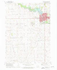 1973 Independence1977 Print · USGSIndependence and its surrounding townships are shown here in the mid-seventies as a bustling rail and river hub. You can trace the historic institutional grounds of the State Hospital or locate local landmarks like the Fairground and Oakwood Cem.2 unique versions available
 - 1973 Map of Troy Mills, 1977 Print
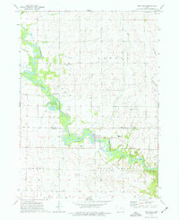 1973 Troy Mills1977 Print · USGSThe Wapsipinicon River valley in the early 1970s shows a landscape of river-bend conservation and rural crossroads. Local historians can trace the foundations of Troy Mills and find family names at St Patricks Cem, Troy Mills Cem, and Hoosier Ch.
 - 1973 Map of Quasqueton, 1977 Print
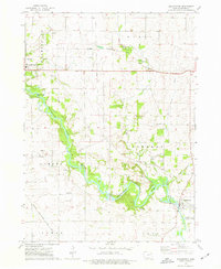 1973 Quasqueton1977 Print · USGSBuchanan County's river valleys and rail corridors are captured here in the early 1970s as the river-based economy evolved. Researchers can trace land use around Quasqueton, locate the Pine Creek Mission Ch, and follow the Old RR Grade.2 unique versions available
 - 1973 Map of Winthrop, 1977 Print
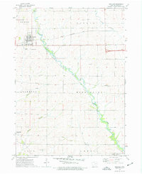 1973 Winthrop1977 Print · USGSBuchanan County's agricultural heartland is documented in the mid-seventies, centered on the railroad town of Winthrop. Genealogists and local historians can trace family plots at Fairview Cem or follow the path of the Illinois Central Gulf and an Old RR Grade.2 unique versions available
 - 1973 Map of Masonville, 1977 Print
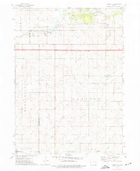 1973 Masonville1977 Print · USGSMasonville and the surrounding townships appear here in the early 1970s, illustrating the agricultural and rail-based economy of the Delaware-Buchanan county line. Genealogists and local historians can locate early burial sites like Greenwood Cem and St Mary Cem or trace the Illinois Central Gulf railroad corridor.
 - 1973 Map of Coggon, 1977 Print
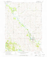 1973 Coggon1977 Print · USGSThe agricultural borderlands of Linn and Delaware counties are captured here in the early 1970s. Researchers can trace the path of the Illinois Central Gulf through Coggon or locate family sites like Spring Grove Ch and St Johns Cem.
 - 1973 Map of Cheney, 1977 Print
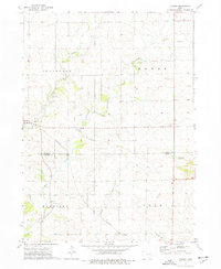 1973 Cheney1977 Print · USGSThe rural borderlands of Buchanan and Benton Counties are captured here in the early 1970s, showcasing a landscape of winding creeks and section-line roads. Researchers can trace local history through the Townhall, Bear Creek Cemetery, and the settlement of Brandon.
 - 1973 Map of Walker, 1977 Print
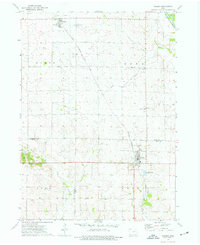 1973 Walker1977 Print · USGSEastern Iowa farmland is captured here in the early 1970s, spanning the border of Buchanan and Linn counties. Researchers can trace the Chicago Rock Island and Pacific rail line between Rowley and Walker, locating landmarks like Sacred Heart Cem and Spencers Grove.2 unique versions available
 - 1976 Map of Dubuque
 1976 Dubuque1976 Print · USGSThe tri-state borderlands of Iowa, Wisconsin, and Illinois come alive during the mid-seventies, showing a region built on river commerce and mining. Genealogists and historians can trace the paths of the Illinois Central railroad or locate heritage sites like the New Melleray Abbey Monastery and Backbone State Park.
 - 1981 Map of Stanley, 1982 Print
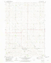 1981 Stanley1982 Print · USGSThe rural borderlands of Buchanan and Fayette Counties are captured here in the early eighties, centered on the village of Stanley. Local historians can trace family roots through the Stanley Cem, Garden Prairie Ch, and the path of the Chicago and North Western railroad.
Showing maps 1-25 of 132
Top cities of Buchanan County
- Independence historical maps
- Jesup historical maps
- Winthrop historical maps
- Hazleton historical maps
- Quasqueton historical maps
- Lamont historical maps
See more
Frequently asked questions
- What are the different types of historical maps available for Buchanan County?
- What is the oldest map of Buchanan County?
- Where can I purchase historical maps of Buchanan County for my home or office?
- Where can I download high-res historical maps of Buchanan County?
- Are there historical topographic maps available for Buchanan County?
- Is there historical aerial imagery available for Buchanan County?
- Where are historical maps of Buchanan County sourced from?