Old Maps of Clarke County, Iowa for Hiking & Exploration
Hike through history with 112 historic maps of Clarke County. Explore old trails, ghost towns, and forgotten backroads — perfect for outdoor adventurers and local explorers.
- Rediscover forgotten places: Map out old mining camps, roads, and footpaths that no longer exist on modern maps.
- Layer with modern tools: Combine with LiDAR or satellite views to plan hikes through historical terrain.
- Made for exploration: Popular among hikers, overlanders, and local history lovers.
Use these maps to find adventure and explore the hidden past of Clarke County.
Clarke County, IA maps
(112)- 1950 Map of New Virginia, 1978 Print
 1950 New Virginia1978 Print · USGSThe rural borders of Warren and Clarke counties come into focus at mid-century, showing a landscape of small settlements and neighborhood schoolhouses. Genealogists can trace family roots through numerous sites like Mt Tabor Cem, Ottawa Sch, and the Chicago Burlington and Quincy rail line.
 - 1951 Map of Osceola, 1953 Print
 1951 Osceola1953 Print · USGSSouthern Iowa's rural townships are captured here in the early fifties, showing the rail-centered growth of OSCEOLA and Murray. Researchers can trace the layout of numerous vanished country schoolhouses like Prairie Grove Sch and old burial sites such as Ebenezer Cem.2 unique versions available
 - 1951 Map of Afton, 1953 Print
 1951 Afton1953 Print · USGSSouthern Iowa's rural landscape is captured here in the early fifties, showing a region defined by its rail-and-river economy and dense network of country schools. Researchers can trace family history through dozens of landmarks like Mt Pisgah Cem, Macksburg, and Green Lawn Cem.2 unique versions available
 - 1952 Map of New Virginia
 1952 New Virginia1952 Print · USGSSouthern Iowa rural life in the early fifties is mapped here in fine detail across the border of Warren and Clarke counties. Genealogists can locate family landmarks like Mt Tabor Cem, Ottawa, and numerous local schoolhouses including Quiet Dell Sch and Cool School.2 unique versions available
 - 1954 Map of Centerville, 1967 Print
 1954 Centerville1967 Print · USGSThe Iowa-Missouri borderlands at mid-century reveal a landscape shaped by river valleys and the height of the regional rail network. Genealogists and historians can trace the paths of the Wabash railroad and locate old townsites like Mystic, Moulton, and Greentop.3 unique versions available
 - 1954 Map of Omaha, 1967 Print
 1954 Omaha1967 Print · USGSMid-century development radiates from the river bluffs into the agricultural heartland during this period of post-war growth. Genealogists and historians can trace rail-connected towns like Atlantic and Red Oak or locate the sprawling grounds of Offutt Air Force Base and Manawa Lake.3 unique versions available
 - 1954 Map of Des Moines, 1973 Print
 1954 Des Moines1973 Print · USGSCentral Iowa's evolving landscape is captured here in the early seventies, just as major reservoirs were reshaping the river valleys. Genealogists and historians can trace the rail corridors of the Burlington Northern or locate family roots near Pella, Indianola, and Knoxville.2 unique versions available
 - 1955 Map of Nebraska City, 1967 Print
 1955 Nebraska City1967 Print · USGSThe four-state region surrounding the Missouri River valley appears here in the mid-1950s, a landscape of rail-dependent market towns and rural school districts. Genealogists can locate family landmarks like the Rock Bluff School, St Oswald Church, and the Clarinda State Hospital.3 unique versions available
 - 1956 Map of Des Moines
 1956 Des Moines1956 Print · USGSCentral Iowa in the mid-fifties shows a landscape defined by bustling rail hubs and deep-rooted agricultural research. Genealogists and researchers can trace the growth of Des Moines and Ames, locate the Sac and Fox Indian Reservation, or study the paths of the Skunk River and South Skunk River.
 - 1957 Map of Des Moines
 1957 Des Moines1957 Print · USGSCentral Iowa's post-war landscape is defined here by the converging rail lines and river valleys that shaped its earliest settlements. Genealogists and historians can trace the paths of the Rock Island Railroad and locate community landmarks in Des Moines, Ames, and Newton.
 - 1957 Map of Nebraska City
 1957 Nebraska City1957 Print · USGSThe four-state junction of Nebraska, Iowa, Missouri, and Kansas comes alive in this mid-fifties survey of the Missouri River valley. Genealogists and historians can trace the rail-and-road networks connecting Nebraska City, Maryville, and the Squaw Creek National Wildlife Refuge.
 - 1957 Map of Omaha
 1957 Omaha1957 Print · USGSWestern Iowa and the Missouri River valley are seen here in the mid-fifties during the height of the rail-and-road era. Researchers can trace the sprawling rail lines of the Chicago And North Western or locate Cold War landmarks like Offutt Air Force Base.
 - 1957 Map of Centerville
 1957 Centerville1957 Print · USGSThe Iowa-Missouri borderlands in the mid-fifties reveal a landscape of river-valley agriculture and vital rail corridors. Genealogists and historians can trace family-named landmarks and small-town growth in Centerville, Kirksville, and along the Wabash railroad line.
 - 1958 Map of Omaha
 1958 Omaha1958 Print · USGSOmaha and Council Bluffs stand at the center of this mid-fifties landscape, where the Missouri River splits the urban plains of Nebraska from the rolling hills of western Iowa. Genealogists can trace the rail lines of the Wabash RR and Illinois Central RR to rural settlements like Missouri Valley and Red Oak.2 unique versions available
 - 1958 Map of Centerville
 1958 Centerville1958 Print · USGSThe Iowa-Missouri borderlands come into focus during the mid-fifties, showing a landscape defined by river valleys and intersecting rail lines. Genealogists and local historians can trace family roots through dozens of rural hubs like Bloomfield, Unionville, and Corydon.
 - 1958 Map of Nebraska City
 1958 Nebraska City1958 Print · USGSThe Missouri River Valley and its fertile four-state borderlands are captured here during the mid-century expansion of the regional highway and rail networks. Genealogists can trace family roots through numerous rural landmarks like Moulton School, Shady Grove Church, and the Clarinda State Hospital.
 - 1965 Map of Weldon, 1966 Print
 1965 Weldon1966 Print · USGSSouthern Clarke County at the mid-century reveals an agrarian landscape centered on the settlement of Weldon. Researchers can trace the Old Railroad Grade and locate family burial sites such as Hebron Cem and Metier Cem.
 - 1965 Map of Le Roy, 1966 Print
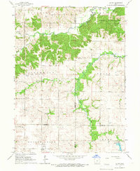 1965 Le Roy1966 Print · USGSSouthern Iowa's rural landscape at the crossroads of four counties is captured here in the mid-1960s. Researchers can trace the path of the Old Railroad Grade or find family sites like Smyrna Cem and the settlement of Last Chance.
 - 1969 Map of Des Moines
 1969 Des Moines1969 Print · USGSCentral Iowa's fertile plains and growing capital are captured here during the late sixties, a time of major highway expansion and reservoir construction. Genealogists and researchers can trace rural township boundaries, local cemeteries, and rail lines serving towns like Pella, Grinnell, and Oskaloosa.
 - 1981 Map of Hopeville
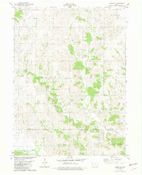 1981 Hopeville1981 Print · USGSThe rural borderlands of Clarke and Decatur Counties are captured in the early eighties, centered on the settlement of Hopeville. Researchers can trace old family burial sites like Warrick Cem and Sanders Cem tucked among the forks of Long Creek.
 - 1981 Map of Tingley NE
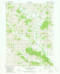 1981 Tingley NE1981 Print · USGSSouthern Iowa farm country at the dawn of the eighties reveals a landscape defined by the Thompson River and its numbered creeks. Researchers can locate remote rural landmarks like Otterbein Cem, Spring Valley Lake, and Oak Hill Ch among the rolling fields.
 - 1981 Map of Lacelle
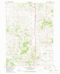 1981 Lacelle1981 Print · USGSSouthern Iowa farmland in the early eighties centers on the rural communities of Lacelle and Leslie. Researchers can trace old family lines at Lacelle Cemetery or follow the intricate paths of Spring Creek and South White Breast Creek through the countryside.
 - 1981 Map of Leon, 1982 Print
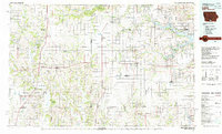 1981 Leon1982 Print · USGSSouthern Iowa and northern Missouri are captured here in the early eighties as the rural landscape balances traditional agriculture with large-scale water management. Researchers can trace the path of the Burlington Northern through Leon or locate early settlements like Decatur City and New Buda.
 - 1983 Map of Osceola
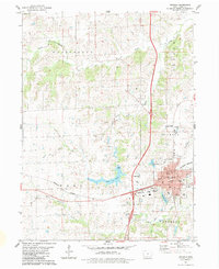 1983 Osceola1983 Print · USGSOsceola is captured here in the early eighties as a vital Iowa rail and highway junction. Researchers can trace family history through Maple Hill Cemetery, locate the local Courthouse, and explore the banks of West Lake and Squaw Creek.
 - 1983 Map of New Virginia
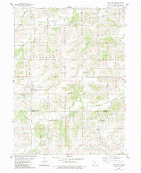 1983 New Virginia1983 Print · USGSNew Virginia and the surrounding Warren and Clarke County townships are documented here during the early eighties. Local researchers can trace the Old RR Grade or locate historic burial sites like Mt Tabor Cem and Liberty Cem.
Showing maps 1-25 of 112
Top cities of Clarke County
Frequently asked questions
- What are the different types of historical maps available for Clarke County?
- What is the oldest map of Clarke County?
- Where can I purchase historical maps of Clarke County for my home or office?
- Where can I download high-res historical maps of Clarke County?
- Are there historical topographic maps available for Clarke County?
- Is there historical aerial imagery available for Clarke County?
- Where are historical maps of Clarke County sourced from?