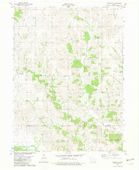
1981 Map of Hopeville
USGS Topo · Published 1981About this map
Hopeville serves as the primary focal point of this rural southern Iowa landscape, situated in the southwest corner of Clarke County. The terrain is defined by a dense network of drainage, where East Long Creek and West Long Creek converge as they flow toward the Thompson River in the south. This 1981 edition documents the township structures of Troy, Ward, Doyle, and Knox, while tracing the county line where Clarke County and Decatur County meet. Genealogists will find significant value in the distribution of family-named burial grounds across the hills, including Sanders Cem, Gregg Cem, and the Tennessee Cem near the southern border. The map also records smaller settlement nodes like McCay, providing a clear look at the agricultural footprint and rural infrastructure just before the turn of the decade.
Find a feature on this map
19 named features on this map. Tap any name to fly to it.
Don’t see what you’re looking for? This feature index may not catch every label — zoom into the map to look around manually.
Map Details
Editions of this 1981 Hopeville Map
This is the sole edition of this map. No revisions or reprints were ever made.
Other maps of this area

1951 · Osceola
USGS Topo · 1:62,500

1951 · Afton
USGS Topo · 1:62,500

1954 · Centerville
USGS Topo · 1:250,000

1954 · Omaha
USGS Topo · 1:250,000

1954 · Des Moines
USGS Topo · 1:250,000

1955 · Nebraska City
USGS Topo · 1:250,000

1956 · Des Moines
USGS Topo · 1:250,000

1957 · Des Moines
USGS Topo · 1:250,000

1957 · Nebraska City
USGS Topo · 1:250,000

1957 · Omaha
USGS Topo · 1:250,000