Old Maps of Hauntown, Iowa for Metal Detecting
Plan your next treasure hunt with 14 historic maps of Hauntown. Find old homesites, ghost towns, trails, and gathering spots that may be lost to time — perfect for identifying promising metal detecting locations.
- Locate forgotten sites: Uncover places like long-lost settlements, abandoned rail lines, or gathering spots.
- Plan better hunts: Use map overlays combined with LiDAR or satellite views to narrow in on historically rich areas.
- Made for detectorists: Thousands of hobbyists use these maps to discover relics, coins, and hidden history.
Use these historic maps to boost your research and find new opportunities beneath the surface of Hauntown.
Hauntown, IA maps
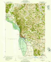
(14)- 1892 Map of Savanna
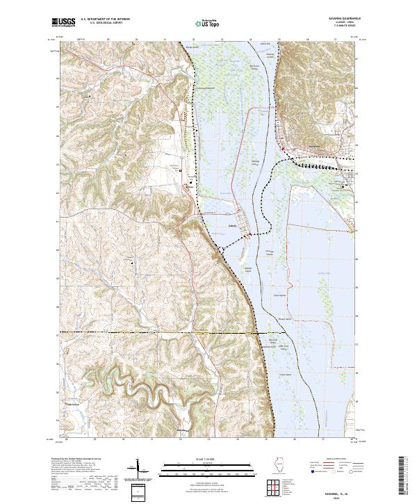
 1892 Savanna1892 Print · USGSThe upper Mississippi corridor in the late nineteenth century was a bustling hub of river commerce and competing rail lines. Map enthusiasts can trace the old tracks of the Chicago Burlington and Northern Railroad and locate vanished landmarks like Hickory Grove or Idens Lake.8 unique versions available
 - 1952 Map of Savanna, 1954 Print
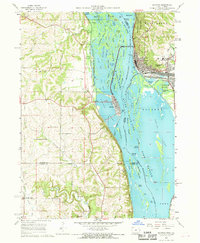
 1952 Savanna1954 Print · USGSThe Mississippi River bluffs and rail corridors define this Illinois riverfront during the early fifties. Genealogists and historians can trace numerous rural schoolhouses and family-named cemeteries like Massbach Cem, Palsgrove, and the sprawling Savanna Ordnance Depot.3 unique versions available
 - 1959 Map of Dubuque, 1982 Print
 1959 Dubuque1982 Print · USGSThe Tri-State region comes alive in the mid-twentieth century as a hub of river commerce and rail transit. Genealogists and historians can trace the paths of the Illinois Central Gulf through Dubuque or locate the Savanna Ordnance Depot and Lock and Dam No 11.
 - 1961 Map of Dubuque
 1961 Dubuque1961 Print · USGSThe Tri-State region's river-and-rail landscape is captured here during the early sixties, showing the convergence of Iowa, Illinois, and Wisconsin. Trace mid-century rail lines like the Chicago Great Western Ry and explore sites like the Savanna Ordnance Depot and Backbone State Park.
 - 1962 Map of Dubuque
 1962 Dubuque1962 Print · USGSThe Tri-State region's river-and-rail economy is captured here in the early sixties, centered on the Mississippi River bluffs. Genealogists and historians can locate Numerous lead and zinc mines, the New Melleray Abbey Monastery, and rural hubs like Saint Olaf.2 unique versions available
 - 1967 Map of Savanna, 1968 Print
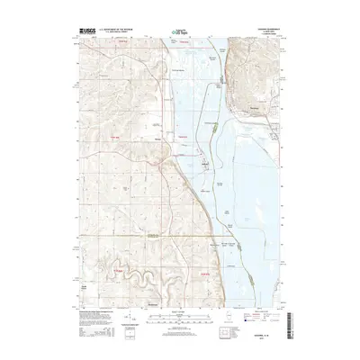
 1967 Savanna1968 Print · USGSThe riverfront towns of Savanna and Sabula are captured in the late sixties as bustling rail and river hubs. Genealogists can locate several local burial grounds including St Johns Cem and Canada Hollow Cem near the Plum River.4 unique versions available
 - 1976 Map of Dubuque
 1976 Dubuque1976 Print · USGSThe tri-state borderlands of Iowa, Wisconsin, and Illinois come alive during the mid-seventies, showing a region built on river commerce and mining. Genealogists and historians can trace the paths of the Illinois Central railroad or locate heritage sites like the New Melleray Abbey Monastery and Backbone State Park.
 - 1984 Map of Dubuque South, 1985 Print
 1984 Dubuque South1985 Print · USGSEastern Iowa and Northwest Illinois meet along the Mississippi in the mid-eighties, a landscape defined by river industry and limestone bluffs. Trace the rail lines of the Illinois Central Gulf or explore notable sites like the Savanna Army Depot and Maquoketa Caves State Park.4 unique versions available
 - 2011 Map of Savanna, 2011 Print
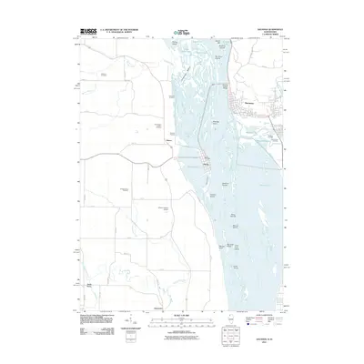 2011 Savanna2011 Print · USGSCovers Hauntown, including Savanna, Sabula, and other nearby areas
 - 2012 Map of Savanna, 2012 Print
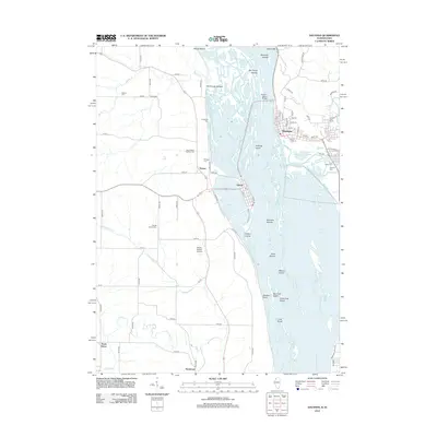 2012 Savanna2012 Print · USGSCovers Hauntown, including Savanna, Sabula, and other nearby areas
 - 2015 Map of Savanna, 2015 Print
 2015 Savanna2015 Print · USGSCovers Hauntown, including Savanna, Sabula, and other nearby areas
 - 2018 Map of Savanna, 2018 Print
 2018 Savanna2018 Print · USGSCovers Hauntown, including Savanna, Sabula, and other nearby areas
 - 2021 Map of Savanna, 2021 Print
 2021 Savanna2021 Print · USGSCovers Hauntown, including Savanna, Sabula, and other nearby areas
 - 2024 Map of Savanna, 2024 Print
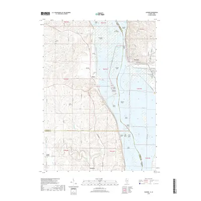
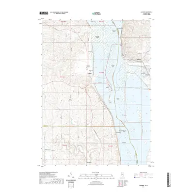
 2024 Savanna2024 Print · USGSThe Mississippi River corridor between Illinois and Iowa comes alive in this study of its islands and sloughs during the mid-2020s. Genealogists can locate family names at Evergreen Cem and Simpson Cem or trace the old roads connecting Samoa and Sabula.
End of results
Showing maps 1-14 of 14
Top cities near Hauntown
- Clinton historical maps
- Camanche historical maps
- Morrison historical maps
- Fulton historical maps
- Savanna historical maps
- Mount Carroll historical maps
See more
Frequently asked questions
- What are the different types of historical maps available for Hauntown?
- What is the oldest map of Hauntown?
- Where can I purchase historical maps of Hauntown for my home or office?
- Where can I download high-res historical maps of Hauntown?
- Are there historical topographic maps available for Hauntown?
- Is there historical aerial imagery available for Hauntown?
- Where are historical maps of Hauntown sourced from?