Old Maps of Crawford County, Iowa for Metal Detecting
Plan your next treasure hunt with 152 historic maps of Crawford County. Find old homesites, ghost towns, trails, and gathering spots that may be lost to time — perfect for identifying promising metal detecting locations.
- Locate forgotten sites: Uncover places like long-lost settlements, abandoned rail lines, or gathering spots.
- Plan better hunts: Use map overlays combined with LiDAR or satellite views to narrow in on historically rich areas.
- Made for detectorists: Thousands of hobbyists use these maps to discover relics, coins, and hidden history.
Use these historic maps to boost your research and find new opportunities beneath the surface of Crawford County.
Crawford County, IA maps
(152)- 1954 Map of Omaha, 1967 Print
 1954 Omaha1967 Print · USGSMid-century development radiates from the river bluffs into the agricultural heartland during this period of post-war growth. Genealogists and historians can trace rail-connected towns like Atlantic and Red Oak or locate the sprawling grounds of Offutt Air Force Base and Manawa Lake.3 unique versions available
 - 1954 Map of Fort Dodge, 1968 Print
 1954 Fort Dodge1968 Print · USGSNorthwest Iowa is shown here during a period of steady industrial and rail activity in the mid-fifties. Researchers can trace the extensive rail lines connecting Fort Dodge to mining and manufacturing sites like Gypsum and Industry Station.3 unique versions available
 - 1957 Map of Omaha
 1957 Omaha1957 Print · USGSWestern Iowa and the Missouri River valley are seen here in the mid-fifties during the height of the rail-and-road era. Researchers can trace the sprawling rail lines of the Chicago And North Western or locate Cold War landmarks like Offutt Air Force Base.
 - 1957 Map of Fort Dodge
 1957 Fort Dodge1957 Print · USGSWest-central Iowa thrived as a network of rail-linked agricultural hubs and river towns during the mid-fifties. Researchers can trace the development of the Des Moines River valley and locate historic landmarks in Fort Dodge, Storm Lake, and Lehigh.
 - 1958 Map of Omaha
 1958 Omaha1958 Print · USGSOmaha and Council Bluffs stand at the center of this mid-fifties landscape, where the Missouri River splits the urban plains of Nebraska from the rolling hills of western Iowa. Genealogists can trace the rail lines of the Wabash RR and Illinois Central RR to rural settlements like Missouri Valley and Red Oak.2 unique versions available
 - 1958 Map of Fort Dodge
 1958 Fort Dodge1958 Print · USGSWestern Iowa in the mid-1950s reveals a productive landscape of river-valley industry and prairie agricultural hubs. Researchers can trace the development of the Des Moines River corridor through Fort Dodge and locate vanished local landmarks near Coalville or Storm Lake.
 - 1969 Map of Danbury, 1971 Print
 1969 Danbury1971 Print · USGSDanbury and the surrounding river valleys are captured here in the late sixties as the rail-and-river economy shaped Woodbury County. Researchers can locate several burial grounds including St Marys Cem and Hartleben Cem, or trace the Chicago and North Western line.2 unique versions available
 - 1971 Map of Ricketts, 1973 Print
 1971 Ricketts1973 Print · USGSThe town of Ricketts and the surrounding Crawford County townships are captured here in the early 1970s. Trace the path of the Old Railroad Grade and locate local landmarks such as Immanuel Ch and the banks of the Soldier River.
 - 1971 Map of Earling, 1973 Print
 1971 Earling1973 Print · USGSShelby County, Iowa, is shown in the early 1970s as a landscape of established rail lines and winding creek valleys. Researchers can trace the Chicago Milwaukee St Paul and Pacific rail corridor and locate landmarks like St Joseph Cem and Camp Manteno.
 - 1971 Map of Ute, 1973 Print
 1971 Ute1973 Print · USGSThe Soldier River valley in the early 1970s was a landscape defined by the iron rails and river bends near the Monona and Crawford county line. Genealogists can trace family landmarks like St Marys Cem and Putman Cem or locate the old Berne townsite.
 - 1971 Map of Dunlap SW, 1973 Print
 1971 Dunlap SW1973 Print · USGSHarrison County's river-and-rail infrastructure is on full display in the early 1970s as transportation lines follow the natural path of the Boyer River. Researchers can trace the dual-track corridor of the Illinois Central Gulf and Chicago North Western and locate local landmarks like Valley View Cem.
 - 1971 Map of Dunlap, 1973 Print
 1971 Dunlap1973 Print · USGSThe rail-and-river town of Dunlap is captured in the early 1970s at the meeting point of three counties. Genealogists and local historians can trace family plots at Pleasant Hill Cemetery or Township Cem and follow the old routes of the Illinois Central Gulf railroad.
 - 1971 Map of Schleswig, 1973 Print
 1971 Schleswig1973 Print · USGSSchleswig and the surrounding Crawford County townships are captured here in the early 1970s amidst a landscape of river valleys and rural homesteads. Researchers can locate family burial sites at Grant Cem and Morgan Cem or trace the path of the Old Railroad Grade.
 - 1971 Map of Earling NE, 1973 Print
 1971 Earling NE1973 Print · USGSCrawford County's rural townships are captured in the early 1970s during a period of steady agricultural production and infrastructure development. Genealogists can trace family footprints at Zion Cem and Township Cem, while rail enthusiasts can follow the Chicago Milwaukee St Paul and Pacific line.
 - 1971 Map of Denison, 1973 Print
 1971 Denison1973 Print · USGSDenison and the Boyer River valley are shown in the early seventies, at the busy junction of two major Midwestern rail lines. Researchers can trace family history through several local burial grounds, including Milford Cem, and find old landmarks like the Zion Sch and Our Savior Ch.
 - 1971 Map of Dow City, 1973 Print
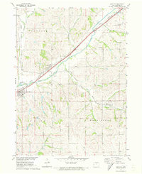 1971 Dow City1973 Print · USGSCrawford County's rail-and-river network is on full display in the early seventies, featuring the convergence of three major railroads. Genealogists and local historians can trace the foundations of Dow City, Arion, and Buck Grove, or locate family sites like Butler Cem.
 - 1971 Map of Charter Oak, 1973 Print
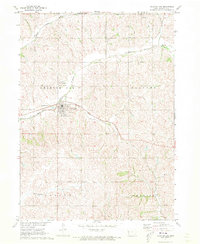 1971 Charter Oak1973 Print · USGSCrawford County's agricultural and rail corridors are captured in the early 1970s before modern consolidation changed the rural landscape. Researchers can trace family sites at St Boniface Cem, follow the Milwaukee Road tracks, or locate the small settlement of Kenwood.
 - 1971 Map of Defiance, 1973 Print
 1971 Defiance1973 Print · USGSShelby and Crawford counties are captured in the early 1970s as agricultural life centered on the river valleys and rail lines. Genealogists and local historians can locate early burial sites such as St Pauls Cem and Astor Cem or trace the routes of the Chicago Milwaukee St Paul and Pacific Railroad.
 - 1971 Map of Denison SW, 1973 Print
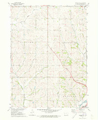 1971 Denison SW1973 Print · USGSCrawford County's rolling farmland and river valleys are captured here in the early seventies, showing the rural township boundaries of Morgan and Hanover. Trace the C & NW rail line as it follows the Boyer River past a local Gravel Pit.
 - 1971 Map of Dunlap NE, 1973 Print
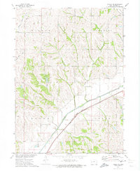 1971 Dunlap NE1973 Print · USGSCrawford County's agricultural and rail infrastructure is well-established in the early 1970s. Local researchers can trace family landmarks and transport routes including the Dow City Cem, the Chicago and North Western railroad, and Nelson Park.
 - 1971 Map of Kiron, 1973 Print
 1971 Kiron1973 Print · USGSCrawford County agriculture and rail history intersect here in the early seventies, centered on the village of Kiron. Genealogists and local historians can trace family roots at Kiron Cem or St Johns Ch and follow the path of the Old Railroad Grade.
 - 1971 Map of Dunlap NW, 1974 Print
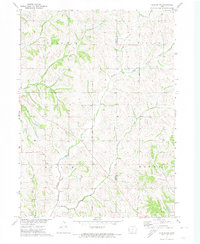 1971 Dunlap NW1974 Print · USGSMonona County's loess hills and rural townships are captured in the early 1970s, as the region's agricultural landscape matured within the Missouri River Basin. Genealogists and local historians can trace family land across Soldier and Willow townships along the banks of Middle Willow Creek and Norway Creek.
 - 1978 Map of Manilla
 1978 Manilla1978 Print · USGSCrawford County's agricultural heartland is documented here during the late seventies, centered on the rail-linked communities of Manilla and Aspinwall. Researchers can trace old property lines across East Boyer and locate family burial sites at Mt Olivet Cem and Nishnabotna Cem.
 - 1978 Map of Irwin
 1978 Irwin1978 Print · USGSShelby County farmland and the river-rail corridor are captured here during the late seventies. Family historians can locate Irwin and Botna, trace the Chicago and North Western line, and find the Oak Hill Cem.
 - 1978 Map of Manning
 1978 Manning1978 Print · USGSManning and the surrounding farmsteads of Carroll and Crawford counties are captured here in the late seventies. Genealogists and local historians can trace the paths of the Chicago and North Western railroad or locate Township Cem and the Municipal Airport.
Showing maps 1-25 of 152
Top cities of Crawford County
- Denison historical maps
- Schleswig historical maps
- Manilla historical maps
- Charter Oak historical maps
- Dow City historical maps
- Vail historical maps
See more
Frequently asked questions
- What are the different types of historical maps available for Crawford County?
- What is the oldest map of Crawford County?
- Where can I purchase historical maps of Crawford County for my home or office?
- Where can I download high-res historical maps of Crawford County?
- Are there historical topographic maps available for Crawford County?
- Is there historical aerial imagery available for Crawford County?
- Where are historical maps of Crawford County sourced from?