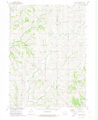
1971 Map of Dunlap NW
USGS Topo · Published 1974About this map
The Missouri River Basin development program informed this 1970s-era topographic study of western Iowa, where the boundary between Monona and Crawford counties follows the intricate ridges and valleys of the Loess Hills. The landscape is defined by a dense network of watercourses, including Middle Willow Creek and South Willow Creek, which carve through the townships of Soldier, Willow, and Boyer.
Find a feature on this map
11 named features on this map. Tap any name to fly to it.
Don’t see what you’re looking for? This feature index may not catch every label — zoom into the map to look around manually.
Map Details
Editions of this 1971 Dunlap NW Map
This is the sole edition of this map. No revisions or reprints were ever made.
Other maps of this area

1954 · Omaha
USGS Topo · 1:250,000

1954 · Fort Dodge
USGS Topo · 1:250,000

1957 · Omaha
USGS Topo · 1:250,000

1957 · Fort Dodge
USGS Topo · 1:250,000

1958 · Omaha
USGS Topo · 1:250,000

1958 · Fort Dodge
USGS Topo · 1:250,000
1971 · Mapleton SE
USGS Topo · 1:24,000

1971 · Moorhead SE
USGS Topo · 1:24,000

1971 · Ute
USGS Topo · 1:24,000

1971 · Dunlap SW
USGS Topo · 1:24,000