Old Maps of Fayette County, Iowa for Hiking & Exploration
Hike through history with 139 historic maps of Fayette County. Explore old trails, ghost towns, and forgotten backroads — perfect for outdoor adventurers and local explorers.
- Rediscover forgotten places: Map out old mining camps, roads, and footpaths that no longer exist on modern maps.
- Layer with modern tools: Combine with LiDAR or satellite views to plan hikes through historical terrain.
- Made for exploration: Popular among hikers, overlanders, and local history lovers.
Use these maps to find adventure and explore the hidden past of Fayette County.
Fayette County, IA maps
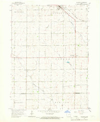
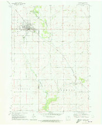
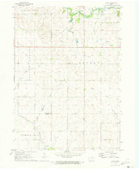
(139)- 1901 Map of Oelwein
 1901 Oelwein1901 Print · USGSNortheast Iowa at the turn of the century was a bustling network of rail-side towns and river valleys. Genealogists can trace family locations across dozens of early settlements like Strawberry Point, Hawkeye, and the railroad junction at Oelwein.4 unique versions available
 - 1906 Map of Decorah
 1906 Decorah1906 Print · USGSNortheast Iowa at the turn of the century was a land of intricate river valleys and vital railroad junctions. Genealogists can trace the early rail-and-river economy through landmarks like Decorah, the historic site of Fort Atkinson, and the junction at Calmar.3 unique versions available
 - 1954 Map of Mason City, 1967 Print
 1954 Mason City1967 Print · USGSSouthern Minnesota and northern Iowa are shown here at the height of the mid-century rail era, centered on the regional hubs of Mason City and Rochester. Researchers can trace the vanished paths of the Chicago Great Western and find local landmarks like Pilot Knob and Bear Lake.2 unique versions available
 - 1954 Map of Waterloo, 1968 Print
 1954 Waterloo1968 Print · USGSCentral Iowa at the height of its mid-century agricultural and rail boom features the growing hubs of Waterloo and Cedar Falls. Genealogists and researchers can trace the rail corridors of the Chicago Great Western and find local landmarks like Iowa State College and Brushy Ridge.4 unique versions available
 - 1955 Map of Waterloo
 1955 Waterloo1955 Print · USGSCentral Iowa in the mid-fifties presents a dense landscape of rail-connected farming towns and growing river cities. Researchers can trace ancestral roots and old transport routes through Waterloo, Marshalltown, and Ames, while locating rural Cemeteries and local Quarries.2 unique versions available
 - 1957 Map of Mason City
 1957 Mason City1957 Print · USGSThe Minnesota-Iowa border region comes alive in this mid-century survey, from the industrial plants of Mason City to the medical hub of Rochester. Researchers can trace the rail-and-river economy through the Chicago Great Western Railway and the Shell Rock River.
 - 1958 Map of Mason City
 1958 Mason City1958 Print · USGSSouthern Minnesota and northern Iowa are shown during the mid-fifties when railroads still anchored the regional economy. Genealogists and historians can trace the intricate rail networks of the Illinois Central and find local landmarks in Mason City, Albert Lea, and Austin.
 - 1958 Map of La Crosse, 1979 Print
 1958 La Crosse1979 Print · USGSThe Driftless Area of Wisconsin and Iowa is captured here during the late seventies, showing the intricate river valleys and ridge-top settlements. Genealogists and historians can trace the rail corridors of the Soo Line or locate landmarks like Grandad Bluff and Effigy Mounds National Monument.2 unique versions available
 - 1959 Map of Dubuque, 1982 Print
 1959 Dubuque1982 Print · USGSThe Tri-State region comes alive in the mid-twentieth century as a hub of river commerce and rail transit. Genealogists and historians can trace the paths of the Illinois Central Gulf through Dubuque or locate the Savanna Ordnance Depot and Lock and Dam No 11.
 - 1961 Map of Dubuque
 1961 Dubuque1961 Print · USGSThe Tri-State region's river-and-rail landscape is captured here during the early sixties, showing the convergence of Iowa, Illinois, and Wisconsin. Trace mid-century rail lines like the Chicago Great Western Ry and explore sites like the Savanna Ordnance Depot and Backbone State Park.
 - 1961 Map of La Crosse
 1961 La Crosse1961 Print · USGSThe Driftless Area at the start of the 1960s reveals a complex network of river towns and rail lines along the Mississippi River. Genealogists and historians can trace old settlements like New Amsterdam and Wyattville or locate major landmarks like Camp McCoy Military Reservation and Effigy Mounds National Monument.
 - 1962 Map of Dubuque
 1962 Dubuque1962 Print · USGSThe Tri-State region's river-and-rail economy is captured here in the early sixties, centered on the Mississippi River bluffs. Genealogists and historians can locate Numerous lead and zinc mines, the New Melleray Abbey Monastery, and rural hubs like Saint Olaf.2 unique versions available
 - 1965 Map of La Crosse
 1965 La Crosse1965 Print · USGSThe Driftless Area and the Upper Mississippi valley are captured here during a period of steady mid-century growth. Researchers can trace the rail lines of the Chicago and North Western or locate riverfront sites like Effigy Mounds National Monument and the Camp McCoy Military Reservation.
 - 1965 Map of Elgin, 1966 Print
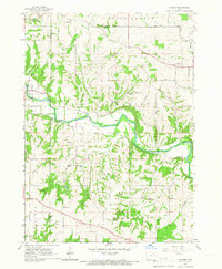
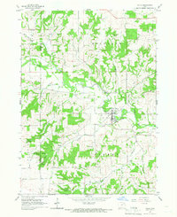
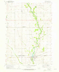
 1965 Elgin1966 Print · USGSFayette County's river-valley communities come into focus during the mid-sixties as the railroad and river define the local economy. Researchers can locate family landmarks like St Peters Cem, trace the Chicago Rock Island and Pacific rail line, and find the rural outpost of Illyria.
 - 1965 Map of Wadena, 1966 Print
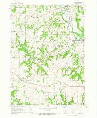
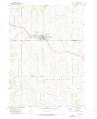
 1965 Wadena1966 Print · USGSFayette County's winding river valleys are captured here in the 1960s, showing the intersection of rail transport and rural settlement. Genealogists can trace the communities of Wadena, Lima, and Taylorsville, alongside landmarks like St Josephs Cem and Brush Creek Canyon State Park.
 - 1965 Map of Gunder, 1966 Print
 1965 Gunder1966 Print · USGSClayton and Fayette counties in the mid-sixties show a landscape of deep river valleys and high plateau farms. Researchers can trace rural life through landmarks like the East Clermont Ch, Houg Cem, and the riverside community of Elgin.
 - 1965 Map of Strawberry Point, 1966 Print
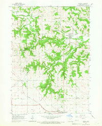
 1965 Strawberry Point1966 Print · USGSStrawberry Point and the surrounding Iowa countryside are captured here in the mid-sixties at the junction of four counties. Trace the rail-and-river landscape from the Milwaukee Road tracks to Backbone State Forest and the Fish Hatchery.
 - 1965 Map of Arlington, 1966 Print
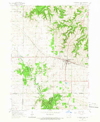
 1965 Arlington1966 Print · USGSArlington and the rolling farm country of Fayette and Buchanan counties appear here in the mid-1960s as a landscape of river-fed townships and rail. Trace the old rail lines of the Milwaukee Road and find family sites at Union Ch Cem or Maryville.
 - 1965 Map of Volga, 1966 Print
 1965 Volga1966 Print · USGSThe Volga River valley comes into focus in the mid-1960s, showing the town of Volga City and the rural community of Thomasville. Researchers can trace old township lines and local landmarks like Pilot Knob and German Hollow.
 - 1971 Map of Postville, 1973 Print
 1971 Postville1973 Print · USGSPostville and the four-county border region of northeast Iowa are captured here during the early seventies as a thriving rail and agricultural center. Local historians can trace the Chicago Milwaukee St Paul and Pacific rail line and locate landmarks like Township Cem, the Fairground, and various Quarries.
 - 1971 Map of Sumner, 1973 Print
 1971 Sumner1973 Print · USGSSumner and the surrounding Iowa farmlands are shown in the early seventies, centered on the Little Wapsipinicon River and the local rail network. Genealogists can trace family footprints at Union Mound Cemetery, Mt Calvary Cemetery, and the rural Murphy Church.
 - 1971 Map of Alpha, 1973 Print
 1971 Alpha1973 Print · USGSNortheast Iowa farmland is captured here in the early seventies, showcasing a landscape of section-line roads and creek-side settlements. Genealogists and historians can trace local family roots through Bethel Cem and Wilson Grove Cem or locate old industrial sites like the Quarry and Gravel Pits.
 - 1971 Map of Fairbank, 1973 Print
 1971 Fairbank1973 Print · USGSNortheast Iowa farmland at the start of the 1970s is centered here on the crossing of the Little Wapsipinicon River and the Chicago and North Western railroad. Genealogists can trace family roots at Immaculate Conception Cem and St Peter Cem or explore the old layout of Fairbank.
 - 1976 Map of Dubuque
 1976 Dubuque1976 Print · USGSThe tri-state borderlands of Iowa, Wisconsin, and Illinois come alive during the mid-seventies, showing a region built on river commerce and mining. Genealogists and historians can trace the paths of the Illinois Central railroad or locate heritage sites like the New Melleray Abbey Monastery and Backbone State Park.
 - 1976 Map of La Crosse
 1976 La Crosse1976 Print · USGSThe Driftless Area and Mississippi River valley are captured here in the mid-seventies, showing a landscape of deep coulees and river commerce. Genealogists can trace family footprints from La Crosse to smaller hamlets like Newburg Corners and Witoka.
Showing maps 1-25 of 139
Top cities of Fayette County
- Oelwein historical maps
- West Union historical maps
- Fayette historical maps
- Elgin historical maps
- Clermont historical maps
- Maynard historical maps
See more
Frequently asked questions
- What are the different types of historical maps available for Fayette County?
- What is the oldest map of Fayette County?
- Where can I purchase historical maps of Fayette County for my home or office?
- Where can I download high-res historical maps of Fayette County?
- Are there historical topographic maps available for Fayette County?
- Is there historical aerial imagery available for Fayette County?
- Where are historical maps of Fayette County sourced from?