Old Maps of Jones County, Iowa for Academic Research
Study the evolution of Jones County with 121 high-resolution historic maps. Whether you're teaching, researching, or modeling changes in land use, these maps provide essential visual documentation of urban, environmental, and geographic change.
- Analyze long-term change: Track patterns in development, transportation, and natural features.
- Ideal for environmental or urban studies: Support academic projects with primary historical map data.
- Use in the classroom or lab: Educators and researchers rely on these maps to bring historical context to life.
These maps are a powerful tool for teaching, research, and visualizing how Jones County has changed over the decades.
Jones County, IA maps
(121)- 1889 Map of Tipton
 1889 Tipton1889 Print · USGSCedar County at the close of the nineteenth century was a landscape shaped by two major rail lines. Genealogists and local historians can trace the early town plats of Tipton, Mechanicsville, and Stanwood, alongside landmarks like Sugar Creek and the Chicago and North-Western Railroad.
 - 1890 Map of Tipton
 1890 Tipton1890 Print · USGSCedar County in the late nineteenth century is captured here as a thriving rail-centered landscape. Genealogists and local historians can trace the early grids of Tipton, Mechanicsville, and Stanwood along the tracks of the Chicago and North-Western Railroad.2 unique versions available
 - 1890 Map of Anamosa
 1890 Anamosa1890 Print · USGSEastern Iowa was a landscape defined by river valleys and expanding rail lines in the 1890s. Genealogists can trace family roots through early settlements like Anamosa, Springville, and Viola along the Chicago Milwaukee and St. Paul Railroad.2 unique versions available
 - 1891 Map of Monticello
 1891 Monticello1891 Print · USGSJones County at the peak of the rail era shows a landscape organized by iron rails and river bends. Trace the junctions and early plats of Monticello, Center Junction, and Wyoming along the Chicago and North Western Railroad.3 unique versions available
 - 1891 Map of Mechanicsville
 1891 Mechanicsville1891 Print · USGSEastern Iowa during the late Victorian era is defined here by its emerging rail corridors and the winding path of the Cedar River. Genealogists can trace the early footprints of settlements like Mechanicsville, Mt. Vernon, and Solon before modern development.
 - 1891 Map of Baldwin
 1891 Baldwin1891 Print · USGSJackson County at the end of the century shows a rugged landscape transitioning from river-based industry to a railroad economy. Genealogists can trace family footprints in early settlements like Ozark, Clay Mills, and the rail hubs of Baldwin and Monmouth.3 unique versions available
 - 1892 Map of Wheatland
 1892 Wheatland1892 Print · USGSEastern Iowa in the late nineteenth century was a landscape of burgeoning rail towns and river settlements. Genealogists and historians can trace early property boundaries and rail corridors through Wheatland, the winding Wapsipinicon River, and the curiously named Lost Nation.
 - 1894 Map of Wheatland
 1894 Wheatland1894 Print · USGSClinton and Jones counties thrived along the river and rail corridors of the 1890s. Genealogists can trace the early development of Oxford Junction and Wheatland, or locate old mill sites near Oxford Mills and Massillon.2 unique versions available
 - 1894 Map of Mechanicsville
 1894 Mechanicsville1894 Print · USGSEast-central Iowa thrived as a rail and river hub in the 1890s, where major lines connected growing agricultural towns. Researchers can trace the development of Mt. Vernon and Lisbon along the northern tracks or follow the Cedar River to Cedar Bluffs.2 unique versions available
 - 1900 Map of Anamosa
 1900 Anamosa1900 Print · USGSEastern Iowa is shown here during the peak of its rail-driven development at the end of the century. Genealogists and historians can trace the early layouts of Anamosa and Monticello or locate smaller settlements like Sand Spring and Rockville.4 unique versions available
 - 1901 Map of Peosta
 1901 Peosta1901 Print · USGSDubuque and Jackson counties were a hub of river commerce and early rail expansion at the turn of the century. Genealogists and historians can trace the foundations of communities like Peosta, St.Donatus, and the mill sites at Washington Mills.4 unique versions available
 - 1901 Map of Rock Island
 1901 Rock Island1901 Print · USGSThe eastern Iowa borderlands and the Mississippi River confluence thrive during the rail boom of the late nineteenth century. Genealogists and historians can trace family roots through numerous small settlements like Lost Nation, Grand Mound, and the vital U. S. Arsenal grounds.2 unique versions available
 - 1901 Map of Stanwood
 1901 Stanwood1901 Print · USGSEastern Iowa is defined by its fertile plains and busy rail corridors at the turn of the century. Genealogists and historians can trace the early layouts of Tipton, West Liberty, and Mt. Vernon, alongside vanished stopping points like Lime City and Walden.2 unique versions available
 - 1910 Map of Rock Island, 1949 Print
 1910 Rock Island1949 Print · USGSEastern Iowa and the Illinois borderlands come alive in this late nineteenth-century survey of the river valleys and rail hubs. Genealogists and historians can trace old homesteads near Lost Nation, the early streets of Dewitt, and the sprawling U.S. Arsenal.
 - 1958 Map of Davenport, 1968 Print
 1958 Davenport1968 Print · USGSEastern Iowa and western Illinois thrive along the river during the late fifties, defined by the industrial Quad Cities and a robust rail network. Genealogists can trace family roots through settlements like Oasis and Stanwood or along the Cedar River.2 unique versions available
 - 1959 Map of Dubuque, 1982 Print
 1959 Dubuque1982 Print · USGSThe Tri-State region comes alive in the mid-twentieth century as a hub of river commerce and rail transit. Genealogists and historians can trace the paths of the Illinois Central Gulf through Dubuque or locate the Savanna Ordnance Depot and Lock and Dam No 11.
 - 1961 Map of Dubuque
 1961 Dubuque1961 Print · USGSThe Tri-State region's river-and-rail landscape is captured here during the early sixties, showing the convergence of Iowa, Illinois, and Wisconsin. Trace mid-century rail lines like the Chicago Great Western Ry and explore sites like the Savanna Ordnance Depot and Backbone State Park.
 - 1961 Map of Davenport
 1961 Davenport1961 Print · USGSThe Quad Cities and the eastern Iowa riverlands are captured here in the early sixties, showing the region's transition into a modern industrial and transit hub. Genealogists and historians can trace the paths of major railroads and find river landmarks like Rock Island Arsenal, Huron Island, and the Coralville Reservoir.
 - 1962 Map of Dubuque
 1962 Dubuque1962 Print · USGSThe Tri-State region's river-and-rail economy is captured here in the early sixties, centered on the Mississippi River bluffs. Genealogists and historians can locate Numerous lead and zinc mines, the New Melleray Abbey Monastery, and rural hubs like Saint Olaf.2 unique versions available
 - 1962 Map of Davenport
 1962 Davenport1962 Print · USGSThe Quad Cities and the Mississippi River corridor are shown at their industrial peak just before the interstate era fully transformed the region. Researchers can trace the sprawling rail networks of the Chicago Rock Island and Pacific and find landmarks like the Rock Island Arsenal and Wild Cat Den State Park.
 - 1965 Map of Stanwood, 1966 Print
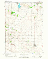 1965 Stanwood1966 Print · USGSEastern Iowa's agricultural heartland is documented here during the mid-sixties, showing the rail-linked growth of Mechanicsville and Stanwood. Researchers can trace the Chicago and North Western line or locate family sites like Walnut Grove Cem and Olin Cem.
 - 1965 Map of Mechanicsville, 1967 Print
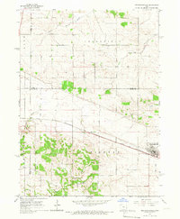 1965 Mechanicsville1967 Print · USGSThe rural landscape of Eastern Iowa is captured in the mid-1960s, showing the intersection of three counties around the rail town of Mechanicsville. Researchers can trace old family burial sites like Andre Cem and Pioneer Cem or follow the Chicago and North Western rail line.
 - 1966 Map of Fillmore, 1967 Print
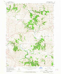 1966 Fillmore1967 Print · USGSEastern Iowa in the mid-1960s reveals a landscape defined by the winding North Fork Maquoketa River and the meeting of three counties. Genealogists and local historians can trace the early footprints of Fillmore and Cascade or locate a riverside Quarry.2 unique versions available
 - 1966 Map of Hopkinton East, 1967 Print
 1966 Hopkinton East1967 Print · USGSEastern Delaware County and parts of Jones County are captured here in the mid-1960s as the regional rail-and-river economy persists. Researchers can trace the path of the Chicago Milwaukee St Paul and Pacific through Sand Springs or locate family sites at Livingston Cem and Sacred Heart Cem.
 - 1966 Map of Cascade, 1967 Print
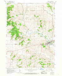 1966 Cascade1967 Print · USGSThe town of Cascade and the winding North Fork Maquoketa River define this mid-sixties survey of the Dubuque and Jones County border. Researchers can locate Bowens Prairie Cem and rural industrial sites like the local Sandpit or Gravel Pit.
Showing maps 1-25 of 121
Top cities of Jones County
- Anamosa historical maps
- Monticello historical maps
- Olin historical maps
- Wyoming historical maps
- Oxford Junction historical maps
- Martelle historical maps
See more
Frequently asked questions
- What are the different types of historical maps available for Jones County?
- What is the oldest map of Jones County?
- Where can I purchase historical maps of Jones County for my home or office?
- Where can I download high-res historical maps of Jones County?
- Are there historical topographic maps available for Jones County?
- Is there historical aerial imagery available for Jones County?
- Where are historical maps of Jones County sourced from?