2020s Maps of Marshalltown, Iowa
Explore 3 historic maps of Marshalltown from the 2020s. These maps offer a rare glimpse into what life looked like during the 2020s — showing old roads, neighborhoods, homes, and landmarks that have changed or disappeared over time.
Whether you're researching your family's past, planning a metal detecting trip, or studying how Marshalltown's landscape evolved across the 2020s, these high-resolution maps are a powerful tool for exploring the history of this region.
- Focus on a specific era: All maps on this page are from the 2020s, giving you a focused view of this time period.
- See what’s changed: Compare century-old streets, trails, and buildings to today's modern landscape using overlays and satellite layers.
- Research with precision: Use these maps for genealogy, historical research, land use analysis, or educational projects.
- View, download, or print: Maps are fully viewable online in high resolution, and can be downloaded or printed for your own records.
Start exploring Marshalltown's history through authentic maps from the 2020s. This is your window into the past.
Marshalltown, IA maps
(3)- 2022 Map of Le Grand, 2022 Print
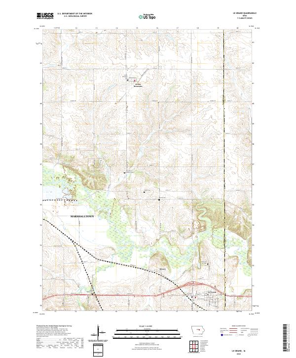 2022 Le Grand2022 Print · USGSThe Marshall County prairie comes into focus in this recent survey of the lands between Green Mountain and Le Grand. Genealogists can trace family heritage through local burial sites like Pleasant Hill Cem, Bowles Cem, and the Green Mountain Cem.
 - 2022 Map of Laurel, 2022 Print
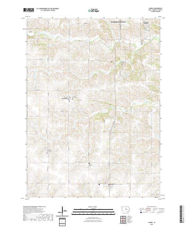 2022 Laurel2022 Print · USGSSouthern Marshall County in the early twenty-first century remains a landscape of section-line roads and family-named cemeteries. Genealogists can locate specific burial sites and rural settlements like Laurel, Haverhill, and the Laurel Methodist Cem.
 - 2022 Map of Marshalltown, 2022 Print
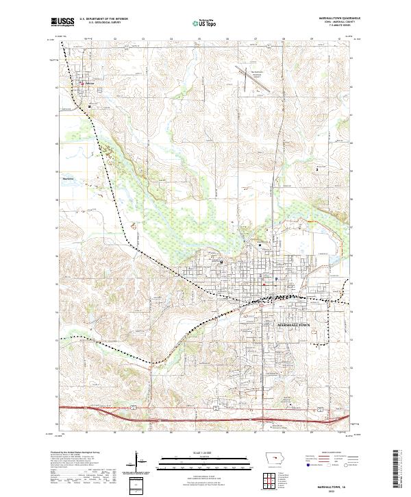 2022 Marshalltown2022 Print · USGSMarshall County at the start of the 2020s shows the continued growth of Marshalltown along the Iowa River. Researchers can locate historic landmarks like the Marshall County Courthouse or trace family plots at Riverside Cem and Albion Cem.
End of results
Showing maps 1-3 of 3
Top cities near Marshalltown
- Conrad historical maps
- Le Grand historical maps
- Gladbrook historical maps
- Melbourne historical maps
- Gilman historical maps
- Garwin historical maps
See more
Top neighborhoods of Marshalltown
Frequently asked questions
- What are the different types of historical maps available for Marshalltown?
- What is the oldest map of Marshalltown?
- Where can I purchase historical maps of Marshalltown for my home or office?
- Where can I download high-res historical maps of Marshalltown?
- Are there historical topographic maps available for Marshalltown?
- Is there historical aerial imagery available for Marshalltown?
- Where are historical maps of Marshalltown sourced from?