2020s Maps of Des Moines, Iowa
Explore 8 historic maps of Des Moines from the 2020s. These maps offer a rare glimpse into what life looked like during the 2020s — showing old roads, neighborhoods, homes, and landmarks that have changed or disappeared over time.
Whether you're researching your family's past, planning a metal detecting trip, or studying how Des Moines's landscape evolved across the 2020s, these high-resolution maps are a powerful tool for exploring the history of this region.
- Focus on a specific era: All maps on this page are from the 2020s, giving you a focused view of this time period.
- See what’s changed: Compare century-old streets, trails, and buildings to today's modern landscape using overlays and satellite layers.
- Research with precision: Use these maps for genealogy, historical research, land use analysis, or educational projects.
- View, download, or print: Maps are fully viewable online in high resolution, and can be downloaded or printed for your own records.
Start exploring Des Moines's history through authentic maps from the 2020s. This is your window into the past.
Des Moines, IA maps
(8)- 2022 Map of Des Moines NE, 2022 Print
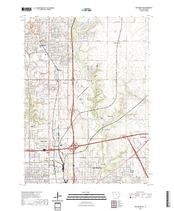 2022 Des Moines NE2022 Print · USGSThe northern reaches of the Des Moines metro area are shown here at a moment of significant growth and suburban expansion. Genealogists and local historians can trace the foundations of the county through sites like Greenwood Friends Cem, Enterprise, and Berwick.
 - 2022 Map of Norwalk, 2022 Print
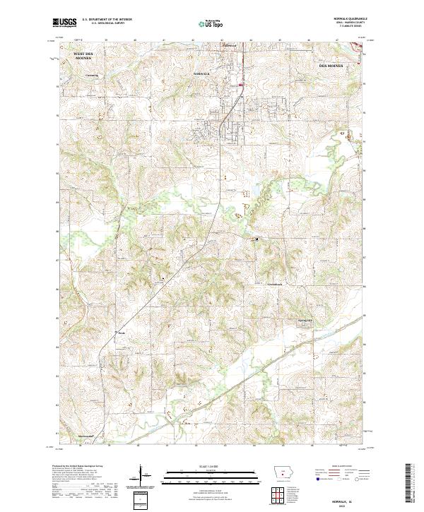 2022 Norwalk2022 Print · USGSWarren County at the dawn of the 2020s shows a landscape in transition as suburban expansion reaches southward from the capital. Researchers can trace historic local sites like Linn Grove Cem, the small settlement of Greenbush, and the length of the Great Western Trl.
 - 2022 Map of Des Moines SW, 2022 Print
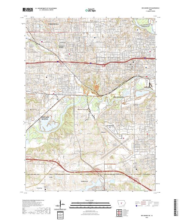 2022 Des Moines SW2022 Print · USGSGreater Des Moines at the start of the 2020s shows a sophisticated landscape of urban development and riverfront greenways. Researchers can trace historic cemeteries like Woodland Cem or find smaller sites like Orilla and Millman near the Des Moines International Airport.
 - 2022 Map of Des Moines SE, 2022 Print
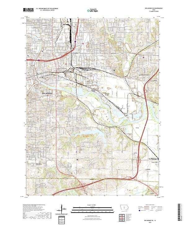 2022 Des Moines SE2022 Print · USGSDes Moines and its southeastern suburbs are captured here during a period of modern expansion along the river valleys. Genealogists and local historians can trace legacy sites like Fort Des Moines, Children of Israel Cem, and the old rail paths of the CB AND Q ST.
 - 2022 Map of Altoona, 2022 Print
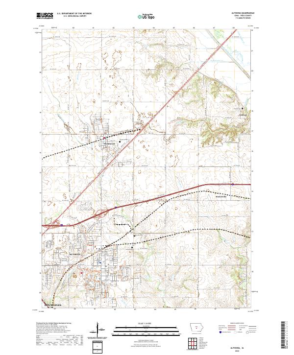 2022 Altoona2022 Print · USGSGreater Des Moines expands into the prairie landscape of eastern Polk County in the early twenty-first century. Researchers can locate family heritage sites at the Bondurant Cem and Franklin Cem or trace the Old Channel of the South Skunk River.
 - 2022 Map of Rising Sun, 2022 Print
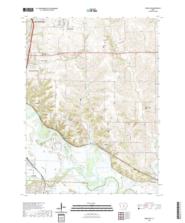 2022 Rising Sun2022 Print · USGSSoutheast of the state capital, this area shows the meeting of river bottomlands and growing suburban corridors during the early 2020s. Genealogists can locate several family-named burial sites including Warren Powers Cem, Wicker Cem, and the riverfront settlement of Adelphi.
 - 2022 Map of Scotch Ridge, 2022 Print
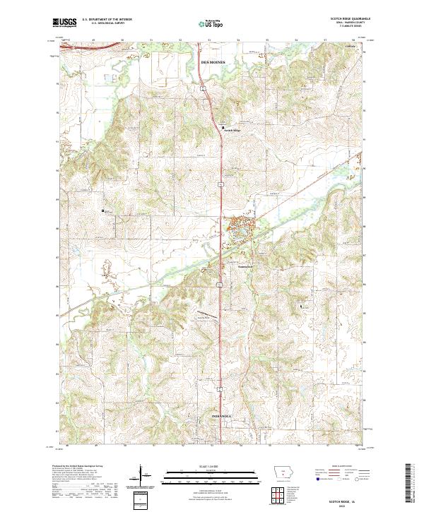 2022 Scotch Ridge2022 Print · USGSWarren County in the 2020s shows a landscape where the river valleys of the Middle River and N River meet growing communities. Researchers can trace local heritage at Scotch Ridge Cem or follow the path of the Summerset Trl.
 - 2022 Map of Des Moines NW, 2022 Print
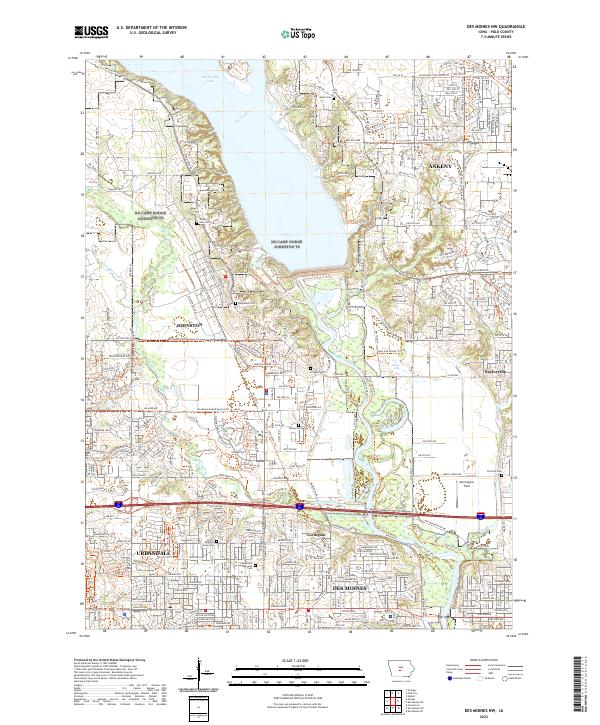 2022 Des Moines NW2022 Print · USGSThe northern edge of the Des Moines metro area comes into focus in the early 2020s as suburban growth meets the waters of Saylorville Lake. Researchers can trace old transportation routes like the Interurban Trl or locate legacy sites such as Ridgedale Cem and Morningstar Field.
End of results
Showing maps 1-8 of 8
Top cities near Des Moines
- West Des Moines historical maps
- Ankeny historical maps
- Urbandale historical maps
- Johnston historical maps
- Waukee historical maps
- Altoona historical maps
See more
Top neighborhoods of Des Moines
- Marquisville historical maps
- Bowsher historical maps
- Wivfat Plaza historical maps
- Avon historical maps
- Chesterfield historical maps
- Valley High Manor historical maps
See more
Frequently asked questions
- What are the different types of historical maps available for Des Moines?
- What is the oldest map of Des Moines?
- Where can I purchase historical maps of Des Moines for my home or office?
- Where can I download high-res historical maps of Des Moines?
- Are there historical topographic maps available for Des Moines?
- Is there historical aerial imagery available for Des Moines?
- Where are historical maps of Des Moines sourced from?