2022 Map of Norwalk
USGS Topo · Published 2022About this map
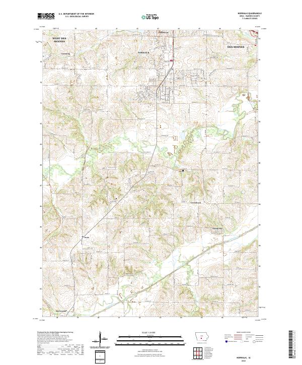
The rolling agricultural and suburban landscape south of Des Moines is defined by the convergence of the Middle River and the N River valley. This contemporary survey captures the growing residential outskirts of Norwalk and Lakewood, while maintaining a clear view of the rural heritage preserved in small communities like Spring Hill and Prole. The conversion of old rail corridors into the Great Western Trl is a notable feature, cutting diagonally across the landscape toward Martensdale. Genealogists will find particular value in the locations of Linn Grove Cem and Webb Cem, which sit alongside established regional roads like Co Rd G24 and Fulton St. The map illustrates how traditional farming acreage is gradually transitioning into the suburban fabric of West Des Moines and its neighbors.
Find a feature on this map
60 named features on this map. Tap any name to fly to it.
Don’t see what you’re looking for? This feature index may not catch every label — zoom into the map to look around manually.
Map Details
Editions of this 2022 Norwalk Map
This is the sole edition of this map. No revisions or reprints were ever made.