1970s Maps of Sac County, Iowa
Explore 5 historic maps of Sac County from the 1970s. These maps offer a rare glimpse into what life looked like during the 1970s — showing old roads, neighborhoods, homes, and landmarks that have changed or disappeared over time.
Whether you're researching your family's past, planning a metal detecting trip, or studying how Sac County's landscape evolved across the 1970s, these high-resolution maps are a powerful tool for exploring the history of this region.
- Focus on a specific era: All maps on this page are from the 1970s, giving you a focused view of this time period.
- See what’s changed: Compare century-old streets, trails, and buildings to today's modern landscape using overlays and satellite layers.
- Research with precision: Use these maps for genealogy, historical research, land use analysis, or educational projects.
- View, download, or print: Maps are fully viewable online in high resolution, and can be downloaded or printed for your own records.
Start exploring Sac County's history through authentic maps from the 1970s. This is your window into the past.
Sac County, IA maps
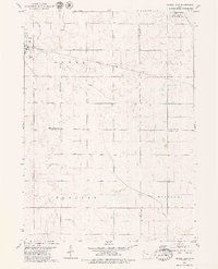
(5)- 1971 Map of Kiron, 1973 Print
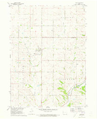 1971 Kiron1973 Print · USGSCrawford County agriculture and rail history intersect here in the early seventies, centered on the village of Kiron. Genealogists and local historians can trace family roots at Kiron Cem or St Johns Ch and follow the path of the Old Railroad Grade.
 - 1979 Map of Lakeside
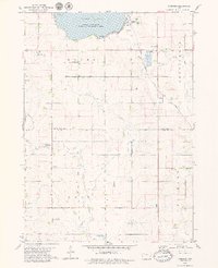 1979 Lakeside1979 Print · USGSThe southern shores of Storm Lake come into focus during the late seventies, showing a landscape of lakeside recreation and steady agricultural growth. Genealogists and local historians can locate Chase Cem, Immanuel Ch, and the grounds of Iowa Central Community College.
 - 1979 Map of Newell West
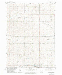
 1979 Newell West1979 Print · USGSAgricultural progress and rail connectivity define this Buena Vista County landscape in the late 1970s. Trace the paths of the Illinois Central Gulf through Newell or locate the Iowa State University Allee Experimental Farm.
 - 1979 Map of Schaller North
 1979 Schaller North1979 Print · USGSBuena Vista and Sac counties are captured here in the late seventies, showing the agricultural heart of the Maple Valley. Genealogists and local historians can trace the environs of Schaller and Hanover, locating landmarks like St John Sch and the Chicago and North Western railroad.
 - 1979 Map of Newell East
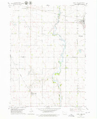
 1979 Newell East1979 Print · USGSBuena Vista County farming and rail transport are in focus during the late seventies as the town of Newell expands. Researchers can trace land divisions across Cedar and Douglas townships or locate specific landmarks like Sunken Island Lake and the local Cem.
End of results
Showing maps 1-5 of 5
Top cities of Sac County
- Sac City historical maps
- Lake View historical maps
- Odebolt historical maps
- Wall Lake historical maps
- Schaller historical maps
- Early historical maps
See more
Frequently asked questions
- What are the different types of historical maps available for Sac County?
- What is the oldest map of Sac County?
- Where can I purchase historical maps of Sac County for my home or office?
- Where can I download high-res historical maps of Sac County?
- Are there historical topographic maps available for Sac County?
- Is there historical aerial imagery available for Sac County?
- Where are historical maps of Sac County sourced from?