1971 Map of Kiron
USGS Topo · Published 1973About this map
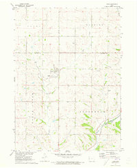
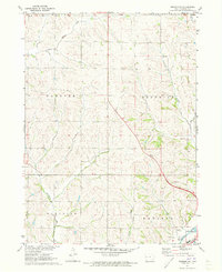
Kiron serves as the primary hub of this early 1970s landscape, situated at the crossroads of Crawford, Ida, and Sac Counties. The terrain is defined by the drainage of Otter Creek and the Boyer River, which flows through the southeastern corner of the quadrangle. Transportation history is visible in the transition from active rail to land reclamation, marked by the presence of both the Chicago and North Western line and a long section of Old Railroad Grade cutting across the central plains.
Find a feature on this map
19 named features on this map. Tap any name to fly to it.
Don’t see what you’re looking for? This feature index may not catch every label — zoom into the map to look around manually.
Map Details
Editions of this 1971 Kiron Map
This is the sole edition of this map. No revisions or reprints were ever made.
Other maps of this area

1954 · Fort Dodge
USGS Topo · 1:250,000

1957 · Fort Dodge
USGS Topo · 1:250,000

1958 · Fort Dodge
USGS Topo · 1:250,000
1967 · Ida Grove
USGS Topo · 1:24,000
1971 · Schleswig
USGS Topo · 1:24,000
1971 · Denison
USGS Topo · 1:24,000
1971 · Denison SW
USGS Topo · 1:24,000
1980 · Odebolt East
USGS Topo · 1:24,000
1980 · Boyer
USGS Topo · 1:24,000
1980 · Odebolt West
USGS Topo · 1:24,000