Old Maps of Davenport, Iowa for Academic Research
Study the evolution of Davenport with 59 high-resolution historic maps. Whether you're teaching, researching, or modeling changes in land use, these maps provide essential visual documentation of urban, environmental, and geographic change.
- Analyze long-term change: Track patterns in development, transportation, and natural features.
- Ideal for environmental or urban studies: Support academic projects with primary historical map data.
- Use in the classroom or lab: Educators and researchers rely on these maps to bring historical context to life.
These maps are a powerful tool for teaching, research, and visualizing how Davenport has changed over the decades.
Davenport, IA maps
(59)- 1891 Map of Davenport
 1891 Davenport1891 Print · USGSIowa's riverfront and rolling prairie townships are captured here during a period of rapid railroad expansion in the late nineteenth century. Trace early land tracts and rail junctions like Eldridge Junction or locate landmarks such as Green Tree Tavern and Maysville.
 - 1892 Map of Leclaire
 1892 Leclaire1892 Print · USGSThe Mississippi River border between Iowa and Illinois comes alive in the 1890s, before modern locks reshaped the shoreline. Genealogists and historians can trace riverside settlements like Leclaire, Port Byron, and the railroad junction at Watertown.
 - 1893 Map of Leclaire
 1893 Leclaire1893 Print · USGSThe riverfronts of Scott County and Rock Island County thrived in the late nineteenth century as vital hubs for steamboats and steam rail. Researchers can trace the early grids of Leclaire, Port Byron, and Valley City alongside the sprawling banks of the Mississippi River.4 unique versions available
 - 1894 Map of Davenport
 1894 Davenport1894 Print · USGSDavenport and the surrounding Scott County prairies come alive in this late nineteenth-century survey of the Mississippi River front. Researchers can trace the early rail networks through Eldridge Junction and locate vanished landmarks like Green Tree Tavern and Gilbertown.4 unique versions available
 - 1899 Map of Clinton
 1899 Clinton1899 Print · USGSThe Mississippi River valley comes alive in the late 1890s, capturing the river-and-rail economy of Iowa and Illinois before modern channelization. Genealogists and historians can trace early townships and river landings, finding precise locations for Low Moor, Folletts, and Pink Prairie.5 unique versions available
 - 1901 Map of Rock Island
 1901 Rock Island1901 Print · USGSThe eastern Iowa borderlands and the Mississippi River confluence thrive during the rail boom of the late nineteenth century. Genealogists and historians can trace family roots through numerous small settlements like Lost Nation, Grand Mound, and the vital U. S. Arsenal grounds.2 unique versions available
 - 1910 Map of Rock Island, 1949 Print
 1910 Rock Island1949 Print · USGSEastern Iowa and the Illinois borderlands come alive in this late nineteenth-century survey of the river valleys and rail hubs. Genealogists and historians can trace old homesteads near Lost Nation, the early streets of Dewitt, and the sprawling U.S. Arsenal.
 - 1912 Map of Milan
 1912 Milan1912 Print · USGSThe river confluence and burgeoning rail networks of Rock Island County are captured here just before the First World War. Researchers can trace the legacy of early industry and education through sites like the Coal Valley Mine, Blackhawk Watchtower, and Excelsior School.7 unique versions available
 - 1944 Map of Milan, 1958 Print
 1944 Milan1958 Print · USGSThe Illinois-Iowa border comes alive in the 1940s, highlighting the industrial riverfronts and the rural interior of Rock Island and Mercer Counties. Trace family roots and local industry at the Coal Valley Mine, the US Arsenal, or the vanished schoolhouses like Doxie School.
 - 1948 Map of Milan, 1955 Print
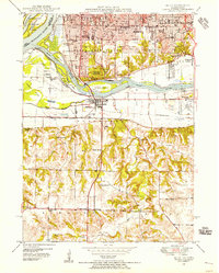 1948 Milan1955 Print · USGSThe Quad Cities area in the late 1940s reveals a landscape defined by the convergence of the Rock River and Mississippi River. Genealogists and local historians can trace legacy sites like Chippiannock Cem, the County Sanitarium, and numerous country schools such as Tindall Sch.
 - 1949 Map of Silvis
 1949 Silvis1949 Print · USGSThe Illinois riverfront along the Mississippi at the close of the 1940s reveals a powerful hub of rail and industry. Genealogists and historians can trace institutional grounds like the East Moline State Hospital or find the early Miller Landing Field.
 - 1949 Map of Davenport
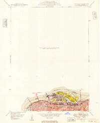 1949 Davenport1949 Print · USGSThe Quad Cities area emerged from the war years as a vital rail and river hub along the Mississippi River. Researchers can trace the complex industrial layout of Rock Island, find local landmarks like Augustana College, and locate the National Cem on the arsenal island.
 - 1950 Map of Milan
 1950 Milan1950 Print · USGSThe Tri-Cities area comes alive in the mid-century as industrial centers like Rock Island and Moline expand across the river islands. Researchers can locate dozens of local landmarks, from Chippiannock Cem to rural outposts like Tindall School No 1.2 unique versions available
 - 1953 Map of Silvis, 1956 Print
 1953 Silvis1956 Print · USGSThe Quad Cities area flourished in the early fifties as an industrial powerhouse along the Mississippi River. Genealogists and historians can trace the footprint of the East Moline State Hospital, several rural schools like Barr School, and the grounds of Fairview Cemetery.3 unique versions available
 - 1953 Map of Davenport East, 1956 Print
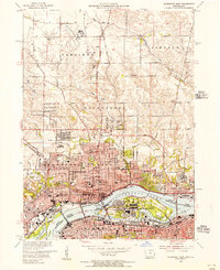 1953 Davenport East1956 Print · USGSThe Quad Cities are captured at a peak of mid-century growth, following the path of the Mississippi River and the bustling Rock Island Arsenal. Local historians can trace family roots at St Ambrose College or locate the former aviation hub at Cram Field.3 unique versions available
 - 1953 Map of Milan, 1956 Print
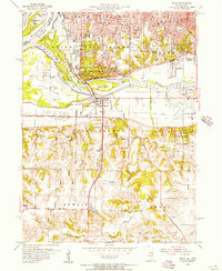 1953 Milan1956 Print · USGSThe Quad Cities area in the early fifties shows a landscape of river-driven industry and rapid post-war growth. Genealogists can trace family roots through numerous named schools and cemeteries like Chippiannock Cemetery and the rural Pleasant Hill Cem.3 unique versions available
 - 1953 Map of Davenport West, 1958 Print
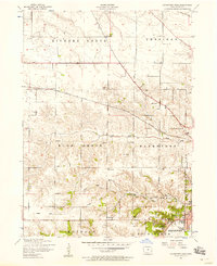 1953 Davenport West1958 Print · USGSThe western edges of Davenport and the surrounding Scott County townships are captured here in the early fifties. Genealogists and local historians can trace rural school districts from Fairview School to School No. 5 and locate family burial sites like Friday Family Cemetery.3 unique versions available
 - 1953 Map of Andalusia, 1958 Print
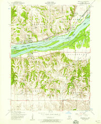 1953 Andalusia1958 Print · USGSThe Mississippi River corridor south of Davenport is captured here in the early fifties, showing a landscape defined by rail lines and river islands. Researchers can locate rural landmarks like Asbury Cemetery, Buffalo Heights, and the Coon Hunters Club along the bluffs.3 unique versions available
 - 1953 Map of Milan, 1959 Print
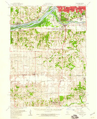 1953 Milan1959 Print · USGSRock Island County and the Mississippi riverfront are captured here in the mid-fifties, showing the region's transition from river-town industry to suburban growth. Genealogists and historians can locate numerous rural landmarks like St Josephs Ch, Colony Cem, and the old Edgington Sch.
 - 1958 Map of Davenport, 1968 Print
 1958 Davenport1968 Print · USGSEastern Iowa and western Illinois thrive along the river during the late fifties, defined by the industrial Quad Cities and a robust rail network. Genealogists can trace family roots through settlements like Oasis and Stanwood or along the Cedar River.2 unique versions available
 - 1961 Map of Davenport
 1961 Davenport1961 Print · USGSThe Quad Cities and the eastern Iowa riverlands are captured here in the early sixties, showing the region's transition into a modern industrial and transit hub. Genealogists and historians can trace the paths of major railroads and find river landmarks like Rock Island Arsenal, Huron Island, and the Coralville Reservoir.
 - 1962 Map of Davenport
 1962 Davenport1962 Print · USGSThe Quad Cities and the Mississippi River corridor are shown at their industrial peak just before the interstate era fully transformed the region. Researchers can trace the sprawling rail networks of the Chicago Rock Island and Pacific and find landmarks like the Rock Island Arsenal and Wild Cat Den State Park.
 - 1984 Map of Davenport, 1985 Print
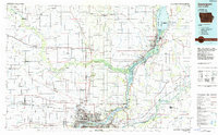 1984 Davenport1985 Print · USGSThe Quad Cities and the eastern Iowa riverlands are captured in the mid-eighties as industry and conservation converged along the Mississippi. Genealogists and local historians can trace rural roots through Stender Church, Oxford Mills, and the Elmwood Cem burial grounds.2 unique versions available
 - 1984 Map of Aledo, 1985 Print
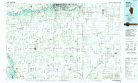 1984 Aledo1985 Print · USGSThe Mississippi River borderlands and Illinois heartland are captured here in the mid-eighties as industry and agriculture overlap. Trace the Hennepin Canal, the historic Swedish colony at Bishop Hill, and the rail corridors of the Burlington Northern.
 - 1989 Map of Aledo
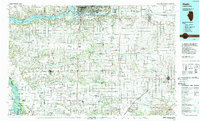 1989 Aledo1989 Print · USGSWestern Illinois and eastern Iowa are shown here during the late twentieth century, when the river-and-rail economy still defined the Quad Cities and the surrounding prairie. Researchers can trace historic settlements like Bishop Hill and Millersburg alongside active routes like the Chicago Rock Island & Pacific RR.
Showing maps 1-25 of 59
Top cities near Davenport
- Moline historical maps
- Bettendorf historical maps
- Rock Island historical maps
- East Moline historical maps
- Silvis historical maps
- Eldridge historical maps
See more
Top neighborhoods of Davenport
- Walnut Grove historical maps
- Nahant historical maps
- Village of East Davenport historical maps
- Park Lawn historical maps
- Americana Park historical maps
- Riverview Terrace Historic District historical maps
See more
Frequently asked questions
- What are the different types of historical maps available for Davenport?
- What is the oldest map of Davenport?
- Where can I purchase historical maps of Davenport for my home or office?
- Where can I download high-res historical maps of Davenport?
- Are there historical topographic maps available for Davenport?
- Is there historical aerial imagery available for Davenport?
- Where are historical maps of Davenport sourced from?