Old Maps of Liberty Township, Iowa for Genealogy
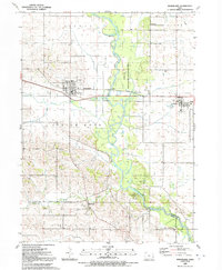
Trace your family roots with 38 historic maps of Liberty Township. These high-res maps reveal old neighborhoods, homesites, landmarks, and streets — helping you uncover where your ancestors lived and how the area evolved over time.
- Explore historic neighborhoods: Identify where your relatives may have lived in the 1800s or 1900s.
- Compare maps over time: Trace the changes in streets, buildings, and landmarks for multi-generational research.
- Perfect for genealogy & ancestry research: Used by family historians and researchers to map out lineage and migration.
These maps are an incredible resource for exploring your personal connection to Liberty Township's past.
Liberty Township, IA maps
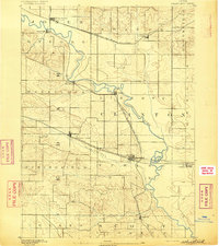
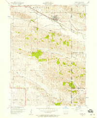
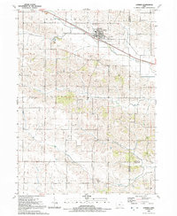
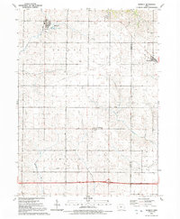
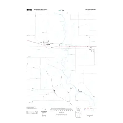
(38)- 1890 Map of Durant
 1890 Durant1890 Print · USGSEastern Iowa's rail-dependent farming communities are documented in the late nineteenth century as the grid of townships began to mature. Genealogists and historians can trace the early footprints of Durant, Walcott, and the remote Round Grove P.O. along established rail lines.
 - 1892 Map of Wheatland
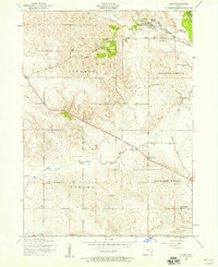
 1892 Wheatland1892 Print · USGSEastern Iowa in the late nineteenth century was a landscape of burgeoning rail towns and river settlements. Genealogists and historians can trace early property boundaries and rail corridors through Wheatland, the winding Wapsipinicon River, and the curiously named Lost Nation.
 - 1894 Map of Wheatland
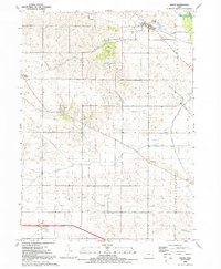
 1894 Wheatland1894 Print · USGSClinton and Jones counties thrived along the river and rail corridors of the 1890s. Genealogists can trace the early development of Oxford Junction and Wheatland, or locate old mill sites near Oxford Mills and Massillon.2 unique versions available
 - 1894 Map of Durant
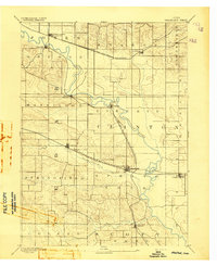
 1894 Durant1894 Print · USGSAgricultural towns and pioneering rail lines define this Iowa landscape in the 1890s. Family historians can trace early settlements and transit hubs from Durant and Walcott to the rural Round Grove P.O. and Pleasant Prairie.2 unique versions available
 - 1901 Map of Rock Island
 1901 Rock Island1901 Print · USGSThe eastern Iowa borderlands and the Mississippi River confluence thrive during the rail boom of the late nineteenth century. Genealogists and historians can trace family roots through numerous small settlements like Lost Nation, Grand Mound, and the vital U. S. Arsenal grounds.2 unique versions available
 - 1910 Map of Rock Island, 1949 Print
 1910 Rock Island1949 Print · USGSEastern Iowa and the Illinois borderlands come alive in this late nineteenth-century survey of the river valleys and rail hubs. Genealogists and historians can trace old homesteads near Lost Nation, the early streets of Dewitt, and the sprawling U.S. Arsenal.
 - 1953 Map of Bennett, 1958 Print
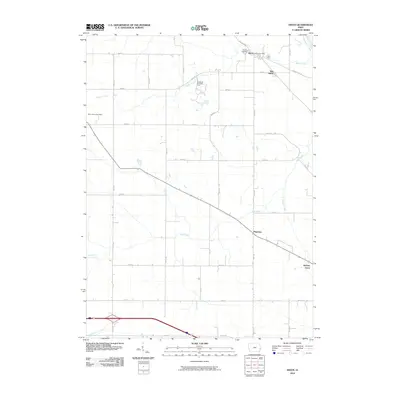
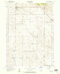 1953 Bennett1958 Print · USGSEastern Iowa farm country is captured here in the early fifties, showing the transition from rail-dependent commerce to a modern road network. Genealogists can locate several rural schoolhouses like Sunbury School and Center School, plus the Grain Elevator in Bennett.2 unique versions available
 - 1953 Map of Wheatland, 1958 Print
 1953 Wheatland1958 Print · USGSEastern Iowa farmland and river bottomlands come alive in the mid-fifties as the Chicago and Northwestern railroad connects local hubs. Trace ancestral roots at Big Rock or find family plots at Rose Hill Cemetery and St Pauls Cemetery.2 unique versions available
 - 1953 Map of Lowden, 1958 Print
 1953 Lowden1958 Print · USGSIn the early 1950s, the Cedar County countryside around Lowden was a network of rail-side commerce and rural school districts. Researchers can trace the heritage of local families through landmarks like Pioneer Cemetery and Red Oak School.2 unique versions available
 - 1953 Map of Dixon, 1958 Print
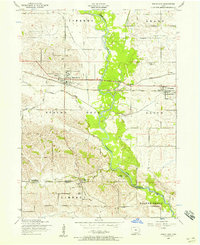
 1953 Dixon1958 Print · USGSDixon and the surrounding Scott County townships are seen here in the early fifties, caught at the intersection of the Wapsipinicon River and the rail line. Researchers can trace rural landmarks from Plain View to the Conestoga Girl Scout Camp and several local schoolhouses.3 unique versions available
 - 1958 Map of Davenport, 1968 Print
 1958 Davenport1968 Print · USGSEastern Iowa and western Illinois thrive along the river during the late fifties, defined by the industrial Quad Cities and a robust rail network. Genealogists can trace family roots through settlements like Oasis and Stanwood or along the Cedar River.2 unique versions available
 - 1961 Map of Davenport
 1961 Davenport1961 Print · USGSThe Quad Cities and the eastern Iowa riverlands are captured here in the early sixties, showing the region's transition into a modern industrial and transit hub. Genealogists and historians can trace the paths of major railroads and find river landmarks like Rock Island Arsenal, Huron Island, and the Coralville Reservoir.
 - 1962 Map of Davenport
 1962 Davenport1962 Print · USGSThe Quad Cities and the Mississippi River corridor are shown at their industrial peak just before the interstate era fully transformed the region. Researchers can trace the sprawling rail networks of the Chicago Rock Island and Pacific and find landmarks like the Rock Island Arsenal and Wild Cat Den State Park.
 - 1984 Map of Davenport, 1985 Print
 1984 Davenport1985 Print · USGSThe Quad Cities and the eastern Iowa riverlands are captured in the mid-eighties as industry and conservation converged along the Mississippi. Genealogists and local historians can trace rural roots through Stender Church, Oxford Mills, and the Elmwood Cem burial grounds.2 unique versions available
 - 1991 Map of Dixon, 1992 Print
 1991 Dixon1992 Print · USGSScott County and the border of Clinton County are captured here in the early nineties, centered on the community of Dixon. Local historians can trace the rural layouts of Plainview and New Liberty or locate family sites at Hope Ch and Memorial Park.
 - 1991 Map of Lowden, 1992 Print
 1991 Lowden1992 Print · USGSEastern Iowa farmland centered on the railroad town of Lowden is documented here just before the turn of the millennium. Researchers can trace rural family plots and community hubs like Inland Cem, Zion Ch, and the waters of Yankee Run.
 - 1991 Map of Bennett, 1992 Print
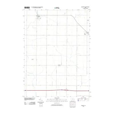
 1991 Bennett1992 Print · USGSThe rural borderlands of Cedar and Scott counties are captured here in the early nineties, featuring the established town sites of Bennett and Sunbury. Genealogists and local historians can trace township boundaries across Inland and Farmington or locate landmarks like Bennett Park and New Liberty.
 - 1991 Map of Wheatland, 1992 Print
 1991 Wheatland1992 Print · USGSClinton and Scott counties in the early nineties show a landscape defined by the winding Wapsipinicon River and local rail lines. Researchers can find old rural cemeteries like Pine Hill Cem and landmarks such as the High Rock Bridge.
 - 2010 Map of Lowden, 2010 Print
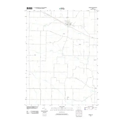 2010 Lowden2010 Print · USGSCovers Liberty Township, including Lowden, Scott County, and other nearby areas
 - 2010 Map of Wheatland, 2010 Print
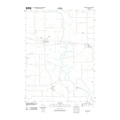 2010 Wheatland2010 Print · USGSCovers Liberty Township, including Wheatland, Calamus, and other nearby areas
 - 2010 Map of Dixon, 2010 Print
 2010 Dixon2010 Print · USGSCovers Liberty Township, including Walcott, Dixon, and other nearby areas
 - 2010 Map of Bennett, 2010 Print
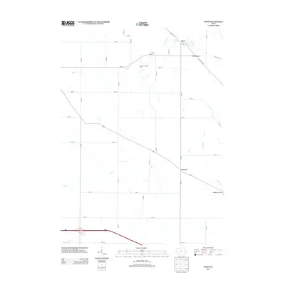
 2010 Bennett2010 Print · USGSCovers Liberty Township, including Bennett, New Liberty, and other nearby areas
 - 2013 Map of Dixon, 2013 Print
 2013 Dixon2013 Print · USGSCovers Liberty Township, including Walcott, Dixon, and other nearby areas
 - 2013 Map of Bennett, 2013 Print
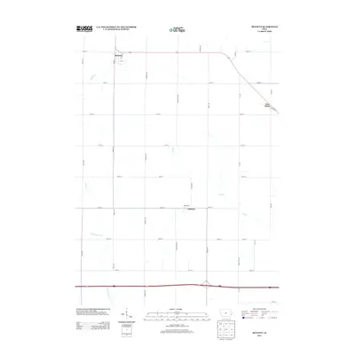 2013 Bennett2013 Print · USGSCovers Liberty Township, including Bennett, New Liberty, and other nearby areas
 - 2013 Map of Wheatland, 2013 Print
 2013 Wheatland2013 Print · USGSCovers Liberty Township, including Wheatland, Calamus, and other nearby areas
Showing maps 1-25 of 38
Top cities near Liberty Township
- Davenport historical maps
- Rock Island historical maps
- Eldridge historical maps
- Wilton historical maps
- Durant historical maps
- Blue Grass historical maps
See more
Top neighborhoods of Liberty Township
Frequently asked questions
- What are the different types of historical maps available for Liberty Township?
- What is the oldest map of Liberty Township?
- Where can I purchase historical maps of Liberty Township for my home or office?
- Where can I download high-res historical maps of Liberty Township?
- Are there historical topographic maps available for Liberty Township?
- Is there historical aerial imagery available for Liberty Township?
- Where are historical maps of Liberty Township sourced from?