1960s Maps of Winneshiek County, Iowa
Explore 7 historic maps of Winneshiek County from the 1960s. These maps offer a rare glimpse into what life looked like during the 1960s — showing old roads, neighborhoods, homes, and landmarks that have changed or disappeared over time.
Whether you're researching your family's past, planning a metal detecting trip, or studying how Winneshiek County's landscape evolved across the 1960s, these high-resolution maps are a powerful tool for exploring the history of this region.
- Focus on a specific era: All maps on this page are from the 1960s, giving you a focused view of this time period.
- See what’s changed: Compare century-old streets, trails, and buildings to today's modern landscape using overlays and satellite layers.
- Research with precision: Use these maps for genealogy, historical research, land use analysis, or educational projects.
- View, download, or print: Maps are fully viewable online in high resolution, and can be downloaded or printed for your own records.
Start exploring Winneshiek County's history through authentic maps from the 1960s. This is your window into the past.
Winneshiek County, IA maps
(7)- 1961 Map of La Crosse
 1961 La Crosse1961 Print · USGSThe Driftless Area at the start of the 1960s reveals a complex network of river towns and rail lines along the Mississippi River. Genealogists and historians can trace old settlements like New Amsterdam and Wyattville or locate major landmarks like Camp McCoy Military Reservation and Effigy Mounds National Monument.
 - 1965 Map of La Crosse
 1965 La Crosse1965 Print · USGSThe Driftless Area and the Upper Mississippi valley are captured here during a period of steady mid-century growth. Researchers can trace the rail lines of the Chicago and North Western or locate riverfront sites like Effigy Mounds National Monument and the Camp McCoy Military Reservation.
 - 1965 Map of Wilmington, 1966 Print
 1965 Wilmington1966 Print · USGSThe Houston County borderlands are captured here in the mid-sixties, showing the transition from wooded ridges to deep creek valleys. Researchers can locate family landmarks like Stone Cem, the Wilmington Ch, and the rural settlement of Bee.2 unique versions available
 - 1965 Map of Harmony, 1966 Print
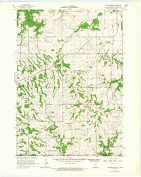
 1965 Harmony1966 Print · USGSThe Minnesota-Iowa borderlands near Harmony are shown in the mid-1960s, a time when rail and river still defined the local geography. Researchers can trace the Milwaukee Road railroad or locate family burial sites at Rice Cem and Old Big Spring Cem.2 unique versions available
 - 1965 Map of Mabel, 1966 Print
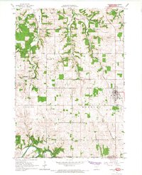
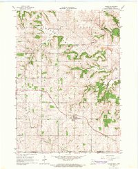
 1965 Mabel1966 Print · USGSThe Minnesota-Iowa border comes alive in the mid-1960s, showing the intersection of rail transport and forest conservation. Genealogists and historians can trace the Milwaukee St Paul and Pacific railroad through Mabel and find remote sites like Scheie Ch or Prosper Cem.
 - 1965 Map of Spring Grove, 1966 Print
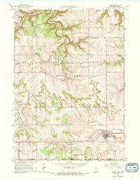
 1965 Spring Grove1966 Print · USGSSoutheastern Minnesota's ridge-and-valley landscape is preserved here during the mid-sixties, showing the rural communities of Houston County. Trace family roots at St Marys Cem or Trinity Cem, and locate landmarks like Sylling Landing Field and the rail stop at Newhouse.
 - 1965 Map of Canton, 1966 Print
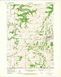
 1965 Canton1966 Print · USGSSoutheast Minnesota near the Iowa border is captured in the mid-sixties, showing a landscape defined by the South Fork Root River and its rail-linked villages. Researchers can trace the Chicago Milwaukee St Paul and Pacific tracks through Canton and find family-named sites like Henrytown and Scotland Cem.
End of results
Showing maps 1-7 of 7
Top cities of Winneshiek County
- Decorah historical maps
- Calmar historical maps
- Ossian historical maps
- Spillville historical maps
- Fort Atkinson historical maps
- Ridgeway historical maps
See more
Frequently asked questions
- What are the different types of historical maps available for Winneshiek County?
- What is the oldest map of Winneshiek County?
- Where can I purchase historical maps of Winneshiek County for my home or office?
- Where can I download high-res historical maps of Winneshiek County?
- Are there historical topographic maps available for Winneshiek County?
- Is there historical aerial imagery available for Winneshiek County?
- Where are historical maps of Winneshiek County sourced from?