Old Maps of Winneshiek County, Iowa for Metal Detecting
Plan your next treasure hunt with 172 historic maps of Winneshiek County. Find old homesites, ghost towns, trails, and gathering spots that may be lost to time — perfect for identifying promising metal detecting locations.
- Locate forgotten sites: Uncover places like long-lost settlements, abandoned rail lines, or gathering spots.
- Plan better hunts: Use map overlays combined with LiDAR or satellite views to narrow in on historically rich areas.
- Made for detectorists: Thousands of hobbyists use these maps to discover relics, coins, and hidden history.
Use these historic maps to boost your research and find new opportunities beneath the surface of Winneshiek County.
Winneshiek County, IA maps
(172)- 1906 Map of Decorah
 1906 Decorah1906 Print · USGSNortheast Iowa at the turn of the century was a land of intricate river valleys and vital railroad junctions. Genealogists can trace the early rail-and-river economy through landmarks like Decorah, the historic site of Fort Atkinson, and the junction at Calmar.3 unique versions available
 - 1954 Map of Mason City, 1967 Print
 1954 Mason City1967 Print · USGSSouthern Minnesota and northern Iowa are shown here at the height of the mid-century rail era, centered on the regional hubs of Mason City and Rochester. Researchers can trace the vanished paths of the Chicago Great Western and find local landmarks like Pilot Knob and Bear Lake.2 unique versions available
 - 1957 Map of Mason City
 1957 Mason City1957 Print · USGSThe Minnesota-Iowa border region comes alive in this mid-century survey, from the industrial plants of Mason City to the medical hub of Rochester. Researchers can trace the rail-and-river economy through the Chicago Great Western Railway and the Shell Rock River.
 - 1958 Map of Mason City
 1958 Mason City1958 Print · USGSSouthern Minnesota and northern Iowa are shown during the mid-fifties when railroads still anchored the regional economy. Genealogists and historians can trace the intricate rail networks of the Illinois Central and find local landmarks in Mason City, Albert Lea, and Austin.
 - 1958 Map of La Crosse, 1979 Print
 1958 La Crosse1979 Print · USGSThe Driftless Area of Wisconsin and Iowa is captured here during the late seventies, showing the intricate river valleys and ridge-top settlements. Genealogists and historians can trace the rail corridors of the Soo Line or locate landmarks like Grandad Bluff and Effigy Mounds National Monument.2 unique versions available
 - 1961 Map of La Crosse
 1961 La Crosse1961 Print · USGSThe Driftless Area at the start of the 1960s reveals a complex network of river towns and rail lines along the Mississippi River. Genealogists and historians can trace old settlements like New Amsterdam and Wyattville or locate major landmarks like Camp McCoy Military Reservation and Effigy Mounds National Monument.
 - 1965 Map of La Crosse
 1965 La Crosse1965 Print · USGSThe Driftless Area and the Upper Mississippi valley are captured here during a period of steady mid-century growth. Researchers can trace the rail lines of the Chicago and North Western or locate riverfront sites like Effigy Mounds National Monument and the Camp McCoy Military Reservation.
 - 1965 Map of Wilmington, 1966 Print
 1965 Wilmington1966 Print · USGSThe Houston County borderlands are captured here in the mid-sixties, showing the transition from wooded ridges to deep creek valleys. Researchers can locate family landmarks like Stone Cem, the Wilmington Ch, and the rural settlement of Bee.2 unique versions available
 - 1965 Map of Harmony, 1966 Print
 1965 Harmony1966 Print · USGSThe Minnesota-Iowa borderlands near Harmony are shown in the mid-1960s, a time when rail and river still defined the local geography. Researchers can trace the Milwaukee Road railroad or locate family burial sites at Rice Cem and Old Big Spring Cem.2 unique versions available
 - 1965 Map of Mabel, 1966 Print
 1965 Mabel1966 Print · USGSThe Minnesota-Iowa border comes alive in the mid-1960s, showing the intersection of rail transport and forest conservation. Genealogists and historians can trace the Milwaukee St Paul and Pacific railroad through Mabel and find remote sites like Scheie Ch or Prosper Cem.
 - 1965 Map of Spring Grove, 1966 Print
 1965 Spring Grove1966 Print · USGSSoutheastern Minnesota's ridge-and-valley landscape is preserved here during the mid-sixties, showing the rural communities of Houston County. Trace family roots at St Marys Cem or Trinity Cem, and locate landmarks like Sylling Landing Field and the rail stop at Newhouse.
 - 1965 Map of Canton, 1966 Print
 1965 Canton1966 Print · USGSSoutheast Minnesota near the Iowa border is captured in the mid-sixties, showing a landscape defined by the South Fork Root River and its rail-linked villages. Researchers can trace the Chicago Milwaukee St Paul and Pacific tracks through Canton and find family-named sites like Henrytown and Scotland Cem.
 - 1971 Map of Postville, 1973 Print
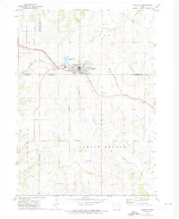 1971 Postville1973 Print · USGSPostville and the four-county border region of northeast Iowa are captured here during the early seventies as a thriving rail and agricultural center. Local historians can trace the Chicago Milwaukee St Paul and Pacific rail line and locate landmarks like Township Cem, the Fairground, and various Quarries.
 - 1971 Map of Dorchester, 1973 Print
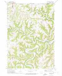 1971 Dorchester1973 Print · USGSAllamakee County, Iowa, is captured in the early 1970s as a landscape of deep river valleys and upland ridges. Genealogists and local historians can trace the foundations of the community at Dorchester, Quandahl, and the Waterloo Ridge Ch.
 - 1971 Map of Frankville, 1973 Print
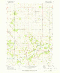 1971 Frankville1973 Print · USGSAllamakee and Winneshiek counties are captured in the early 1970s, showcasing the rural landscapes surrounding the Yellow River. Researchers can trace old family sites near Salem Ch, Bethlehem Cem, and numerous hillside Quarries.
 - 1971 Map of Hanover, 1973 Print
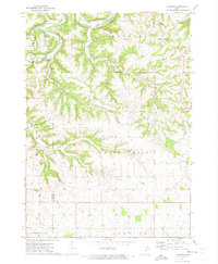 1971 Hanover1973 Print · USGSAllamakee County farmland and river valleys are captured here in the early seventies, showing a landscape shaped by the Upper Iowa River. Genealogists and local historians can locate rural landmarks like St Marys Ch, East Glenwood Cem, and the small settlement of Hanover.
 - 1975 Map of Decorah 4 NW, 1977 Print
 1975 Decorah 4 NW1977 Print · USGSWinneshiek County agriculture and river valleys are shown in detail during the mid-seventies in this aerial orthophotograph. Genealogists and land researchers can trace the exact layout of rural farmsteads and field patterns along the Yellow River.
 - 1975 Map of Decorah 1 NW, 1977 Print
 1975 Decorah 1 NW1977 Print · USGSWinneshiek County farmland is captured in sharp aerial detail during the mid-seventies, showing the precise layout of local homesteads and fields. Trace the rural crossroads at Locust and the secluded valley setting of Highlandville.
 - 1975 Map of Decorah 2 NW, 1977 Print
 1975 Decorah 2 NW1977 Print · USGSWinneshiek County agriculture and river life are captured in this mid-seventies aerial survey of the driftless area. Genealogists and local historians can trace the riverside settlement of Bluffton and the winding course of the Upper Iowa River.
 - 1975 Map of Decorah 1 SW, 1977 Print
 1975 Decorah 1 SW1977 Print · USGSWinneshiek County and the winding valley of the Upper Iowa River are captured in this mid-seventies aerial study. Genealogists and local historians can trace the rural development around Freeport and the intricate farmstead layouts of the era.
 - 1975 Map of Decorah 3 NW, 1977 Print
 1975 Decorah 3 NW1977 Print · USGSWinneshiek County agriculture and river valley settlements are captured in high detail in the mid-1970s. Trace the layout of rural hubs like Fort Atkinson, Spillville, and the crossroads at Conover during this era of farming.
 - 1975 Map of Decorah 2 NE, 1977 Print
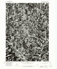 1975 Decorah 2 NE1977 Print · USGSWinneshiek County farmland and rural homesteads are shown at the height of the mid-seventies, revealing the exact layout of the countryside. Genealogists and local historians can trace property boundaries near Burr Oak and Hesper, or follow the banks of the Upper Iowa River.
 - 1975 Map of Decorah 2 SW, 1977 Print
 1975 Decorah 2 SW1977 Print · USGSWinneshiek County's agricultural landscape is captured through aerial photography in the mid-1970s. Trace the rural development and the precise layout of the settlement at Ridgeway during this era of Iowa farming.
 - 1975 Map of Decorah 3 NE, 1977 Print
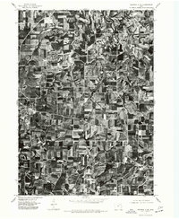 1975 Decorah 3 NE1977 Print · USGSWinneshiek County farmland is captured in sharp detail during the mid-seventies, showing the agricultural patterns of the Iowa countryside. Genealogists and local historians can trace the exact layouts of Calmar and Ossian as they appeared decades ago.
 - 1975 Map of Decorah 2 SE, 1977 Print
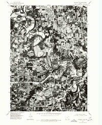 1975 Decorah 2 SE1977 Print · USGSThe river bluffs of Winneshiek County are seen in high detail in this mid-seventies aerial survey. Genealogists and local historians can trace the exact 1975 footprint of Decorah and the winding course of the Upper Iowa River.
Showing maps 1-25 of 172
Top cities of Winneshiek County
- Decorah historical maps
- Calmar historical maps
- Ossian historical maps
- Spillville historical maps
- Fort Atkinson historical maps
- Ridgeway historical maps
See more
Frequently asked questions
- What are the different types of historical maps available for Winneshiek County?
- What is the oldest map of Winneshiek County?
- Where can I purchase historical maps of Winneshiek County for my home or office?
- Where can I download high-res historical maps of Winneshiek County?
- Are there historical topographic maps available for Winneshiek County?
- Is there historical aerial imagery available for Winneshiek County?
- Where are historical maps of Winneshiek County sourced from?