1970s Maps of Winneshiek County, Iowa
Explore 14 historic maps of Winneshiek County from the 1970s. These maps offer a rare glimpse into what life looked like during the 1970s — showing old roads, neighborhoods, homes, and landmarks that have changed or disappeared over time.
Whether you're researching your family's past, planning a metal detecting trip, or studying how Winneshiek County's landscape evolved across the 1970s, these high-resolution maps are a powerful tool for exploring the history of this region.
- Focus on a specific era: All maps on this page are from the 1970s, giving you a focused view of this time period.
- See what’s changed: Compare century-old streets, trails, and buildings to today's modern landscape using overlays and satellite layers.
- Research with precision: Use these maps for genealogy, historical research, land use analysis, or educational projects.
- View, download, or print: Maps are fully viewable online in high resolution, and can be downloaded or printed for your own records.
Start exploring Winneshiek County's history through authentic maps from the 1970s. This is your window into the past.
Winneshiek County, IA maps
(14)- 1971 Map of Postville, 1973 Print
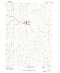 1971 Postville1973 Print · USGSPostville and the four-county border region of northeast Iowa are captured here during the early seventies as a thriving rail and agricultural center. Local historians can trace the Chicago Milwaukee St Paul and Pacific rail line and locate landmarks like Township Cem, the Fairground, and various Quarries.
 - 1971 Map of Dorchester, 1973 Print
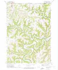 1971 Dorchester1973 Print · USGSAllamakee County, Iowa, is captured in the early 1970s as a landscape of deep river valleys and upland ridges. Genealogists and local historians can trace the foundations of the community at Dorchester, Quandahl, and the Waterloo Ridge Ch.
 - 1971 Map of Frankville, 1973 Print
 1971 Frankville1973 Print · USGSAllamakee and Winneshiek counties are captured in the early 1970s, showcasing the rural landscapes surrounding the Yellow River. Researchers can trace old family sites near Salem Ch, Bethlehem Cem, and numerous hillside Quarries.
 - 1971 Map of Hanover, 1973 Print
 1971 Hanover1973 Print · USGSAllamakee County farmland and river valleys are captured here in the early seventies, showing a landscape shaped by the Upper Iowa River. Genealogists and local historians can locate rural landmarks like St Marys Ch, East Glenwood Cem, and the small settlement of Hanover.
 - 1975 Map of Decorah 4 NW, 1977 Print
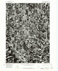
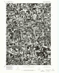 1975 Decorah 4 NW1977 Print · USGSWinneshiek County agriculture and river valleys are shown in detail during the mid-seventies in this aerial orthophotograph. Genealogists and land researchers can trace the exact layout of rural farmsteads and field patterns along the Yellow River.
 - 1975 Map of Decorah 1 NW, 1977 Print
 1975 Decorah 1 NW1977 Print · USGSWinneshiek County farmland is captured in sharp aerial detail during the mid-seventies, showing the precise layout of local homesteads and fields. Trace the rural crossroads at Locust and the secluded valley setting of Highlandville.
 - 1975 Map of Decorah 2 NW, 1977 Print
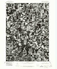 1975 Decorah 2 NW1977 Print · USGSWinneshiek County agriculture and river life are captured in this mid-seventies aerial survey of the driftless area. Genealogists and local historians can trace the riverside settlement of Bluffton and the winding course of the Upper Iowa River.
 - 1975 Map of Decorah 1 SW, 1977 Print
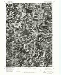
 1975 Decorah 1 SW1977 Print · USGSWinneshiek County and the winding valley of the Upper Iowa River are captured in this mid-seventies aerial study. Genealogists and local historians can trace the rural development around Freeport and the intricate farmstead layouts of the era.
 - 1975 Map of Decorah 3 NW, 1977 Print
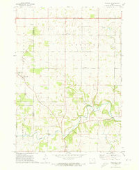
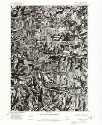
 1975 Decorah 3 NW1977 Print · USGSWinneshiek County agriculture and river valley settlements are captured in high detail in the mid-1970s. Trace the layout of rural hubs like Fort Atkinson, Spillville, and the crossroads at Conover during this era of farming.
 - 1975 Map of Decorah 2 NE, 1977 Print
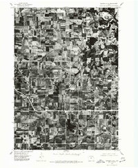
 1975 Decorah 2 NE1977 Print · USGSWinneshiek County farmland and rural homesteads are shown at the height of the mid-seventies, revealing the exact layout of the countryside. Genealogists and local historians can trace property boundaries near Burr Oak and Hesper, or follow the banks of the Upper Iowa River.
 - 1975 Map of Decorah 2 SW, 1977 Print
 1975 Decorah 2 SW1977 Print · USGSWinneshiek County's agricultural landscape is captured through aerial photography in the mid-1970s. Trace the rural development and the precise layout of the settlement at Ridgeway during this era of Iowa farming.
 - 1975 Map of Decorah 3 NE, 1977 Print
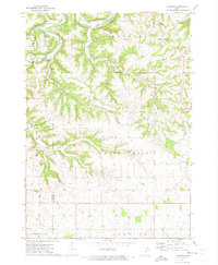
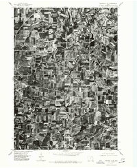 1975 Decorah 3 NE1977 Print · USGSWinneshiek County farmland is captured in sharp detail during the mid-seventies, showing the agricultural patterns of the Iowa countryside. Genealogists and local historians can trace the exact layouts of Calmar and Ossian as they appeared decades ago.
 - 1975 Map of Decorah 2 SE, 1977 Print
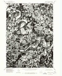 1975 Decorah 2 SE1977 Print · USGSThe river bluffs of Winneshiek County are seen in high detail in this mid-seventies aerial survey. Genealogists and local historians can trace the exact 1975 footprint of Decorah and the winding course of the Upper Iowa River.
 - 1976 Map of La Crosse
 1976 La Crosse1976 Print · USGSThe Driftless Area and Mississippi River valley are captured here in the mid-seventies, showing a landscape of deep coulees and river commerce. Genealogists can trace family footprints from La Crosse to smaller hamlets like Newburg Corners and Witoka.
End of results
Showing maps 1-14 of 14
Top cities of Winneshiek County
- Decorah historical maps
- Calmar historical maps
- Ossian historical maps
- Spillville historical maps
- Fort Atkinson historical maps
- Ridgeway historical maps
See more
Frequently asked questions
- What are the different types of historical maps available for Winneshiek County?
- What is the oldest map of Winneshiek County?
- Where can I purchase historical maps of Winneshiek County for my home or office?
- Where can I download high-res historical maps of Winneshiek County?
- Are there historical topographic maps available for Winneshiek County?
- Is there historical aerial imagery available for Winneshiek County?
- Where are historical maps of Winneshiek County sourced from?