2020s Maps of Winneshiek County, Iowa
Explore 25 historic maps of Winneshiek County from the 2020s. These maps offer a rare glimpse into what life looked like during the 2020s — showing old roads, neighborhoods, homes, and landmarks that have changed or disappeared over time.
Whether you're researching your family's past, planning a metal detecting trip, or studying how Winneshiek County's landscape evolved across the 2020s, these high-resolution maps are a powerful tool for exploring the history of this region.
- Focus on a specific era: All maps on this page are from the 2020s, giving you a focused view of this time period.
- See what’s changed: Compare century-old streets, trails, and buildings to today's modern landscape using overlays and satellite layers.
- Research with precision: Use these maps for genealogy, historical research, land use analysis, or educational projects.
- View, download, or print: Maps are fully viewable online in high resolution, and can be downloaded or printed for your own records.
Start exploring Winneshiek County's history through authentic maps from the 2020s. This is your window into the past.
Winneshiek County, IA maps
(25)- 2022 Map of Harmony, 2022 Print
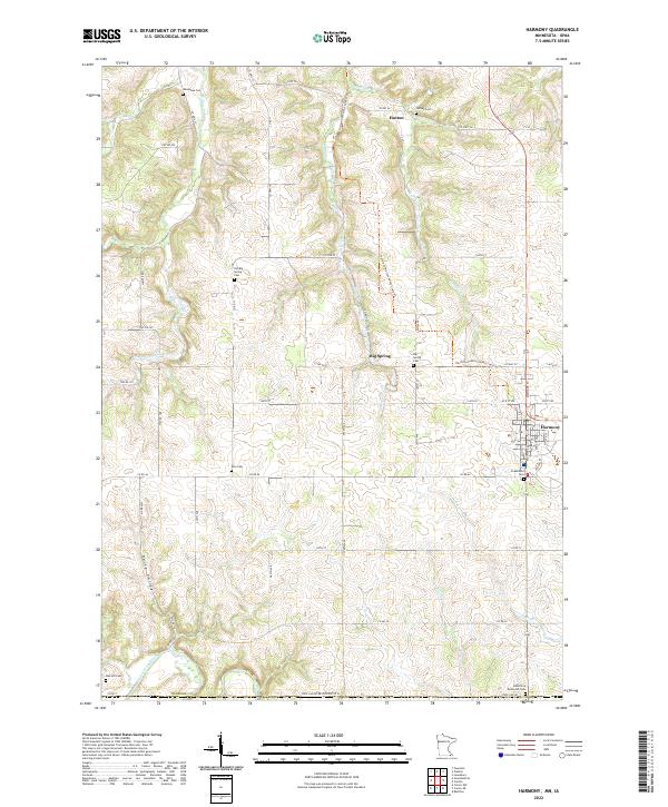 2022 Harmony2022 Print · USGSSouthern Minnesota agricultural life and small-town roots are preserved here as the modern century unfolds. Local historians can trace family plots at Old Big Spring Cem and Hutton Cem or follow the route of the Harmony-Preston Valley State Trl.
 - 2022 Map of Canton, 2022 Print
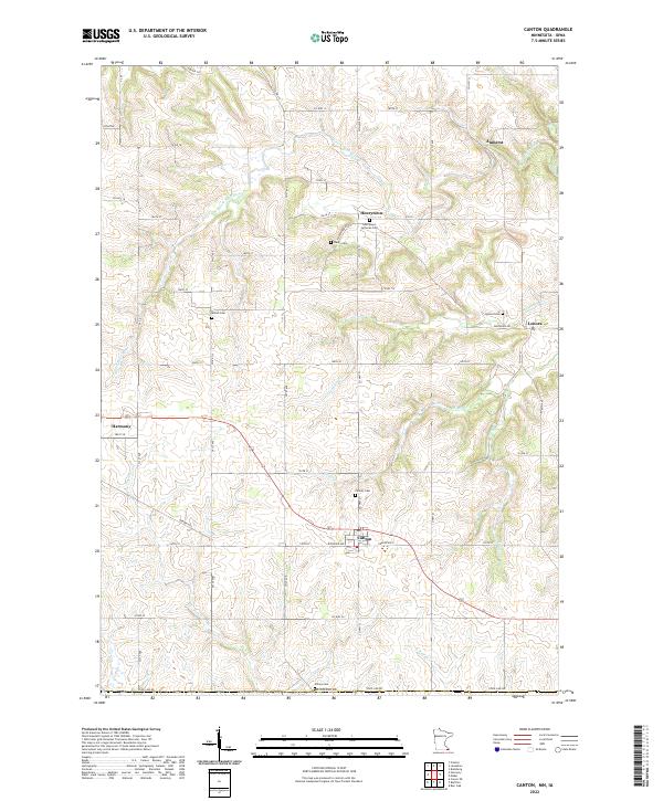 2022 Canton2022 Print · USGSCanton and the southeastern Minnesota borderlands are captured here in the early twenty-first century, showing a landscape of deep-rooted rural settlements. Researchers can trace family history through several burial sites like Amish Cem, Henrytown Lutheran Cem, and Lenora Cem.
 - 2022 Map of Wilmington, 2022 Print
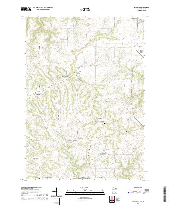 2022 Wilmington2022 Print · USGSSoutheast Minnesota’s driftless landscape remains defined by its ridge-top settlements and deep stream valleys in the early twenty-first century. Genealogists can trace early parish roots at the Wilmington Norwegian Lutheran Cem or explore the rural hubs of Willington Grove and Bee.
 - 2022 Map of Mabel, 2022 Print
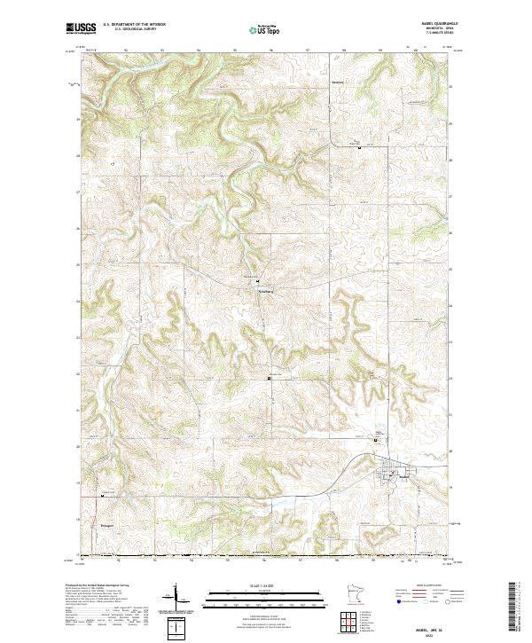 2022 Mabel2022 Print · USGSMabel and its surrounding Fillmore County townships appear here in the early twenty-first century as the landscape meets the Iowa border. Genealogists and local historians can trace family-named routes like Arrowhead Rd and locate rural hubs at Newburg, Prosper, and Tawney.
 - 2022 Map of Spring Grove, 2022 Print
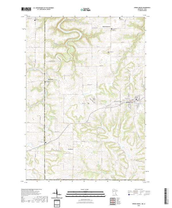 2022 Spring Grove2022 Print · USGSSoutheastern Minnesota’s driftless landscape comes into focus in this recent survey of the ridges and valleys surrounding Spring Grove. Genealogists can trace family connections through numerous sites like Norwegian Ridge Cem and the remote Old Black Hammer Cem.
 - 2022 Map of Waucoma, 2022 Print
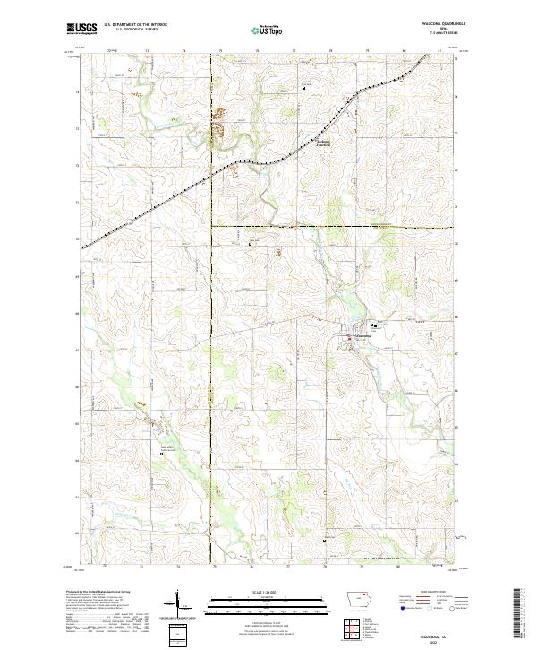 2022 Waucoma2022 Print · USGSNortheast Iowa at the start of the 2020s shows a landscape of steady agricultural roots and small-town centers. Researchers can trace family history through numerous rural sites like Saint Marys Cem, Alpha Cem, and the riverfront streets of Waucoma.
 - 2022 Map of Cresco SE, 2022 Print
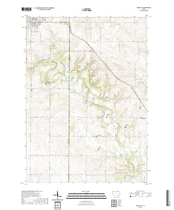 2022 Cresco SE2022 Print · USGSHoward and Winneshiek counties are documented here in the early twenty-first century, showing the established rural grid around Cresco. You can trace old family burials at Ryan Farm Cem and Ladwig Farm Cem or follow the Turkey River through the heart of the region.
 - 2022 Map of Protivin, 2022 Print
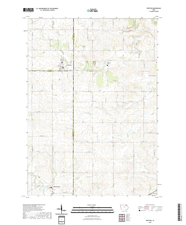 2022 Protivin2022 Print · USGSNortheast Iowa at the start of the 2020s remains a landscape of tightly-knit farming communities and quiet creek valleys. Genealogists can trace local roots through several family landmarks and burial sites, including Holy Trinity Cem in Protivin and the Bohemian National Cem.
 - 2022 Map of Bluffton, 2022 Print
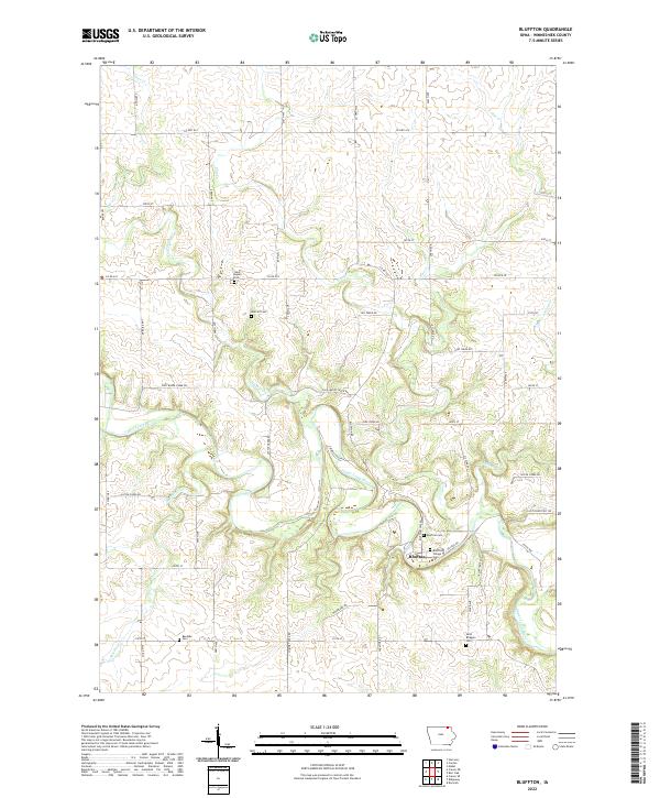 2022 Bluffton2022 Print · USGSNortheastern Iowa's river valleys and rural homesteads are captured here in the early twenty-first century. Researchers can trace family history through sites like Bluffton Village Cem, Saint Bridgets Cem, and Metcalf Cem.
 - 2022 Map of Cresco NE, 2022 Print
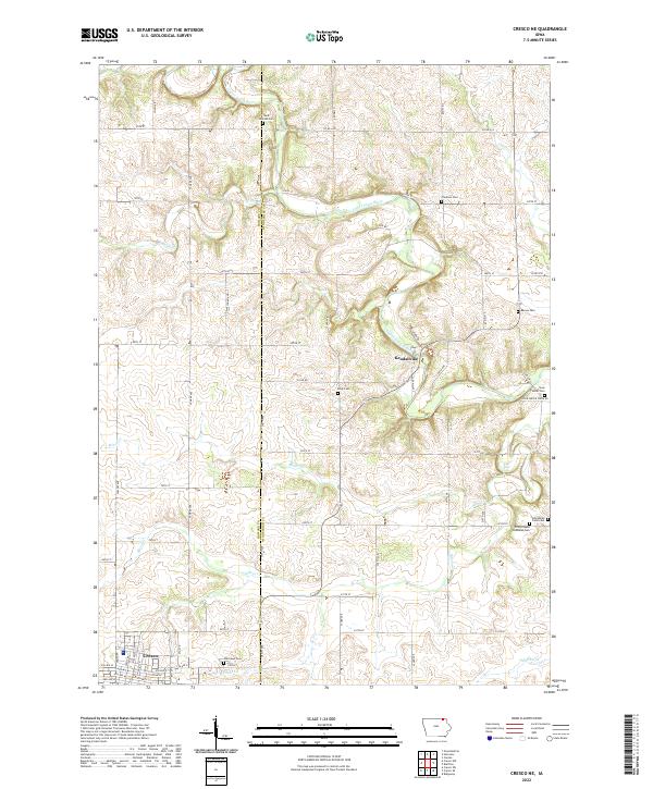 2022 Cresco NE2022 Print · USGSUpper Iowa River country near the Howard and Winneshiek county line was largely defined by its dispersed farmsteads and rural cemeteries during the early twenty-first century. Researchers can locate family landmarks such as Saint Kierans Cem, Kendallville, and First Orleans Lutheran Cem.
 - 2022 Map of Freeport, 2022 Print
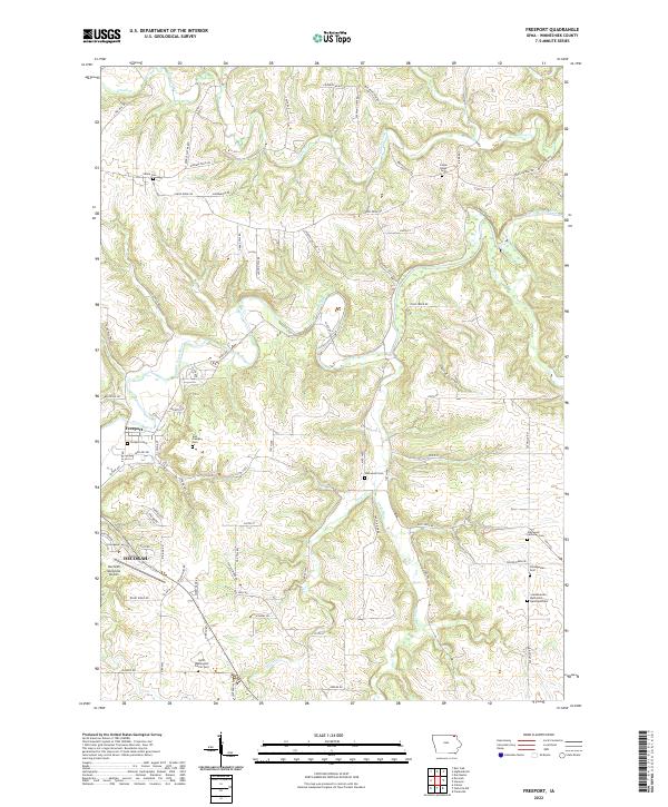 2022 Freeport2022 Print · USGSWinneshiek County is captured here in the early twenty-first century, showing the rural landscapes where the Upper Iowa River meets the Nordic Hills. Genealogists can trace family heritage through numerous historic sites like Freeport Cem and the Glenwood Lutheran Cem.
 - 2022 Map of Postville, 2022 Print
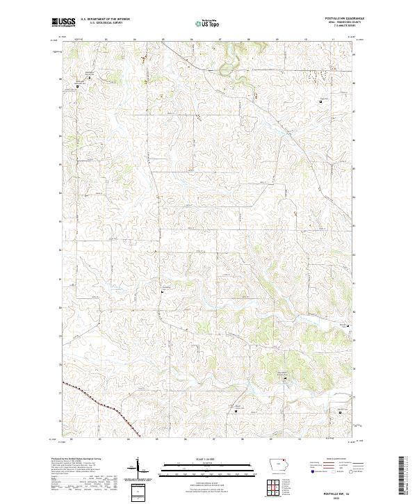
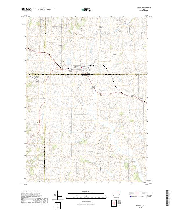 2022 Postville2022 Print · USGSThe intersection of four Iowa counties and the town of Postville are documented in this contemporary survey. Researchers can locate family heritage sites at the Post Township Cem and Fry Cem or trace the winding paths of Williams Cr.
 - 2022 Map of Saint Lucas, 2022 Print
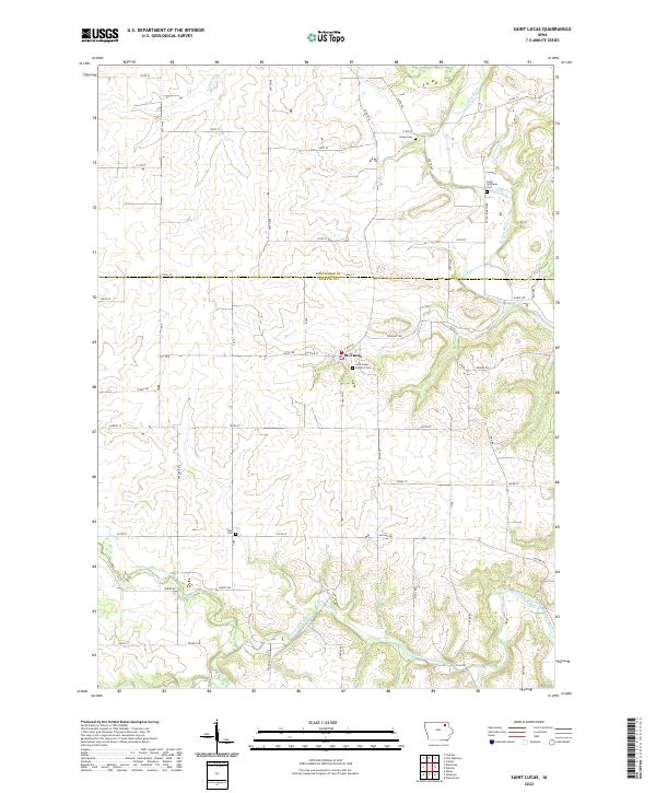 2022 Saint Lucas2022 Print · USGSNortheastern Iowa's agricultural heartland is documented here in the early twenty-first century, spanning the border of Fayette and Winneshiek counties. Genealogists can locate several local burial sites like Saint Lukes Catholic Cem and Eden Cem near the Little Turkey River.
 - 2022 Map of Frankville, 2022 Print
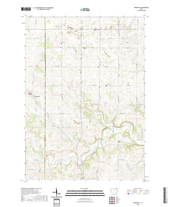 2022 Frankville2022 Print · USGSNortheast Iowa farmland along the Allamakee and Winneshiek county line is documented here in the early twenty-first century. Genealogists can locate several family and community burial sites, including Salem United Cem, Frankville Village Cem, and the Zalmona Cem.
 - 2022 Map of Postville NW, 2022 Print
 2022 Postville NW2022 Print · USGSWinneshiek County's rural landscape is documented here in the early twenty-first century, showing a region defined by its rivers and historic farmstead burial grounds. Researchers can locate numerous local sites including Centennial Cem, Moneek Cem, and the Pagin Cem.
 - 2022 Map of Calmar, 2022 Print
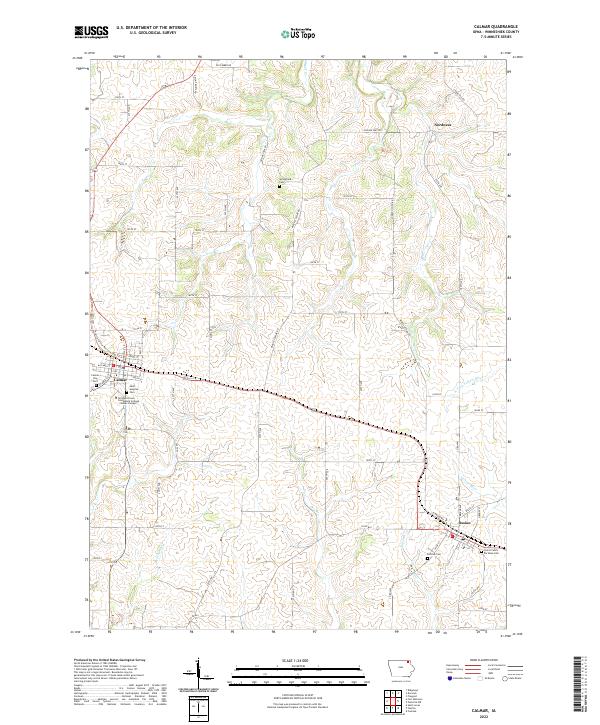 2022 Calmar2022 Print · USGSWinneshiek County crossroads including Calmar and Ossian are documented here during the early 2020s. Researchers can trace local genealogy through numerous sites like Saint Aloysius Cem or explore the route of the Prairie Farmer Recreational Trl.
 - 2022 Map of Festina, 2022 Print
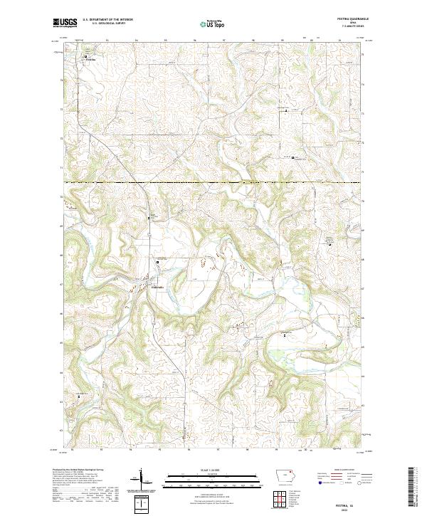 2022 Festina2022 Print · USGSThe rural border of Winneshiek and Fayette counties is documented here in the early twenty-first century as it remains centered on the Turkey River. Genealogists will find a wealth of local burial sites, from Saint Marys Cem to the Dover Township Cem.
 - 2022 Map of Highlandville, 2022 Print
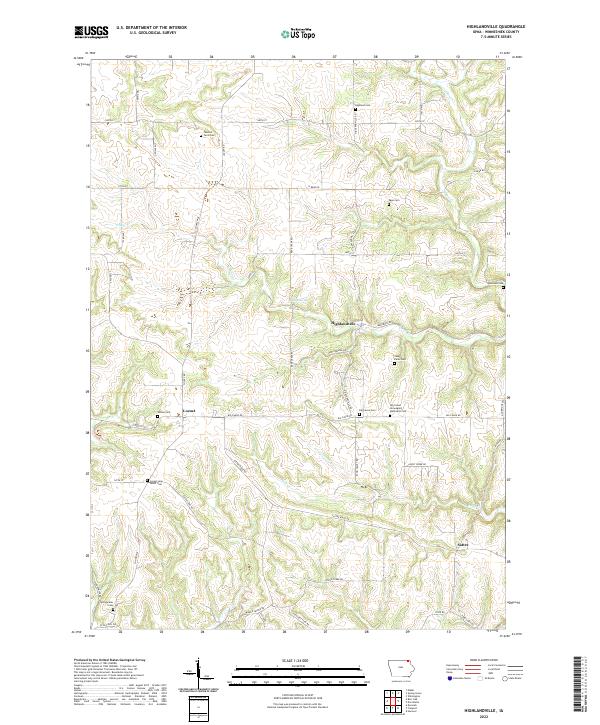 2022 Highlandville2022 Print · USGSWinneshiek County's rural communities and family farmsteads are documented in this recent survey of the Highlandville area. Genealogists and local historians can trace family ties through numerous burial sites like Fawcett Farm Cem, Locust Lane Salem Cem, and the village of Sattre.
 - 2022 Map of Fort Atkinson, 2022 Print
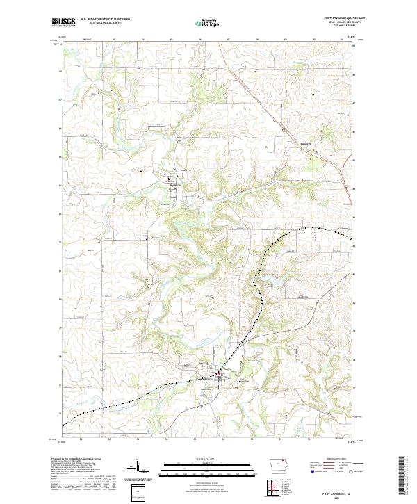 2022 Fort Atkinson2022 Print · USGSThe Turkey River valley in Winneshiek County is captured here in its modern state, showing the enduring layouts of historic river towns. Genealogists and researchers can trace family landmarks and parish sites like Saint Wenceslaus Cem, Fort Atkinson, and Spillville.
 - 2022 Map of Decorah, 2022 Print
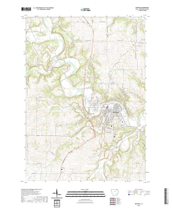 2022 Decorah2022 Print · USGSDecorah and the winding Upper Iowa River valley are captured in this recent survey of northeast Iowa. Researchers can trace the grounds of Luther College, locate the Winneshiek County Courthouse, and find family names at Phelps Cem and Russell Cem.
 - 2022 Map of Ridgeway, 2022 Print
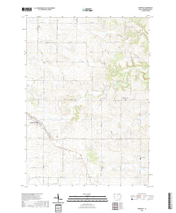 2022 Ridgeway2022 Print · USGSWinneshiek County at the start of the 2020s remains a landscape of traditional farmsteads and historic rural congregations. Local researchers can trace family origins at Madison Settlement Cem, the Mcintosh Cem, and the village of Ridgeway.
 - 2022 Map of Castalia, 2022 Print
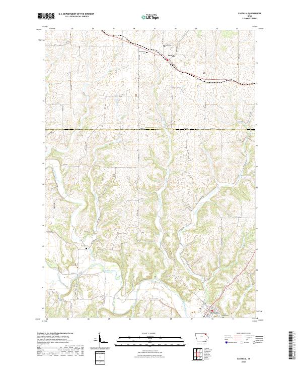 2022 Castalia2022 Print · USGSNortheast Iowa's river valleys and ridge farms are detailed in this contemporary survey of the borderlands between Winneshiek and Fayette counties. Local historians can locate early burial grounds like Bloomfield Cem and Nutting Cem or trace the course of the Turkey River and Quinn Cr.
 - 2022 Map of Hanover, 2022 Print
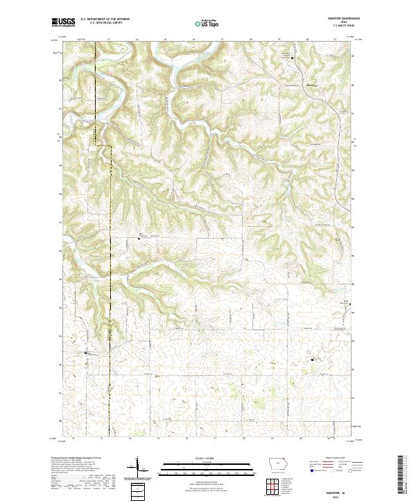 2022 Hanover2022 Print · USGSAllamakee County’s ridge-and-valley landscape is documented here in the early twenty-first century, showing the enduring rural character of northeast Iowa. Researchers can locate numerous cemeteries and landmarks, including Saint Marys Catholic Church, Eells Plot, and the winding Upper Iowa River.
 - 2022 Map of Dorchester, 2022 Print
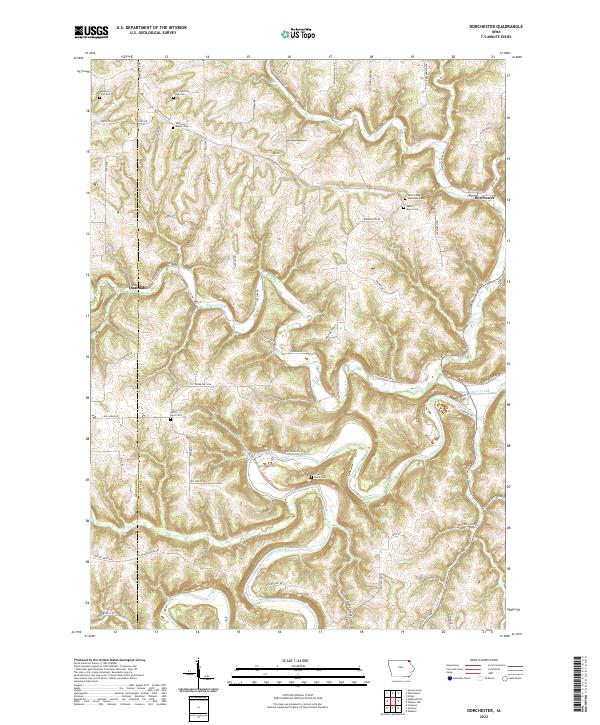 2022 Dorchester2022 Print · USGSNortheastern Iowa's deeply dissected river valleys are captured here in the early twenty-first century, showing the enduring rural character of Allamakee County. Researchers can locate numerous family and church burial sites like Waterloo Ridge Cem and the remote Swenson Farm Cem near the winding Upper Iowa River.
 - 2022 Map of Burr Oak, 2022 Print
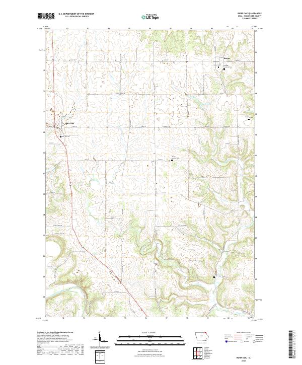 2022 Burr Oak2022 Print · USGSWinneshiek County near the Minnesota border reveals its deep rural roots through this contemporary survey. Genealogists can trace family heritage at numerous local burial sites like Burr Oak Cem and the Hesper Lutheran Cem along the Canoe Cr drainage.
End of results
Showing maps 1-25 of 25
Top cities of Winneshiek County
- Decorah historical maps
- Calmar historical maps
- Ossian historical maps
- Spillville historical maps
- Fort Atkinson historical maps
- Ridgeway historical maps
See more
Frequently asked questions
- What are the different types of historical maps available for Winneshiek County?
- What is the oldest map of Winneshiek County?
- Where can I purchase historical maps of Winneshiek County for my home or office?
- Where can I download high-res historical maps of Winneshiek County?
- Are there historical topographic maps available for Winneshiek County?
- Is there historical aerial imagery available for Winneshiek County?
- Where are historical maps of Winneshiek County sourced from?