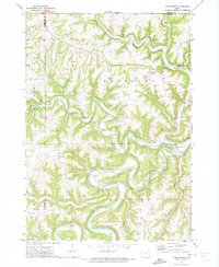
1971 Map of Dorchester
USGS Topo · Published 1973About this map
Upper Iowa River meanders through the southern portion of this landscape, deeply incising the terrain alongside numerous tributary valleys. The settlement of Dorchester sits at the junction of Waterloo Creek and Duck Creek in the northeast, while the small community of Quandahl is positioned further west. The upland areas are characterized by prominent heights like Waterloo Ridge, which is home to the Waterloo Ridge Ch. The map reveals a rural community supported by local resource extraction, evidenced by several quarries and gravel pits scattered near the watercourses. Social and historical foundations are well-documented through several burial grounds, including St Johns Cem, St Marys Cem, and the Iowa River Cem. Recreation and youth activity are represented by Camp Tahigwa and the Bear Creek Public Access, showing how the winding creeks defined both the economy and the community life of the region.
Find a feature on this map
26 named features on this map. Tap any name to fly to it.
Don’t see what you’re looking for? This feature index may not catch every label — zoom into the map to look around manually.
Map Details
Editions of this 1971 Dorchester Map
This is the sole edition of this map. No revisions or reprints were ever made.
Other maps of this area

1903 · Waukon
USGS Topo · 1:125,000

1906 · Decorah
USGS Topo · 1:125,000

1956 · Brownsville
USGS Topo · 1:62,500

1958 · La Crosse
USGS Topo · 1:250,000

1961 · La Crosse
USGS Topo · 1:250,000

1965 · La Crosse
USGS Topo · 1:250,000

1965 · Wilmington
USGS Topo · 1:24,000

1965 · Spring Grove
USGS Topo · 1:24,000

1968 · Waukon
USGS Topo · 1:24,000
1968 · Waukon NW
USGS Topo · 1:24,000