
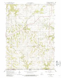
1965 Map of Wilmington
USGS Topo · Published 1966About this map
The rolling hills of Houston County meet the Iowa border in this mid-1960s survey of the Driftless Area. The landscape is defined by the deep valleys of Winnebago Creek and Bee Creek, with much of the upland acreage preserved as part of the Minnesota Memorial Hardwood State Forest. Settlement patterns are concentrated around the small community of Wilmington and the former village of Willington Grove, while the southern edge of the map shows the tiny hamlet of Bee tucked into the creek valley near the state line. For genealogists and local historians, the sheet identifies specific burial grounds like Stone Cem and Old Wilmington Cem, alongside the Wilmington Ch. The northern section is bisected by the Chicago Milwaukee St Paul and Pacific railroad, which skirts the Caledonia Corporate Boundary, reflecting the region's historical reliance on rail for transporting timber and agricultural products from the numerous local Quarries.
Find a feature on this map
20 named features on this map. Tap any name to fly to it.
Don’t see what you’re looking for? This feature index may not catch every label — zoom into the map to look around manually.
Map Details
Editions of this 1965 Wilmington Map
2 editions found
Other maps of this area

1903 · Waukon
USGS Topo · 1:125,000

1906 · Decorah
USGS Topo · 1:125,000

1956 · Brownsville
USGS Topo · 1:62,500

1958 · La Crosse
USGS Topo · 1:250,000

1961 · La Crosse
USGS Topo · 1:250,000

1965 · La Crosse
USGS Topo · 1:250,000

1965 · Spring Grove
USGS Topo · 1:24,000

1965 · Sheldon
USGS Topo · 1:24,000

1965 · Yucatan
USGS Topo · 1:24,000
1968 · Waukon NW
USGS Topo · 1:24,000