
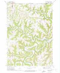
1965 Map of Spring Grove
USGS Topo · Published 1966About this map
The rugged driftless topography of southeast Minnesota is prominently displayed on this 1965 survey, where deep valleys and high ridges dictate the local infrastructure. Spring Grove serves as the primary hub, showing established community markers like a Hospital, Trinity Cem, and the path of the Chicago Milwaukee ST Paul And Pacific railroad. The landscape is heavily wooded, much of it protected within the Minnesota Memorial Hardwood State Forest.
Find a feature on this map
18 named features on this map. Tap any name to fly to it.
Don’t see what you’re looking for? This feature index may not catch every label — zoom into the map to look around manually.
Map Details
Editions of this 1965 Spring Grove Map
This is the sole edition of this map. No revisions or reprints were ever made.
Other maps of this area

1906 · Decorah
USGS Topo · 1:125,000

1958 · La Crosse
USGS Topo · 1:250,000

1961 · La Crosse
USGS Topo · 1:250,000

1965 · La Crosse
USGS Topo · 1:250,000

1965 · Wilmington
USGS Topo · 1:24,000

1965 · Mabel
USGS Topo · 1:24,000

1965 · Sheldon
USGS Topo · 1:24,000

1965 · Yucatan
USGS Topo · 1:24,000

1965 · Bratsberg
USGS Topo · 1:24,000
1971 · Dorchester
USGS Topo · 1:24,000