2020s Maps of Sun City, Kansas
Explore 2 historic maps of Sun City from the 2020s. These maps offer a rare glimpse into what life looked like during the 2020s — showing old roads, neighborhoods, homes, and landmarks that have changed or disappeared over time.
Whether you're researching your family's past, planning a metal detecting trip, or studying how Sun City's landscape evolved across the 2020s, these high-resolution maps are a powerful tool for exploring the history of this region.
- Focus on a specific era: All maps on this page are from the 2020s, giving you a focused view of this time period.
- See what’s changed: Compare century-old streets, trails, and buildings to today's modern landscape using overlays and satellite layers.
- Research with precision: Use these maps for genealogy, historical research, land use analysis, or educational projects.
- View, download, or print: Maps are fully viewable online in high resolution, and can be downloaded or printed for your own records.
Start exploring Sun City's history through authentic maps from the 2020s. This is your window into the past.
Sun City, KS maps
(2)- 2022 Map of Sun City, 2022 Print
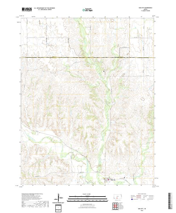 2022 Sun City2022 Print · USGSThe Barber County plains meet the Medicine Lodge River in the early 2020s, revealing a landscape shaped by water and tradition. Genealogists can locate family sites at Sunnyside Cem and Chinn Cem or trace the early industrial footprint of Elm Mills.
 - 2022 Map of Sun City SW, 2022 Print
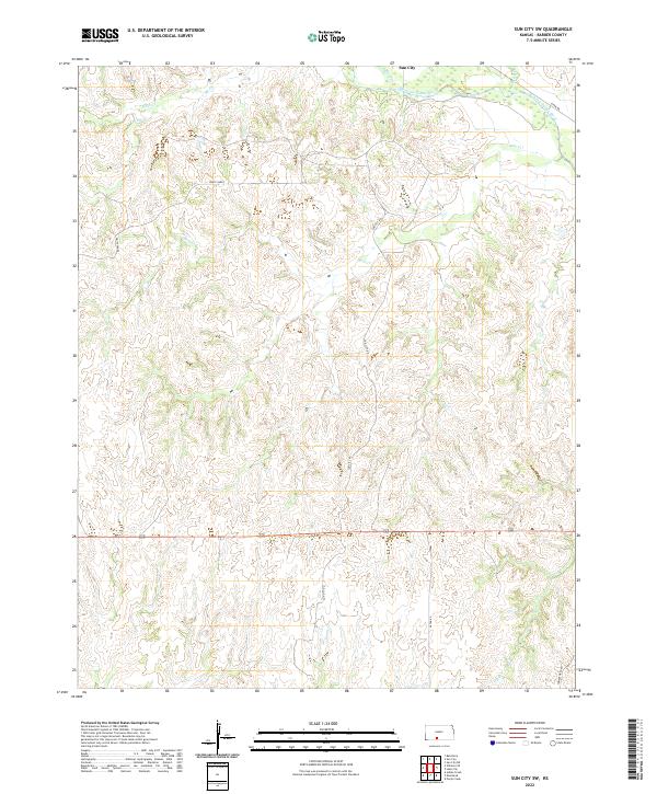 2022 Sun City SW2022 Print · USGSBarber County's rugged drainage networks and the valley of the Medicine Lodge River are captured here in the early twenty-first century. Researchers can trace the winding paths of Bear Cr and Inman Cr or locate the unique terrain of White Sands.
End of results
Showing maps 1-2 of 2
Top cities near Sun City
Frequently asked questions
- What are the different types of historical maps available for Sun City?
- What is the oldest map of Sun City?
- Where can I purchase historical maps of Sun City for my home or office?
- Where can I download high-res historical maps of Sun City?
- Are there historical topographic maps available for Sun City?
- Is there historical aerial imagery available for Sun City?
- Where are historical maps of Sun City sourced from?