Old Maps of Bourbon County, Kansas for Hiking & Exploration
Hike through history with 159 historic maps of Bourbon County. Explore old trails, ghost towns, and forgotten backroads — perfect for outdoor adventurers and local explorers.
- Rediscover forgotten places: Map out old mining camps, roads, and footpaths that no longer exist on modern maps.
- Layer with modern tools: Combine with LiDAR or satellite views to plan hikes through historical terrain.
- Made for exploration: Popular among hikers, overlanders, and local history lovers.
Use these maps to find adventure and explore the hidden past of Bourbon County.
Bourbon County, KS maps
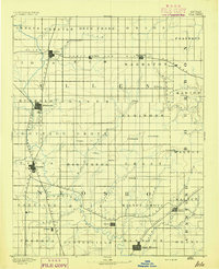
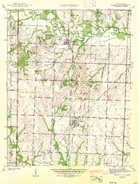
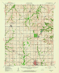
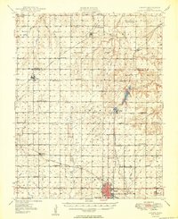
(159)- 1884 Map of Fort Scott, 1954 Print
 1884 Fort Scott1954 Print · USGSSoutheast Kansas is documented here in the late nineteenth century as a booming railroad hub centered on Fort Scott. Researchers can trace the early townships and rail sidings at Hiattville, Uniontown, and along the banks of the Marmaton River.
 - 1885 Map of Garnett
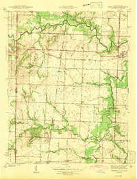
 1885 Garnett1885 Print · USGSAnderson County during the late nineteenth-century rail boom shows a landscape of emerging towns and heavy steam-engine influence. Genealogists can trace family roots in early settlements like Garnett, Central City, and Elizabethtown before the modern highway era.
 - 1886 Map of Iola
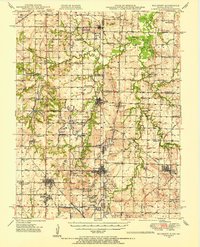
 1886 Iola1886 Print · USGSEastern Kansas was a bustling corridor of competing rail lines and river settlements during the mid-1880s. Genealogists and historians can trace the early footprints of Osage Mission, the growth of Iola, and vanished stops like Warnersburgh along the winding Neosho River.
 - 1886 Map of Fort Scott
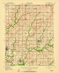
 1886 Fort Scott1886 Print · USGSSoutheast Kansas comes alive in the mid-1880s as Fort Scott emerges as a powerful railroad junction connecting the prairie to the world. Genealogists and historians can trace old property boundaries and rail stops like Uniontown, Hiattville, and the remote Timber Hill.
 - 1887 Map of Mound City
 1887 Mound City1887 Print · USGSLinn and Miami counties are captured here in the 1880s, showcasing a landscape of river-valley agriculture and rapid railroad growth. Researchers can trace the path of the Kansas City Fort Scott and Gulf Railroad through Pleasanton or locate early settlements like Trading Post and Wall Street.
 - 1893 Map of Fort Scott
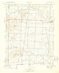
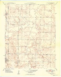
 1893 Fort Scott1893 Print · USGSSoutheast Kansas at the end of the nineteenth century was a bustling nexus of competing rail lines and river valley settlements. Genealogists and historians can trace the early footprints of Fort Scott and rural communities like Zenia (Hay) or Cato along the Marmaton River.7 unique versions available
 - 1893 Map of Iola
 1893 Iola1893 Print · USGSSoutheast Kansas at the end of the nineteenth century is captured here as a thriving rail and river corridor. Genealogists and historians can trace the early development of Iola, Erie, and Humboldt or locate smaller settlements like Odense and Veitsburgh.2 unique versions available
 - 1893 Map of Mound City
 1893 Mound City1893 Print · USGSEastern Kansas at the close of the nineteenth century is defined here by its rail-and-river network and early township boundaries. Genealogists and historians can trace the early growth of Mound City, Pleasanton, and La Cygne along the Kansas City Osage and Gulf Railroad.4 unique versions available
 - 1894 Map of Garnett
 1894 Garnett1894 Print · USGSAnderson County and its neighbors flourished during this Victorian-era railroad boom. Genealogists and historians can trace the exact routes of the Missouri Pacific Railroad and locate early settlements like Elizabethtown, Central City, and Mont Ida.5 unique versions available
 - 1904 Map of Iola
 1904 Iola1904 Print · USGSSoutheast Kansas at the start of the century was a land defined by the iron rail and the winding Neosho River. Genealogists and historians can trace the early footprints of Iola, Chamute, and Erie, alongside smaller depots like Gas and Savonburg.4 unique versions available
 - 1939 Map of Deerfield, 1953 Print
 1939 Deerfield1953 Print · USGSVernon County at the end of the thirties was a region defined by its river valleys and a dense network of local schoolhouses. Genealogists and historians can trace family roots through numerous sites like Sunny Slope Sch, Bunnville, and the rail junction at Eve.3 unique versions available
 - 1940 Map of Hume, 1954 Print
 1940 Hume1954 Print · USGSThe Missouri-Kansas borderlands come to life in this late-depression era survey centered on Hume. Genealogists and local historians can trace family roots through numerous rural landmarks like Hume Cem, Union Chapel, and the settlement of Amos.3 unique versions available
 - 1942 Map of Hume
 1942 Hume1942 Print · USGSThe Missouri-Kansas border area near Hume is captured here just before the mid-century, showing a landscape tightly woven with railroads and rural school districts. Genealogists can locate family landmarks like Lawrence Cem, Union Chapel, and the now-vanished rail stop at Amos.2 unique versions available
 - 1942 Map of Richards
 1942 Richards1942 Print · USGSThe Missouri-Kansas borderlands in the late 1930s were defined by the crossing of major rail lines and the winding Little Osage River. Researchers can trace old township schoolhouses like Enoch Sch and local burial sites including Turley Cem and East Liberty Cem.3 unique versions available
 - 1942 Map of Deerfield
 1942 Deerfield1942 Print · USGSThe Missouri-Kansas border comes into focus in the early 1940s, showing a rural landscape defined by the Marmaton River and the Kansas City Southern railroad. Researchers can locate numerous country schools like Lone Elm Sch and Sunny Slope Sch or trace the small settlements of Deerfield and Eve.2 unique versions available
 - 1947 Map of Lawrence, 1954 Print
 1947 Lawrence1954 Print · USGSEastern Kansas and western Missouri thrive in the late 1940s, showing a landscape defined by major river valleys and a dense railway network. Genealogists can trace family settlements from Lawrence to Greenwood and locate landmarks like Olathe Navy and Lake Lotawana.
 - 1947 Map of Joplin, 1954 Print
 1947 Joplin1954 Print · USGSThe borderlands of Missouri, Kansas, and Oklahoma are shown here during the late 1940s, a period of heavy industrial and military activity. Researchers can trace the extensive Tri-State Mining District, the layout of Camp Crowder, and local landmarks like Mount Hope Cem.
 - 1948 Map of Mulberry, 1954 Print
 1948 Mulberry1954 Print · USGSThe Kansas-Missouri border was a hive of industrial activity just after the war, marked by extensive coal excavations. Genealogists can trace family roots through dozens of rural schools and small settlements like Arma, Croweburg, and Coalvale.2 unique versions available
 - 1948 Map of Erie, 1960 Print
 1948 Erie1960 Print · USGSSoutheast Kansas at the end of the 1940s reveals a landscape of thriving rail-side towns and rural school districts. Genealogists and historians can trace family locations near Savonburg, St Paul, and dozens of country schools like Wannersburg Sch or Osborn Sch.
 - 1948 Map of Girard, 1963 Print
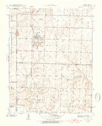
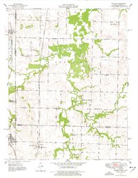
 1948 Girard1963 Print · USGSCrawford and Bourbon counties come to life in the late 1940s, showcasing a landscape of busy rail junctions and rural school districts. You can trace family roots through numerous sites like Lutheran Cem, Gunn Sch, and the old Fish Hatchery.
 - 1948 Map of Garland, 1977 Print
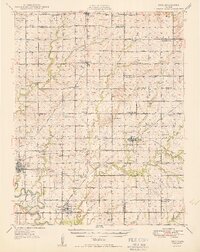
 1948 Garland1977 Print · USGSThe Kansas-Missouri borderlands come alive in this mid-century survey, showing the busy rail corridors and coal fields of Bourbon and Vernon counties. Genealogists can trace family roots through numerous rural landmarks like McKill Chapel, Heaviside Cem, and Oskaloosa.
 - 1949 Map of Erie
 1949 Erie1949 Print · USGSSoutheast Kansas in the late 1940s reveals a landscape of thriving rail towns and rural schoolhouses amidst an active oil and gas boom. Genealogists can trace family footprints at St Francis Cem, the County Home, and numerous local schools like Maple Grove Sch.3 unique versions available
 - 1949 Map of Garland
 1949 Garland1949 Print · USGSThe Kansas-Missouri border comes alive in the late 1940s, showing a landscape defined by coal extraction and rail transport. Researchers can trace the Kansas City Southern line past Garland or locate rural landmarks like McKill Chapel and Totten Sch.2 unique versions available
 - 1949 Map of Girard
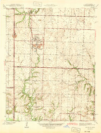
 1949 Girard1949 Print · USGSSoutheast Kansas at the close of the 1940s reveals a landscape of thriving rural townships and critical rail junctions. Genealogists can trace family roots through numerous country schools like Gunn Sch and local burial grounds including Hiattville Cem and Union Center Cem.2 unique versions available
 - 1949 Map of Joplin
 1949 Joplin1949 Print · USGSThe Kansas-Missouri borderlands thrive in the late 1940s, showing a robust network of railroad towns and river valleys. Researchers can trace historic rail lines like the Missouri Pacific RR and locate rural centers such as Chanute, Iola, and Fort Scott.
Showing maps 1-25 of 159
Top cities of Bourbon County
- Fort Scott historical maps
- Marmaton historical maps
- Bronson historical maps
- Uniontown historical maps
- Fulton historical maps
- Redfield historical maps
See more
Frequently asked questions
- What are the different types of historical maps available for Bourbon County?
- What is the oldest map of Bourbon County?
- Where can I purchase historical maps of Bourbon County for my home or office?
- Where can I download high-res historical maps of Bourbon County?
- Are there historical topographic maps available for Bourbon County?
- Is there historical aerial imagery available for Bourbon County?
- Where are historical maps of Bourbon County sourced from?