1950s Maps of Cherokee County, Kansas
Explore 12 historic maps of Cherokee County from the 1950s. These maps offer a rare glimpse into what life looked like during the 1950s — showing old roads, neighborhoods, homes, and landmarks that have changed or disappeared over time.
Whether you're researching your family's past, planning a metal detecting trip, or studying how Cherokee County's landscape evolved across the 1950s, these high-resolution maps are a powerful tool for exploring the history of this region.
- Focus on a specific era: All maps on this page are from the 1950s, giving you a focused view of this time period.
- See what’s changed: Compare century-old streets, trails, and buildings to today's modern landscape using overlays and satellite layers.
- Research with precision: Use these maps for genealogy, historical research, land use analysis, or educational projects.
- View, download, or print: Maps are fully viewable online in high resolution, and can be downloaded or printed for your own records.
Start exploring Cherokee County's history through authentic maps from the 1950s. This is your window into the past.
Cherokee County, KS maps
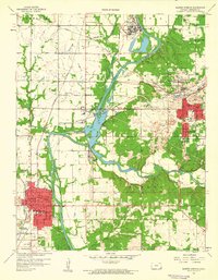
(12)- 1950 Map of Pittsburg
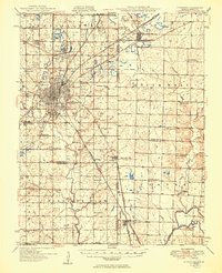 1950 Pittsburg1950 Print · USGSThe coal country along the Kansas-Missouri border was defined by heavy industry and rail just after the war. Genealogists and historians can trace numerous rural schools and family burial sites, including Mindenmines Cem, Council Corner Sch, and the town of Litchfield.2 unique versions available
 - 1950 Map of Racine
 1950 Racine1950 Print · USGSNewton County's tri-state border region is captured here in the mid-century, showing a landscape shaped by mining and rural schooling. Researchers can locate family landmarks like Gibson Cem or trace the old St Louis San Francisco rail line through Racine.2 unique versions available
 - 1954 Map of Tulsa
 1954 Tulsa1954 Print · USGSNortheast Oklahoma and the Ozark border are shown here during a period of massive industrial and infrastructure growth. Researchers can trace the legacy of the Tri-State Mining District and the development of major reservoirs like Grand Lake O' The Cherokees.2 unique versions available
 - 1954 Map of Joplin, 1967 Print
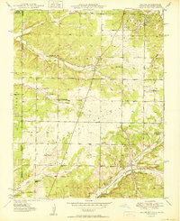
 1954 Joplin1967 Print · USGSThe tri-state border region of Kansas, Missouri, and Oklahoma is captured here during a peak era of mid-century industrial and agricultural activity. Researchers can trace family history through dozens of rural cemeteries or locate landmarks like the Kansas Army Ammunition Plant and Pittsburg State University.3 unique versions available
 - 1958 Map of Joplin
 1958 Joplin1958 Print · USGSThe tri-state border region of Missouri, Kansas, and Oklahoma is shown during the late fifties, a time of heavy rail traffic and mining activity. Local historians can trace the industrial landscape through the Joplin & Pittsburg Ry or locate family sites like Zion Ch and Bender Mounds.
 - 1958 Map of Columbus, 1959 Print
 1958 Columbus1959 Print · USGSSoutheast Kansas in the late fifties was a landscape defined by the intersection of coal mining and small-town civic life. Genealogists and historians can trace the foundations of Columbus through its many schools, like Highland Sch, and the extensive Strip Mine works and railroads that fueled the local economy.2 unique versions available
 - 1958 Map of Neutral, 1959 Print
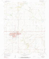
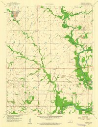
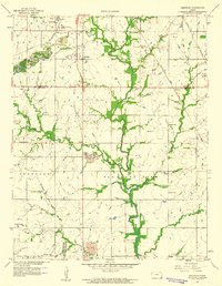
 1958 Neutral1959 Print · USGSCherokee County at the end of the 1950s reveals a landscape defined by the Tri-State mining boom and small rural communities. Genealogists and historians can trace the industrial footprint near Treece or locate local landmarks like Blue Mound Ch and Beasly Cem.3 unique versions available
 - 1958 Map of Tulsa, 1968 Print
 1958 Tulsa1968 Print · USGSNortheast Oklahoma and the Ozark borderlands are captured here during a massive era of reservoir construction and highway expansion. Researchers can trace the mid-century footprints of Tulsa, the sprawling Lake O' the Cherokees, and historical sites like Pea Ridge National Military Park.3 unique versions available
 - 1959 Map of Joplin
 1959 Joplin1959 Print · USGSThe Tri-State region’s mining and rail-driven economy is on full display in the late fifties. Genealogists can locate Lead and Zinc Mines near Joplin, family markers at Oak Hill Cem, and military history at Camp Clark.
 - 1959 Map of Crestline, 1960 Print
 1959 Crestline1960 Print · USGSSoutheast Kansas in the late fifties was a landscape of industrial extraction and quiet rural communities along the Spring River. Genealogists and historians can trace rail-serviced settlements and local landmarks like Wirtonia Cem, Stone Sch, and the CHEMICAL PLANT.3 unique versions available
 - 1959 Map of Baxter Springs, 1960 Print
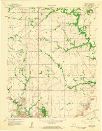
 1959 Baxter Springs1960 Print · USGSSoutheast Kansas at the close of the 1950s reveals a landscape of industrial river towns and rural family landmarks along the Oklahoma border. Researchers can trace the legacy of mining and community through tailings sites, old schoolhouses like Union Chapel Sch, and several burial grounds including Hillcrest Cem.2 unique versions available
 - 1959 Map of Kirkwood, 1960 Print
 1959 Kirkwood1960 Print · USGSThe Kansas-Missouri border region near Opolis shows a landscape shaped by coal extraction and rural community life in the late fifties. Genealogists and historians can trace numerous country schools like Stilwell Sch, the rail lines of the Kansas City Southern, and local landmarks like Crocker Cem.2 unique versions available
End of results
Showing maps 1-12 of 12
Top cities of Cherokee County
- Baxter Springs historical maps
- Columbus historical maps
- Galena historical maps
- Weir historical maps
- Lowell historical maps
- Scammon historical maps
See more
Frequently asked questions
- What are the different types of historical maps available for Cherokee County?
- What is the oldest map of Cherokee County?
- Where can I purchase historical maps of Cherokee County for my home or office?
- Where can I download high-res historical maps of Cherokee County?
- Are there historical topographic maps available for Cherokee County?
- Is there historical aerial imagery available for Cherokee County?
- Where are historical maps of Cherokee County sourced from?