1910s Maps of Cherokee County, Kansas
Explore 2 historic maps of Cherokee County from the 1910s. These maps offer a rare glimpse into what life looked like during the 1910s — showing old roads, neighborhoods, homes, and landmarks that have changed or disappeared over time.
Whether you're researching your family's past, planning a metal detecting trip, or studying how Cherokee County's landscape evolved across the 1910s, these high-resolution maps are a powerful tool for exploring the history of this region.
- Focus on a specific era: All maps on this page are from the 1910s, giving you a focused view of this time period.
- See what’s changed: Compare century-old streets, trails, and buildings to today's modern landscape using overlays and satellite layers.
- Research with precision: Use these maps for genealogy, historical research, land use analysis, or educational projects.
- View, download, or print: Maps are fully viewable online in high resolution, and can be downloaded or printed for your own records.
Start exploring Cherokee County's history through authentic maps from the 1910s. This is your window into the past.
Cherokee County, KS maps
(2)- 1913 Map of Vinita
 1913 Vinita1913 Print · USGSNortheast Oklahoma at the height of its rail-and-ranch era is meticulously detailed here just as the state was entering its second decade. Genealogists can trace family roots through dozens of local landmarks like W H School, Big Cabin, and the Blue Hawk School.3 unique versions available
 - 1918 Map of Columbus
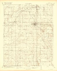 1918 Columbus1918 Print · USGSCherokee County at the end of the Great War was a crossroads of industry and agriculture, dominated by a massive network of competing railroads. Genealogists can locate dozens of country school sites like Rising Sun School and vanished rail stops at Sherwin Junction or Stippville.2 unique versions available
End of results
Showing maps 1-2 of 2
Top cities of Cherokee County
- Baxter Springs historical maps
- Columbus historical maps
- Galena historical maps
- Weir historical maps
- Lowell historical maps
- Scammon historical maps
See more
Frequently asked questions
- What are the different types of historical maps available for Cherokee County?
- What is the oldest map of Cherokee County?
- Where can I purchase historical maps of Cherokee County for my home or office?
- Where can I download high-res historical maps of Cherokee County?
- Are there historical topographic maps available for Cherokee County?
- Is there historical aerial imagery available for Cherokee County?
- Where are historical maps of Cherokee County sourced from?